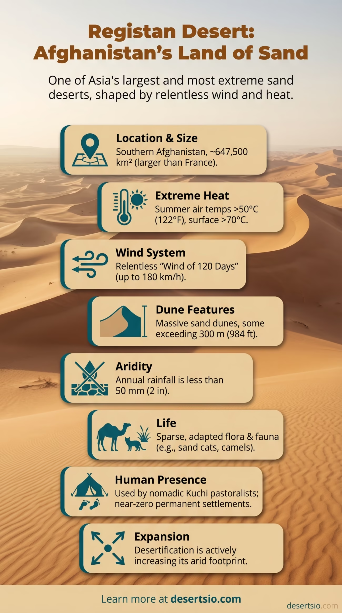
| Location | Southern Afghanistan (Helmand, Nimroz, Kandahar provinces) |
| Area | ~647,500 km² (250,000 sq mi) |
| Type | Sandy desert (erg desert) |
| Dominant Feature | Massive sand dunes, some exceeding 300 m (984 ft) in height |
| Average Daytime Temperature | Up to 50°C (122°F) in summer |
| Average Nighttime Temperature | Can drop to −15°C (5°F) in winter nights |
| Annual Rainfall | Less than 50 mm (2 in) per year |
| Wind System | “Wind of 120 Days” (Sad-o-Bist Roz) — sustained winds up to 180 km/h |
| Sand Coverage | Roughly 50% true sand sea; remainder is gravel plain and rocky terrain |
| Primary River | Helmand River (borders northern edge) |
| Name Meaning | “Land of Sand” in Dari/Pashto |
| Neighboring Deserts | Dasht-e Margo, Dasht-e Lut (Iran), Thar Desert (Pakistan/India) |
Registan — rēgistān, literally “land of sand” in Dari — covers roughly 647,500 square kilometers of southern Afghanistan, making it one of the largest sandy deserts in Asia. That figure alone doesn’t do it justice. A place where dunes stack up to 300 meters tall, where a seasonal wind blows relentlessly for four straight months, and where daytime surface temperatures routinely cook the ground past 70°C — Registan is not simply a desert. It is one of Earth’s most extreme arid environments, full stop.
How Big Is the Registan Desert?
At approximately 647,500 km², the Registan Desert is larger than the entire country of France (643,801 km²). To put it another way, it covers nearly four times the area of the state of Georgia in the United States. The name “Registan” is sometimes applied loosely to include the adjacent Dasht-e Margo (“Desert of Death”) to the northwest, which would push the combined arid zone closer to 800,000 km². Even at the conservative estimate, its scale is staggering.
Only around half of the Registan is true erg — a continuous sand sea. The rest is a mosaic of gravel plains (reg), hardpan flats, and isolated rocky outcrops. The sand sea itself is one of the most extensive on the planet, comparable in character (though not in size) to the Grand Erg Oriental of Algeria.
Formation: How Did This Desert Come to Be?
The Registan’s origins trace back millions of years, to the tectonic collision that built the Hindu Kush and Himalayan mountain ranges. As these ranges rose, they created a massive rain shadow — blocking moisture-laden monsoon air from reaching the interior of the continent. The result: progressive desiccation of the Afghan plateau.
The sand itself comes largely from the Helmand River system. Over millennia, the river deposited enormous volumes of sediment into the basin. When the regional climate shifted toward aridity — particularly during and after the last glacial maximum, roughly 20,000 years ago — those sediments dried out. The Wind of 120 Days did the rest, picking up material and sculpting it into the massive dune fields visible today.
Tectonic uplift, fluvial deposition, and aeolian (wind-driven) redistribution all played roles. It was a slow process. And it is still ongoing — the dunes are not static.
The Wind of 120 Days
If there is one natural force that defines life in the Registan, it is the Sad-o-Bist Roz — the “Wind of 120 Days.” This seasonal northerly wind blows from roughly June through September, sustained at speeds commonly reaching 100–120 km/h, with gusts recorded up to 180 km/h. It is not a storm — it is simply the regional climate.
The wind drives massive sand movement, reshapes dune crests seasonally, and makes large portions of the desert essentially impassable for extended periods. It also accelerates evaporation from any surface water that manages to form after winter rains. Vegetation — what little exists — has adapted over thousands of years specifically to handle this relentless mechanical stress.
Technical Data: Dune Characteristics
- Dune height: Typically 50–150 m; exceptional formations reach 300 m (984 ft)
- Dune type: Predominantly star dunes (pyramidal) and transverse dunes
- Dune migration rate: Estimated 5–25 m/year depending on location and wind exposure
- Sand grain size: Fine to very fine (0.1–0.25 mm), highly mobile under wind
- Active dune coverage: Approximately 300,000 km² of the total area
Temperature Extremes: Day and Night
The Registan operates on brutal thermal swings. In summer, air temperatures regularly exceed 45–50°C (113–122°F) during the day, while the sand surface itself can climb past 70°C. Come nightfall in winter, temperatures plummet to −15°C (5°F) — a swing of more than 60°C between seasonal extremes. Even within a single winter day, diurnal (day-night) temperature differences of 25–30°C are common.
This kind of thermal stress is physically destructive to rock, which explains the angular, broken gravel found across the reg plains. For any organism — plant, animal, or human — surviving these swings demands serious physiological or behavioral adaptation.
Flora and Fauna: Life in an Unlikely Place
The Registan is not lifeless, though it can look that way. Vegetation is sparse, but certain drought-adapted species have colonized the dune margins and interdune flats:
- Haloxylon salicornicum (white saxaul) — a deep-rooting shrub that anchors dunes and provides browse for camels
- Tamarix aphylla (athel tamarisk) — salt-tolerant, found near dried watercourses
- Calligonum polygonoides (rishta) — produces sand-binding root networks
- Sparse annual grasses that germinate rapidly after rare rainfall events
Fauna is more diverse than the landscape suggests. Persian gazelle (Gazella subgutturosa) range across the gravel plains. Sand cats (Felis margarita) — one of the world’s most elusive small felids — inhabit dune zones. Reptiles are particularly well-represented: the Trapelus agilis (agile toad-headed agama) and several species of saw-scaled vipers thrive here. Migratory birds, including various raptors, use the Helmand River corridor seasonally.
And yes — the Bactrian camel, though now mostly domesticated in this region, remains the iconic megafauna of the Registan. Built for exactly this environment.
Human Life in the Registan
Permanent settlements in the core Registan are essentially nonexistent. The environment simply does not support fixed agriculture without irrigation. Yet the desert has never been entirely empty of people.
Baloch and Brahui-speaking nomadic groups have moved through the Registan for centuries, following seasonal grazing routes that track sparse vegetation and water sources. Their movement patterns align with the Wind of 120 Days — they push south and east in summer, returning when conditions ease. This is traditional kuchi pastoralism (kuchi meaning “nomad” in Dari/Pashto), a lifestyle still practiced today, though under increasing pressure from climate shifts and land-use changes.
Along the northern fringe, where the Helmand River provides irrigation potential, settled communities have historically maintained oasis agriculture — growing wheat, cotton, and vegetables. The Helmand Valley irrigation schemes, some dating back to ancient times and expanded significantly in the mid-20th century, represent humanity’s most determined attempt to push agriculture into this arid zone.
Population density across the Registan proper remains below 1 person per km² — among the lowest anywhere on Earth outside of Antarctica.
Desertification and Climate Pressures
The Registan is expanding. That is not a metaphor — it is a measurable reality. Remote sensing data from NASA and ESA satellites show active dune encroachment into previously vegetated or agricultural zones along the desert margins. Between 2000 and 2020, the arid footprint of southwestern Afghanistan increased measurably, driven by a combination of:
- Reduced precipitation (some studies indicate a 10–15% decline in annual rainfall since the 1970s)
- Overgrazing by livestock, which removes the sparse vegetation that stabilizes dune edges
- Disruption of traditional water management systems (karez — underground irrigation channels)
- Increased surface wind erosion on degraded land
This is part of a broader regional desertification trend affecting Central and South Asia. The UN Convention to Combat Desertification (UNCCD) identifies southwestern Afghanistan as one of the most acutely vulnerable areas in the world to land degradation.
Neighboring Deserts: The Wider Arid Zone
The Registan does not exist in isolation. It sits at the heart of a vast belt of arid and semi-arid terrain stretching across Central and South Asia.
| Desert | Location | Area | Key Characteristic |
| Dasht-e Margo | SW Afghanistan | ~150,000 km² | Adjacent to Registan; extremely arid, few inhabitants |
| Dasht-e Lut | SE Iran | ~51,800 km² | Hottest land surface on Earth (up to 70.7°C recorded) |
| Thar Desert | India/Pakistan | ~200,000 km² | World’s most densely populated desert |
| Karakum Desert | Turkmenistan | ~350,000 km² | Sandy desert; site of Darvaza Gas Crater |
| Kyzylkum Desert | Uzbekistan/Kazakhstan | ~298,000 km² | Sand and gravel; significant mineral deposits |
The Dasht-e Lut in eastern Iran deserves special mention as a direct comparison. Both are extreme sand-dominated deserts with massive dune fields (kaluts in Lut’s case — wind-eroded ridges rather than pure dunes). The Lut holds the record for the highest land surface temperature ever recorded — 70.7°C in 2005, measured by satellite — a figure that edges out even the Registan’s surface readings. If you want to understand Registan’s character, the Lut is its closest analogue.
Archaeological Significance
Here is something that often gets overlooked: the Registan was not always this dry. Archaeological evidence — including ancient canal systems, pottery fragments, and traces of Bronze Age settlements — suggests that parts of what is now desert supported agricultural communities as recently as 3,000–4,000 years ago during the Helmand Civilization (sometimes called the Hilmand Culture), contemporaneous with early Indus Valley settlements.
Sites like Shahr-i-Sokhta (“Burnt City”), located near the Iranian border at the edge of the Sistan Basin, give a glimpse of the urban complexity that once thrived in this now-forbidding region. The city was occupied from roughly 3200 to 1800 BCE, at its peak housing perhaps 25,000 people. The desert swallowed it. Climate change — ancient climate change — made that happen.
It is a sobering historical parallel for the desertification pressures the region faces today.
Registan Desert — Glossary of Key Terms
- Erg: A large area of desert covered by wind-swept sand and dunes
- Reg: A flat desert plain covered with compacted gravel or stones
- Kuchi: Dari/Pashto word for nomadic pastoralists of Afghanistan
- Sad-o-Bist Roz: Dari phrase for the “Wind of 120 Days” — the dominant seasonal wind of the Registan
- Karez: Traditional Afghan underground irrigation channel system
- Aeolian: Relating to wind-driven geological processes
What Makes Registan Different from Other Asian Deserts?
Scale, wind intensity, and dune height set the Registan apart. The Thar Desert to the southeast is larger but far more populated and ecologically productive — annual rainfall there averages 150–500 mm, roughly ten times what the Registan receives. The Gobi is enormous and cold, dominated by gravel and rock rather than sand. Even the Karakum in Turkmenistan, another vast Central Asian sandy desert, receives more rainfall and supports more vegetation.
The Registan’s defining combination — extreme aridity + massive mobile dunes + a sustained 120-day gale — is unusual even by global desert standards. Very few places on Earth offer all three at this intensity simultaneously.
Registan vs. Dasht-e Lut
- Similarity: Both are extreme sand deserts in the same regional arid belt
- Difference: Lut is smaller (~51,800 km²) but holds higher recorded surface temperatures
- Dune type: Registan — star/transverse dunes; Lut — kaluts (yardangs) plus sand seas
- Human presence: Both near-zero in core zones
Registan vs. Thar
- Similarity: Both predominantly sandy; both in South/Central Asia
- Difference: Thar receives 10× more rainfall; supports ~83 million people
- Vegetation: Thar far richer; Registan near-barren in core zones
- Wind: Registan’s 120-day wind far more extreme than Thar’s seasonal monsoon winds
The Registan Desert is, in many ways, under-studied relative to its size and significance. Its remoteness has limited scientific fieldwork — most of what researchers know about its hydrology, dune dynamics, and biodiversity comes from satellite data and comparatively brief expeditions. And that knowledge gap matters, because this desert is changing. The dunes are moving. The margins are shifting. And the sparse communities that have coexisted with it for centuries are under pressure they have never faced before.
Understanding the Registan is not just an exercise in geography. It is a window into how landscapes at the edge of human habitability respond — and what happens when the balance tips.