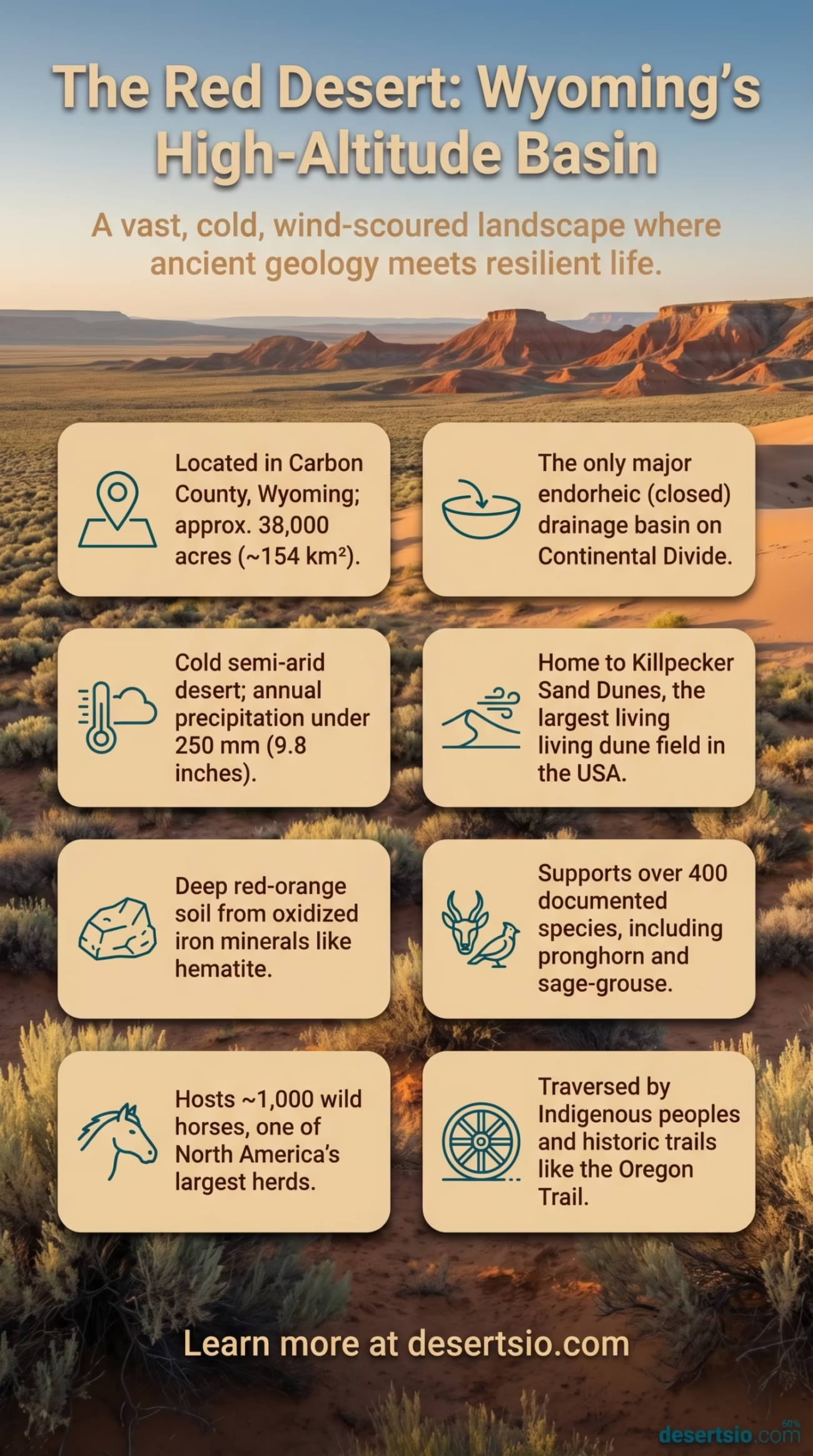
| Location | Carbon County, Wyoming, USA |
| Area | Approximately 38,000 acres (~154 km²) |
| Elevation | 1,980 – 2,290 meters (6,500 – 7,500 ft) above sea level |
| Desert Type | Cold semi-arid desert (high-altitude basin desert) |
| Annual Precipitation | Less than 250 mm (9.8 inches) per year |
| Average Summer Temperature | Daytime: 32–38°C (90–100°F) / Nighttime: 5–10°C (41–50°F) |
| Average Winter Temperature | Daytime: -5°C (23°F) / Nighttime: -20°C (-4°F) |
| Dominant Soil Color | Deep red-orange (iron oxide / hematite-rich sediment) |
| Key Geological Feature | Killpecker Sand Dunes — largest living dune field in the USA |
| Primary Watershed | The only major interior drainage basin in the continental US (endorheic) |
| Wildlife Species Count | Over 400 wildlife species documented |
| Wild Horse Population | ~1,000 wild horses (one of the largest free-roaming herds in North America) |
| Conservation Status | Managed by Bureau of Land Management (BLM); no formal national park designation |
| Comparable Size | Roughly the size of the city of Denver, Colorado |
Tucked into the high plains of south-central Wyoming, the Red Desert sits at an elevation where the air is thin, the wind is relentless, and the land tells a story that stretches back more than 50 million years. It is not a desert in the way most people picture one — no towering sand dunes stretching endlessly to the horizon, no palm trees, no crushing tropical heat. Instead, this is a cold, wind-scoured basin where iron-rich soils blaze in shades of deep rust and burnt sienna, and where silence is broken mostly by the sound of sage and the distant thunder of wild hooves.
Red Desert: Location and Map View
How the Red Desert Formed
The Red Desert occupies the Great Divide Basin — a geological anomaly that makes it unique not just in North America, but on Earth. It is the only significant endorheic basin on the Continental Divide, meaning water that falls here has nowhere to go. No rivers drain outward toward an ocean. Rain and snowmelt simply accumulate, evaporate, or sink into the ground. This creates the dry, mineral-rich environment that defines the desert today.
The basin began forming during the Laramide Orogeny — a major mountain-building event that reshaped western North America roughly 70 to 50 million years ago. As the surrounding ranges rose, the basin sank and filled with sediment. Over millions of years, oxidized iron minerals (primarily hematite and goethite) accumulated in the sedimentary layers, producing the signature red and orange coloration that gives this desert its name. The same process behind the vivid landscapes of Utah’s canyon country is at work here — just expressed differently across Wyoming’s wide-open basin.
How Big Is It — and What Does That Actually Mean?
The Red Desert covers approximately 38,000 acres of core desert terrain, though the broader Great Divide Basin — the geological unit it sits within — spans closer to 4 million acres (roughly 16,000 km²). To put that in perspective: the core red desert landscape is comparable in size to the city of Denver, while the surrounding basin is larger than the state of Connecticut. It is a genuinely vast stretch of American West that most people drive through on Interstate 80 without realizing what they are passing.
Temperature: The Extremes Are Striking
High altitude changes everything here. Summer days can push above 38°C (100°F) under direct sun, but once the sun drops, temperatures can plunge to near 5°C (41°F) the same night — a swing of over 30 degrees within hours. Winters are brutal in a different way: daytime temperatures hover around -5°C (23°F), while nighttime readings can fall to -20°C (-4°F) or below, especially when Wyoming’s notorious wind chill is factored in.
Wind is arguably the desert’s most defining climatic feature. Sustained winds of 50–80 km/h are routine across the basin, and during storms, gusts can exceed 140 km/h. It is this wind — more than heat — that actively shapes the dunes, erodes the badlands, and tests every living thing that calls this place home.
The Killpecker Sand Dunes: A Desert Within a Desert
Inside the Red Desert lies one of North America’s most remarkable geological features: the Killpecker Sand Dunes. Stretching roughly 55 miles (88 km) in length, these are the largest active (living) dune field in the United States. Unlike the ancient, stabilized dunes of many desert regions, the Killpecker dunes are still moving — actively shifting under prevailing westerly winds at measurable rates each year.
The dunes reach heights of up to 100 feet (30 meters) and are composed primarily of fine quartz sand transported from older Eocene-era lake beds. Scattered wetlands and playas exist at the dune margins — oases of standing water in an otherwise desiccated landscape, supporting a surprising range of life. And that is the thing about Killpecker: it should not work biologically, yet it does.
Flora and Fauna: Life That Refuses to Quit
More than 400 wildlife species have been documented across the Red Desert — a number that tends to surprise people expecting a barren wasteland. The desert supports one of the most ecologically intact sagebrush ecosystems remaining in the American West, a habitat type that has disappeared from much of its historic range.
Plant life is dominated by:
- Big sagebrush (Artemisia tridentata) — the ecological backbone of the basin
- Wyoming big sagebrush — a distinct subspecies adapted to cold, dry basin conditions
- Greasewood (Sarcobatus vermiculatus) — tolerates highly alkaline, saline soils near playas
- Indian ricegrass and needle-and-thread grass — key forage grasses
- Prickly pear cactus (Opuntia polyacantha) — surprisingly common across rocky outcrops
Fauna is equally impressive. The desert hosts:
- Pronghorn antelope — the fastest land animal in North America, with a population of roughly 30,000 individuals using this landscape seasonally
- Mule deer and elk — migrating through the basin along ancient corridors
- Greater sage-grouse (Centrocercus urophasianus) — a species of conservation concern whose leks (mating grounds) are scattered across the sagebrush
- Golden eagles, ferruginous hawks, and prairie falcons — riding thermals above the basin rim
- Pygmy rabbits, badgers, swift foxes — largely unseen but ecologically vital
And then, of course, there are the wild horses.
Wild Horses: The Desert’s Most Iconic Residents
The Red Desert is home to approximately 1,000 wild horses, making it one of the largest free-roaming mustang populations in North America. These horses — descended from Spanish colonial stock introduced in the 16th century — have lived in this basin for centuries. They are managed (loosely) under the Wild Free-Roaming Horses and Burros Act of 1971 by the Bureau of Land Management (BLM), which monitors herd sizes and conducts periodic roundups to prevent overgrazing. It is a management approach that sparks ongoing debate among conservationists, ranchers, and wild horse advocates alike — though the horses themselves remain, year after year, spectacularly indifferent to human opinion.
Human Life in the Red Desert
Permanent human settlement in the Red Desert is minimal, and deliberately so. The harsh climate, remoteness, and lack of reliable water make year-round habitation extremely difficult. However, the region carries a deep human history spanning thousands of years.
Indigenous peoples — including the Shoshone, Arapaho, and Crow nations — traversed and hunted across this landscape for millennia. Archaeological evidence documents human presence dating back at least 13,000 years, with tipi rings, stone tool caches, and hunting blinds still visible in remote sections of the basin. The desert sits along a stretch of the historic Oregon Trail, the Mormon Trail, and the Pony Express route — meaning this “empty” landscape was once one of the most traveled corridors in 19th-century America.
Today, the few people who work here are primarily ranchers (cattle and sheep grazing leases cover portions of the basin), energy sector workers (the region underlies significant natural gas and trona deposits), and BLM field staff. Small towns like Rawlins and Rock Springs serve as the nearest service centers.
Geology Up Close: More Than Just Red Sand
The Red Desert’s geological diversity is genuinely underappreciated. Beyond the sand dunes and iron-stained flats, the basin contains:
- Boars Tusk — a volcanic neck (ancient lava plug) rising 400 feet above the desert floor, formed approximately 2.6 million years ago
- Honeycomb Buttes — eroded Eocene badlands featuring intricate hoodoo formations
- Alkali and dry lake beds (playas) — including Adobe Town, a remote badlands area with multi-colored clay layers rivaling Utah’s Painted Desert in visual drama
- Fossil bone beds — the Green River Formation nearby has yielded some of the world’s finest Eocene-era fossil fish, insects, and plants
Adobe Town in particular — sometimes called “Wyoming’s Painted Desert” — sits in the southwestern corner of the Great Divide Basin and presents layered buttes of cream, red, lavender, and gray that shift color dramatically with the light. Very few people see it. The access roads are rough, the area has no infrastructure, and it sits roughly 40 miles from the nearest paved road. That remoteness is, depending on your perspective, either the problem or the entire point.
Nearby Deserts and Comparable Landscapes
The Red Desert does not exist in isolation. Wyoming’s broader basin-and-range terrain connects it to several neighboring arid landscapes worth understanding in context.
Great Basin Desert (Nevada/Utah)
The largest cold desert in North America at ~492,000 km². Shares the Red Desert’s endorheic drainage character and sagebrush dominance, but operates at a larger scale and lower elevation. The Basin similarly traps water with nowhere to escape.
Chihuahuan Desert (Texas/New Mexico/Mexico)
Another high-altitude North American desert (averaging 1,100–1,500 m elevation). More biodiverse than Wyoming’s Red Desert, but shares the extreme temperature swings and mineral-rich soils. White Sands National Park sits at its northern edge.
Wyoming Basin (Broader Region)
The Red Desert is technically a sub-basin within the larger Wyoming Basin — a semi-arid intermontane region flanked by the Rockies. The Wind River Basin to the north and the Green River Basin to the west share similar climatic and geological characteristics.
Painted Desert (Arizona)
Often compared to the Red Desert’s Adobe Town section. Both feature iron and manganese-oxidized sedimentary layers producing vibrant multi-color badland terrain. Arizona’s version is more visited; Wyoming’s version is more isolated.
The Red Desert and Contemporary Conservation
The Red Desert sits at the center of an ongoing and genuinely complex land-use discussion in the American West. The BLM manages the area under a multiple-use mandate — meaning energy development, grazing, recreation, and conservation all compete for priority on the same acreage. Trona (sodium sesquicarbonate) mining in the basin has been active since the 1940s; Wyoming produces roughly 90% of the United States’ trona supply, and a significant portion of those deposits lie within or adjacent to the Red Desert.
Natural gas extraction has also shaped the landscape — the Jonah Field and Pinedale Anticline, both located north of the basin, represent two of the most productive gas fields in the US Rockies and have spurred road-building and infrastructure that edges toward desert margins.
Conservation organizations have long advocated for greater protection of the Red Desert’s intact sagebrush ecosystem, particularly given the greater sage-grouse‘s declining population across the West — a species whose survival is tightly bound to exactly the kind of undisturbed sagebrush steppe the Red Desert still offers. As of the mid-2020s, sage-grouse habitat management remains a live issue in BLM land-use planning for Wyoming.
And the wild horse situation is not getting simpler. Herd numbers fluctuate. Drought years stress the range. The BLM’s population management protocols remain contested. None of it is easy — and none of it is going away.
Desert Glossary: Key Terms for the Red Desert
Endorheic Basin — A closed drainage basin with no outflow to external water bodies; precipitation stays within the basin and evaporates or infiltrates.
Hematite — An iron oxide mineral (Fe₂O₃) responsible for the characteristic red coloration of iron-rich desert soils and sedimentary rock.
Playa — A flat, dry lake bed formed in an endorheic basin; fills seasonally with water and leaves behind salt and mineral deposits upon evaporation.
Lek — A communal display ground used by male greater sage-grouse during mating season; an important habitat indicator for the species.
Volcanic Neck — Solidified magma filling the conduit of an extinct volcano, exposed by erosion of the surrounding softer rock. Boars Tusk in the Red Desert is a classic example.
Trona — A naturally occurring sodium mineral (Na₃H(CO₃)₂·2H₂O) mined commercially for use in glass, paper, and chemical production; Wyoming holds the world’s largest known trona reserves.