| Location | Central Asia — Turkmenistan (covers ~80% of the country) |
| Area | ~350,000 km² (135,000 sq mi) |
| Type | Sandy desert (erg desert) |
| Dominant Sand Color | Black/dark gray (name literally means “Black Sand” in Turkic) |
| Average Annual Precipitation | 70–150 mm (less than 6 inches) |
| Summer High Temperature | Up to +50°C (122°F) during the day |
| Winter Low Temperature | Down to −20°C (−4°F) at night |
| Daily Temperature Swing | Up to 30°C difference between day and night |
| Major River | Amu Darya (Oxus River) — northern boundary |
| Notable Feature | Darvaza Gas Crater (“Door to Hell”) — burning since 1971 |
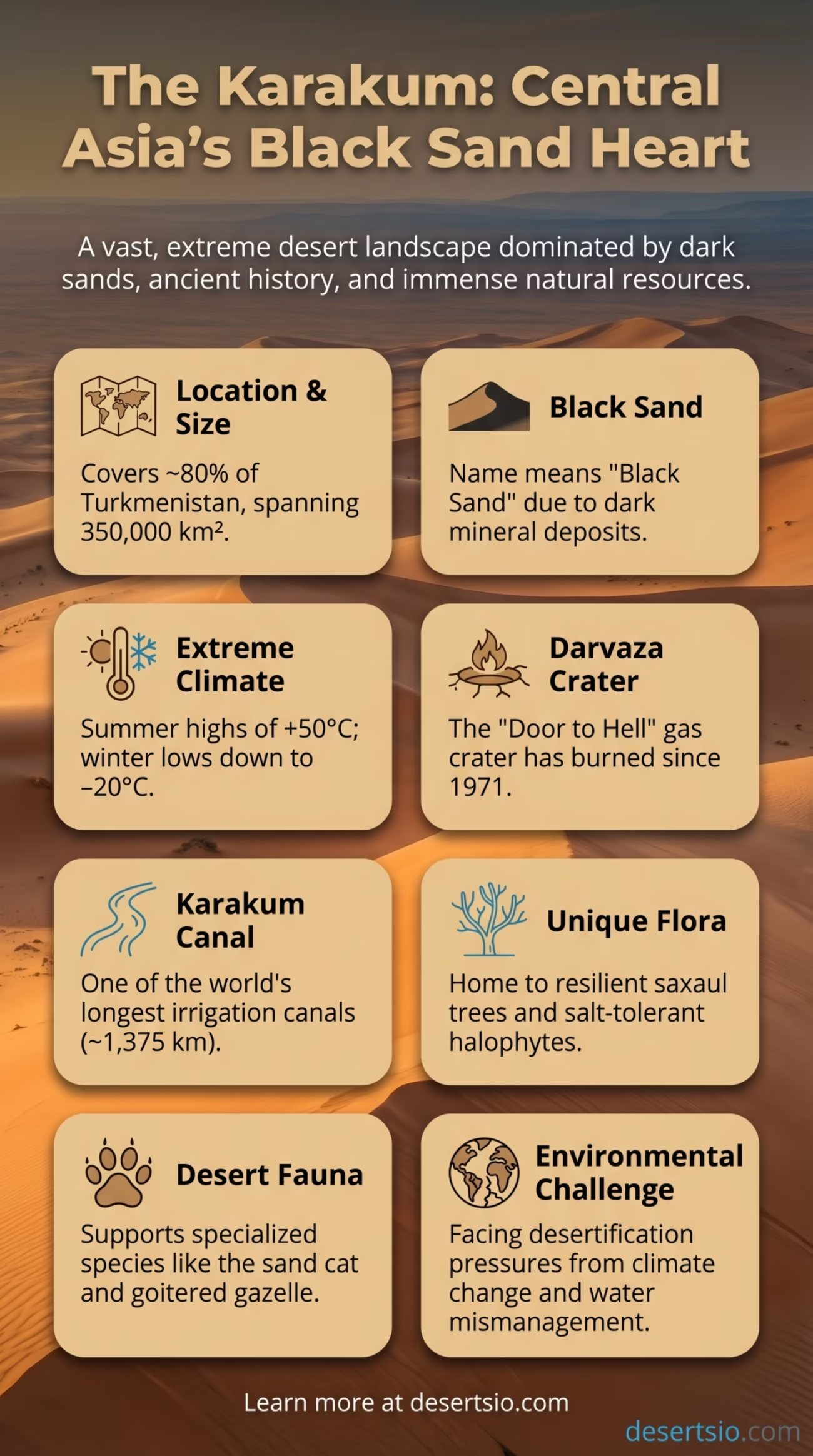
| Primary Vegetation | Saxaul trees, halophytes, sagebrush |
| Borders | Uzbekistan (east), Iran (south), Caspian Sea (west), Amu Darya (north) |
| Karakum Canal Length | ~1,375 km — one of the world’s longest irrigation canals |
The Karakum Desert sits at the heart of Central Asia like a vast, slow-burning furnace — covering roughly 80% of Turkmenistan’s entire landmass. That figure alone tells you something significant. This is not simply a desert that exists within a country; it essentially is the country’s landscape. Stretching across approximately 350,000 square kilometers, the Karakum ranks among the largest sand deserts in the world, and unlike many other deserts that attract immediate recognition, it remains one of the least explored by the wider world.
The name “Karakum” comes from the Turkic words kara (black) and kum (sand). The dark hue of the sand, especially noticeable in certain lighting conditions, is caused by high concentrations of dark minerals — primarily magnetite and biotite — mixed within the sediment. It is not black the way volcanic rock is black, but on a gray overcast morning, the dunes carry a distinctly shadowy tone that justifies the name entirely.
Karakum Desert: Location and Map View
How It Formed — and Why It Is Where It Is
The Karakum did not form overnight. Its origin traces back millions of years to the Tethys Sea, an ancient ocean that once covered much of Central Asia. As tectonic forces pushed the region upward and the sea gradually receded, enormous sedimentary deposits were left behind. Over millions of years, these deposits dried, eroded, and were reworked by wind into the expansive sand sheets and dune fields visible today.
The desert’s formation also owes much to its geography. Surrounded by mountain ranges on multiple sides — including the Kopet Dag to the south and the Pamir-Alay system to the east — the region sits in a deep continental interior. Moisture-laden air from the Atlantic and Indian Ocean simply never reaches here in meaningful quantities. The result is a hyper-arid environment where annual rainfall rarely exceeds 150 mm, and in some interior zones drops below 70 mm.
How Big Is the Karakum — Really?
At 350,000 km², the Karakum Desert is larger than Germany and Poland combined. It is also roughly the same size as the entire country of Japan — or about twice the size of the state of Montana. When you place those comparisons side by side, the scale becomes something you can actually picture.
The desert is broadly divided into three zones based on topography and sand formation:
- Northern Karakum — dominated by flat sandy plains (takyrs) and shallow depressions; historically used as seasonal pasture
- Central Karakum — the most extensive zone, with classic barchan dunes and sand ridges that can reach 25–30 meters in height
- Southern Karakum — more elevated, with a transition toward the Kopet Dag foothills and slightly higher precipitation
Temperature: A Desert of Extremes
The Karakum operates on extremes. During summer, surface sand temperatures can reach +70°C (158°F) — hot enough to cook an egg, quite literally. Air temperatures regularly exceed +45°C to +50°C between June and August. Winter is the opposite shock: temperatures plunge to −20°C (−4°F), and in some northern sections, even lower. The daily temperature swing alone — up to 30°C between afternoon heat and pre-dawn cold — makes this one of the most thermally dramatic desert environments on the planet.
That gap between day and night is not just a curiosity. It shapes everything: the behavior of animals, the survival strategies of plants, the timing of human movement across the desert. Desert travelers — and there have been many across centuries of Silk Road traffic — learned to move at dawn and rest by midday.
The Darvaza Crater — Fire That Has Burned for Decades
No discussion of the Karakum is complete without the Darvaza Gas Crater — also called the “Door to Hell.” Located near the small village of Darvaza in the central desert, this burning pit measures approximately 69 meters wide and 30 meters deep. It has been continuously on fire since approximately 1971, when a Soviet drilling operation caused the ground to collapse into an underground natural gas cavern. The decision to ignite the gas to prevent a methane buildup — intended as a short-term measure — turned into one of the most surreal, long-burning spectacles in the natural world.
In recent years, there have been official discussions about extinguishing the crater, citing environmental concerns and the ongoing release of greenhouse gases. Whether that effort moves forward remains to be seen — but for now, the crater continues to burn against the dark Karakum sky, attracting a growing number of visitors from around the world each year.
Flora and Fauna: Life Against the Odds
The Karakum is not lifeless — far from it. The desert supports a surprisingly resilient and specialized ecosystem, shaped entirely by the demands of heat, drought, and mineral-poor soils.
Plant life here revolves around a few key species built for survival:
- Saxaul (Haloxylon ammodendron) — the signature tree of Central Asian deserts; its roots penetrate deep for water and its wood is so dense it sinks in water
- Sagebrush and wormwood (Artemisia species) — form low gray-green carpets across sandy flats
- Halophytes — salt-tolerant plants that colonize the dry lake beds (takyrs) and saline depressions
- Ephemerals — short-lived spring flowers that bloom rapidly after winter rains and disappear by early summer
Fauna is equally adapted. The sand cat (Felis margarita) — one of the world’s smallest wild cats — is found here, as is the Karakum gecko, the saw-scaled viper, and numerous species of lizard that regulate temperature by burrowing into cooler sand layers. Larger mammals include the goitered gazelle and, historically, the Asiatic cheetah (now functionally extinct in the region). Bird life is significant during migration season, as the Karakum lies along Central Asian flyway routes connecting Siberia to South Asia.
Human Life in the Karakum
People have lived in and around the Karakum for thousands of years. The Tekke Turkmen — the dominant ethnic group in the region — developed a nomadic and semi-nomadic lifestyle perfectly calibrated for this landscape. They herded Karakul sheep, Akhal-Teke horses (one of the oldest horse breeds in the world, prized for endurance in extreme heat), and camels across seasonal grazing routes through the desert.
The Akhal-Teke horse, in particular, deserves a note — this breed evolved directly within the Karakum environment, developing a lean, metallic-coated physique capable of traveling long distances with minimal water. A living artifact of the desert itself.
Today, population density across the Karakum remains extremely low — fewer than 1 person per km² across most of the interior. The majority of Turkmenistan’s ~6 million people live along the desert’s southern and eastern fringes, near the Amu Darya, or in the capital Ashgabat — itself located at the desert’s southern edge against the Kopet Dag.
The Karakum Canal — Engineering on a Colossal Scale
One of the most significant human interventions in the Karakum’s history is the Karakum Canal (Garagum Canal). Completed in stages between 1954 and 1988, it stretches approximately 1,375 kilometers — making it one of the longest irrigation canals ever built. It draws water from the Amu Darya river and carries it westward through the desert, enabling agriculture in an otherwise uncultivable region.
The canal transformed large areas of southern Turkmenistan, allowing cotton cultivation on a massive scale. But it came at a cost. Water loss through seepage and evaporation along the unlined canal is estimated at 30–50% of total flow — a staggering inefficiency that also contributed to the broader drying of the Aral Sea further north. The environmental reckoning from that era continues to play out across the entire region.
Natural Gas: The Karakum Beneath the Surface
The Karakum sits atop one of the world’s largest natural gas reserves. Turkmenistan holds an estimated 265 trillion cubic feet of proven natural gas reserves — ranking it among the top five globally. The Galkynysh gas field, located in the southeastern Karakum, is the second-largest natural gas field in the world by some estimates, with reserves potentially exceeding 26 trillion cubic meters.
This geological reality shapes everything about modern Turkmenistan — its economy, its infrastructure, its geopolitical relationships. And the Darvaza Crater is, in a sense, a very visible symbol of that underground abundance burning quite literally at the surface.
Nearby Deserts and Regional Comparisons
The Karakum does not exist in isolation. Central Asia is one of the world’s great arid zones, and several neighboring deserts share geography, climate patterns, and ecological characteristics:
| Desert | Location | Area | Key Distinction |
| Kyzylkum Desert | Uzbekistan / Kazakhstan | ~298,000 km² | Name means “Red Sand”; borders Karakum to the northeast across Amu Darya |
| Ustyurt Plateau | Kazakhstan / Uzbekistan | ~200,000 km² | Elevated desert plateau; rocky rather than sandy |
| Taklamakan Desert | Xinjiang, China | ~337,000 km² | Similar scale; also a sand sea; even more extreme aridity |
| Iranian Dasht-e Kavir | Iran | ~77,000 km² | Salt desert; located south of Karakum across the Kopet Dag |
The Kyzylkum is arguably the Karakum’s closest twin — similar in age, geological origin, and ecology, separated only by the Amu Darya river. Both deserts share saxaul forests, similar fauna, and a shared history of Silk Road travel. The difference is primarily in the sand color and political borders. Together, the two form one of the largest continuous arid zones in Asia.
Compared to the Taklamakan in western China — which shares a similar scale and continental interior position — the Karakum receives marginally more rainfall and supports slightly denser vegetation. The Taklamakan is often called “the desert you go in but don’t come out of” in Chinese (tāklamakān); the Karakum has its own grim weather reputation, but its edges have supported human habitation for millennia.
Desertification Pressures in the Modern Era
The Karakum is a natural desert — but its edges are expanding in ways that are not natural at all. Overgrazing, unsustainable irrigation, and climate-driven temperature increases are pushing arid conditions outward into areas that were once marginal grasslands or productive agricultural zones.
The Aral Sea disaster — largely driven by Soviet-era water diversion from the Amu Darya and Syr Darya rivers — stands as one of the most dramatic desertification events of the 20th century. The sea lost over 90% of its volume between 1960 and 2007, leaving behind a new desert of salt flats and exposed seabed known as the Aralkum. This man-made desert now covers over 55,000 km² — and its salt-laden dust storms regularly blow across the Karakum region, compounding soil degradation in an already fragile environment.
Climate models for Central Asia project temperature increases of 2–4°C by 2100 under moderate emissions scenarios. For a region already operating at the edge of habitability, those numbers are not abstract projections. They translate directly into water stress, crop failure, and intensifying desertification pressure.
Desert Terminology — Karakum Context
- Takyr — flat, hard-surfaced clay pans found across the Karakum; form when shallow seasonal lakes dry out completely
- Barchan — crescent-shaped sand dunes; the dominant dune form in the central Karakum, moving 5–10 meters per year
- Erg — a large area of sand dunes; the Karakum is classified as an erg desert
- Halophyte — salt-tolerant plant; critical to stabilizing the saline soils around dried water bodies in the region
- Saxaul — the primary woody plant of Central Asian deserts; also used historically for fuel and as a windbreak
And the saxaul forests — once widespread across the Karakum and neighboring deserts — have been dramatically reduced by fuel harvesting and land clearing. Reforestation efforts using saxaul are now underway in several Central Asian countries as a sand stabilization and carbon sequestration strategy, recognizing that this ancient desert tree may be one of the region’s best defenses against further desertification. Slow-growing, dense, and deeply rooted — the saxaul is as much a symbol of the Karakum as the black sand itself.