
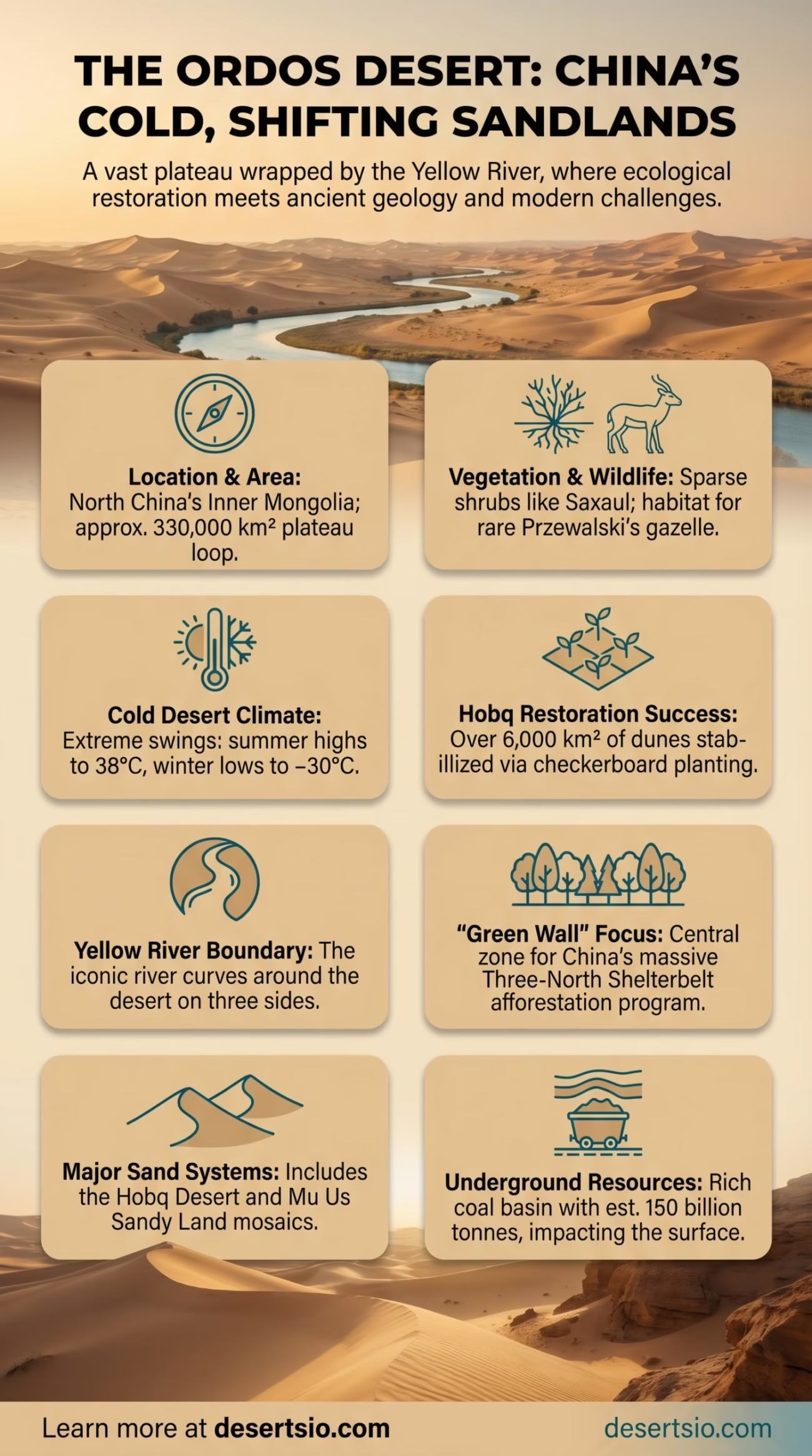
| Location | Northern China, Inner Mongolia Autonomous Region |
| Area | Approximately 330,000 km² (127,000 sq mi) |
| Type | Cold desert / Semi-arid plateau |
| Elevation | 1,000–1,500 m (3,280–4,920 ft) above sea level |
| Average Annual Rainfall | 150–400 mm (varies by zone) |
| Average Summer Temperature | Up to 38°C (100°F) during the day |
| Average Winter Temperature | Down to −30°C (−22°F) at night |
| Day/Night Temperature Difference | Up to 25–30°C within a single day |
| Primary Rivers | Yellow River (borders on three sides) |
| Major Sand Systems | Mu Us Sandy Land, Hobq Desert, Maowusu Sandy Land |
| Dominant Vegetation | Sparse shrubs, grasses, saxaul trees |
| Human Population | Approximately 1.5 million (Inner Mongolia region) |
| UNESCO / Notable Status | Subject of major afforestation efforts; “Green Wall of China” included |
The Ordos Desert sits on a high plateau looped by one of the world’s most iconic rivers — the Yellow River curves around it on three sides, forming a natural boundary that has shaped both the landscape and human history here for millennia. Despite being relatively unknown compared to the Sahara or the Gobi, the Ordos holds a staggering amount of geological, ecological, and cultural significance. And it is changing — fast.
Ordos Desert: Location and Map View
Where Exactly Is the Ordos Desert?
The Ordos Desert occupies the Ordos Plateau in the Inner Mongolia Autonomous Region of northern China. Its borders are defined almost entirely by the dramatic bend of the Yellow River — known locally as the Huang He — which wraps around the plateau from the west, north, and east. The southern edge transitions into the Loess Plateau, another geologically fascinating landform shaped by millennia of windblown sediment.
Administratively, the Ordos region covers parts of what is now Ordos City, a relatively young urban center established in 2001. The desert itself is not a single uniform sandy expanse — it breaks into several distinct sub-regions, each with its own character.
How Big Is the Ordos Desert?
At roughly 330,000 km², the Ordos Desert is larger than the entire country of Poland (312,696 km²). To put it another way, it is nearly twice the size of the state of Georgia in the United States. It is not the largest desert in Asia — the Gobi dwarfs it at over 1.3 million km² — but within China’s borders, the Ordos represents a critically significant dryland zone.
What makes the Ordos especially complex is that it is not a single desert. It functions more like a mosaic of arid and semi-arid landscapes:
- Hobq Desert (Kubuqi) — approximately 18,600 km², one of China’s most actively managed desert systems
- Mu Us Sandy Land (Maowusu) — around 42,200 km², historically one of the most degraded landscapes in the region
- Ordos Plateau proper — a mix of grassland, steppe, and degraded scrubland
Formation: How the Ordos Desert Came to Be
The Ordos Plateau is geologically ancient. The underlying bedrock belongs to the Ordos Block, one of the most stable cratonic units in China, dating back to the Precambrian era — over 541 million years ago. But the desert conditions themselves are far more recent in geological terms.
During the Quaternary period (roughly the last 2.6 million years), shifting monsoon patterns, tectonic uplift of the Tibetan Plateau, and the progressive drying of Central Asia combined to reduce moisture across the entire region. The Yellow River’s sediment load — it carries more sediment per unit of water than almost any other river on Earth — shows how erosion and aridity have shaped the landscape here for millions of years.
Human activity accelerated desertification dramatically over the past 2,000 years. Intensive agriculture, overgrazing, and deforestation during various dynasties stripped the region of its natural vegetation cover. The loss of that cover exposed soils to wind erosion, triggering feedback loops that expanded sandy areas at an alarming rate — particularly from the 14th century onward.
Temperature: A Desert of Extremes
The Ordos is a cold desert — a category that surprises many people who associate deserts only with searing heat. Summer temperatures can reach 38°C (100°F) during peak afternoon hours. Winters are brutally cold, with nighttime temperatures dropping to −30°C (−22°F) in the most exposed areas.
The diurnal temperature range — the difference between daytime highs and nighttime lows — can reach 25 to 30°C within a single 24-hour period. That kind of swing stresses both vegetation and rock alike. It is one reason the landscape here looks so physically beaten: rock fragments, cracked soils, and sparse ground cover are the norm rather than the exception.
Annual precipitation ranges from around 150 mm in the driest western zones to nearly 400 mm in the more humid southeastern margins. Most of that rainfall arrives during summer monsoon season (July–August), which is highly variable from year to year.
Flora and Fauna: Life in a Harsh Landscape
The Ordos is not lifeless — far from it. Its vegetation is dominated by drought-resistant species adapted to thin soils and extreme temperature swings.
Key plant species include:
- Saxaul (Haloxylon ammodendron) — a deep-rooted shrubby tree capable of fixing sand dunes and surviving on minimal water
- Caragana (pea shrubs) — nitrogen-fixing shrubs widely used in restoration planting
- Artemisia species — semi-woody plants that form large mats on sandy soils
- Stipa grasses — feather grasses that colonize semi-stable sandy terrain
Wildlife in the Ordos is more diverse than the landscape suggests. Przewalski’s gazelle — one of the world’s rarest ungulates — has a stronghold near the shores of Qinghai Lake to the southwest, and related gazelle species roam the Ordos steppe. Mongolian wild ass (Equus hemionus), sand fox, and various raptor species including rough-legged buzzards are documented throughout the region. The desert margins also host significant populations of great bustards, a globally threatened bird that relies on undisturbed steppe habitat.
And the rivers matter. The Yellow River corridor along the desert’s edge provides critical wetland habitat — a striking contrast to the dry interior.
Human Life: Who Lives Here?
The Ordos region has a layered human history stretching back tens of thousands of years. Archaeological evidence from the Ordos culture — a Bronze Age civilization — shows that nomadic pastoralists inhabited this plateau as early as the 1st millennium BCE. The region was famously part of the territory contested between Chinese dynasties and steppe nomads, and the area bears the marks of that history in its place names, oral traditions, and land-use patterns.
Today, the Ordos region is home to both ethnic Mongolian herding communities and Han Chinese settlers who arrived in larger numbers during the 20th century. Traditional Mongolian pastoralism — characterized by seasonal migration with sheep, goats, and horses — persists in parts of the plateau, though modernization and land policies have significantly reduced the scale of nomadic movement.
And then there is Ordos City itself. Built largely from scratch in the 2000s on the back of coal revenues, it became internationally famous as China’s so-called “ghost city” — a fully planned urban center that initially struggled to attract permanent residents. As of the 2020s, the city’s population has grown considerably and now functions as a real administrative and commercial hub, though its story remains one of the more striking examples of rapid urban development in dryland environments.
The Hobq Desert: A Restoration Story Worth Noting
Within the Ordos, the Hobq (Kubuqi) Desert has received global attention for one of the most ambitious land restoration projects ever attempted. Over roughly three decades, a combination of government programs and private enterprise has converted more than 6,000 km² of moving sand dunes into stabilized, vegetated land. The approach relied on planting sand-binding species in a grid pattern — a technique sometimes called straw checkerboard stabilization — alongside drip irrigation networks in targeted zones.
In 2017, the Hobq Desert restoration model was recognized at the United Nations Convention to Combat Desertification (UNCCD) as a global best practice. That is not a minor achievement — it places this small corner of Inner Mongolia alongside far better-known conservation efforts worldwide.
The Ordos and China’s Desertification Challenge
China is one of the countries most severely affected by desertification. According to data from the State Forestry and Grassland Administration, approximately 27% of China’s land area is classified as desert or desertified land. The Ordos sits at the heart of this crisis — it is part of a larger arid belt that includes the Gobi, the Taklamakan, and the Loess Plateau.
The “Three-North Shelterbelt Program” — commonly known as the Great Green Wall of China — has been the country’s primary policy response since 1978. This afforestation initiative targets a 4,500 km belt across northern China, with the Ordos region serving as one of its central implementation zones. By 2020, the program had reportedly planted over 66 billion trees, though researchers continue to debate the ecological effectiveness of monoculture plantations versus natural regeneration in dryland systems.
Sandstorms from the Ordos and neighboring deserts regularly affect Beijing — located roughly 700 km to the east. Particularly severe events, like the March 2021 sandstorm that blanketed Beijing in orange dust, are directly tied to conditions across the Ordos Plateau and Mongolian Gobi. These events still occur and are now clearly linked to land degradation data from the region.
Neighboring Deserts: The Broader Dryland Context
The Ordos does not exist in isolation. It belongs to a vast dryland system spanning Central and East Asia. Understanding its neighbors helps frame the scale of the challenge — and the landscape.
| Desert | Location | Area | Key Characteristic |
| Gobi Desert | Mongolia / Northern China | 1.3 million km² | Cold desert; iconic for dinosaur fossils |
| Taklamakan Desert | Xinjiang, China | 337,000 km² | One of the largest shifting sand deserts on Earth |
| Mu Us Sandy Land | Inner Mongolia / Shaanxi | 42,200 km² | Sub-region of Ordos; partially rehabilitated |
| Tengger Desert | Inner Mongolia / Gansu | 36,700 km² | Sand sheet desert; borders the Gobi |
| Badain Jaran Desert | Inner Mongolia | 49,000 km² | Known for towering mega-dunes and salt lakes |
The Gobi Desert is the Ordos’s most significant neighbor — and in some older classifications, the Ordos was treated as a sub-section of the greater Gobi system. Modern geography treats them separately, primarily because the Ordos sits on a distinct geological block and receives slightly more precipitation than the central Gobi. The Badain Jaran Desert, located to the west, is worth a specific mention: it contains some of the tallest stationary sand dunes on Earth, reaching over 500 meters in height, and its mysterious freshwater lakes fed by underground aquifers are still an active area of scientific research.
The Coal Factor: Underground Wealth, Surface Consequences
Beneath the Ordos’s arid surface lies one of China’s richest coal basins. The Ordos Basin contains an estimated 150 billion tonnes of coal reserves — figures that have made this region a major part of China’s energy supply. The basin also holds substantial natural gas and oil deposits.
Extraction activity has reshaped parts of the landscape significantly. Open-pit mining operations, groundwater drawdown from industrial use, and road infrastructure all intersect with the already-fragile ecology of the plateau. This tension between resource extraction and ecological restoration is one of the defining dynamics of the modern Ordos — and one that researchers, policymakers, and local communities navigate in real time.
Ordos City’s rapid growth was almost entirely funded by coal revenues. At its peak in the mid-2000s, the region was producing enormous wealth — and channeling it into infrastructure at a speed that outpaced population growth. The subsequent economic correction left iconic images of empty boulevards and unused apartment blocks, though the city has since stabilized considerably.
Ordos vs. Taklamakan: A Comparison
Both the Ordos and the Taklamakan are Chinese deserts, but they are fundamentally different in character. The Taklamakan is a deep continental desert — enclosed by three mountain ranges, starved of moisture, and dominated by shifting sand seas (erg terrain). The Ordos, by contrast, is a plateau desert with a more varied surface, significantly higher precipitation in its eastern margins, and a much longer history of human habitation.
The Taklamakan is also far more isolated — the ancient Silk Road skirted its edges precisely because its interior was impassable. The Ordos was always more permeable, serving as a corridor between steppe and agricultural China rather than a barrier. That accessibility is part of why its degradation accelerated so quickly under human pressure.
Ordos Desert
- Plateau-based, high elevation
- Cold desert with monsoon-influenced precipitation
- Heavily affected by human land use history
- Significant restoration successes (Hobq)
- Rich in coal and fossil resources
Taklamakan Desert
- Basin-based, enclosed by mountains
- Hyperarid; less than 10 mm rain in some zones
- Historically isolated; Silk Road border zone
- Dominated by massive sand dunes
- Significant oil and gas deposits
A Landscape Still in Motion
The Ordos Desert is not a static place. Satellite data from the past two decades shows measurable greening in certain zones — particularly around the Mu Us Sandy Land, where restoration efforts have genuinely reversed sand encroachment. A 2019 study using NASA and ESA satellite imagery identified the Ordos Plateau as one of the regions contributing to a statistically significant increase in global vegetation cover — a counterintuitive finding that made headlines in the environmental science community.
At the same time, climate projections suggest that the broader dryland zone across Central Asia will continue to expand under warming scenarios. Rainfall patterns in the East Asian monsoon system are becoming more erratic. The ground-level story is genuinely complicated — progress in some areas, continued stress in others.
What remains constant is the scale of the human engagement with this landscape. Few deserts on Earth have been so intensively studied, so actively managed, and so deeply tied to the fortunes of an entire civilization. The Yellow River — the cradle of Chinese civilization — flows around the Ordos not by coincidence but by deep geological design. And that river’s relationship with the desert’s sediment load is itself a story stretching back millions of years.
The Ordos is, in the end, a desert that refuses easy categorization. Cold, mineral-rich, historically significant, ecologically stressed, and actively transforming — it is one of those places where geology, ecology, and human ambition all collide at once.