| Official Name | Rub’ al Khali (Empty Quarter) |
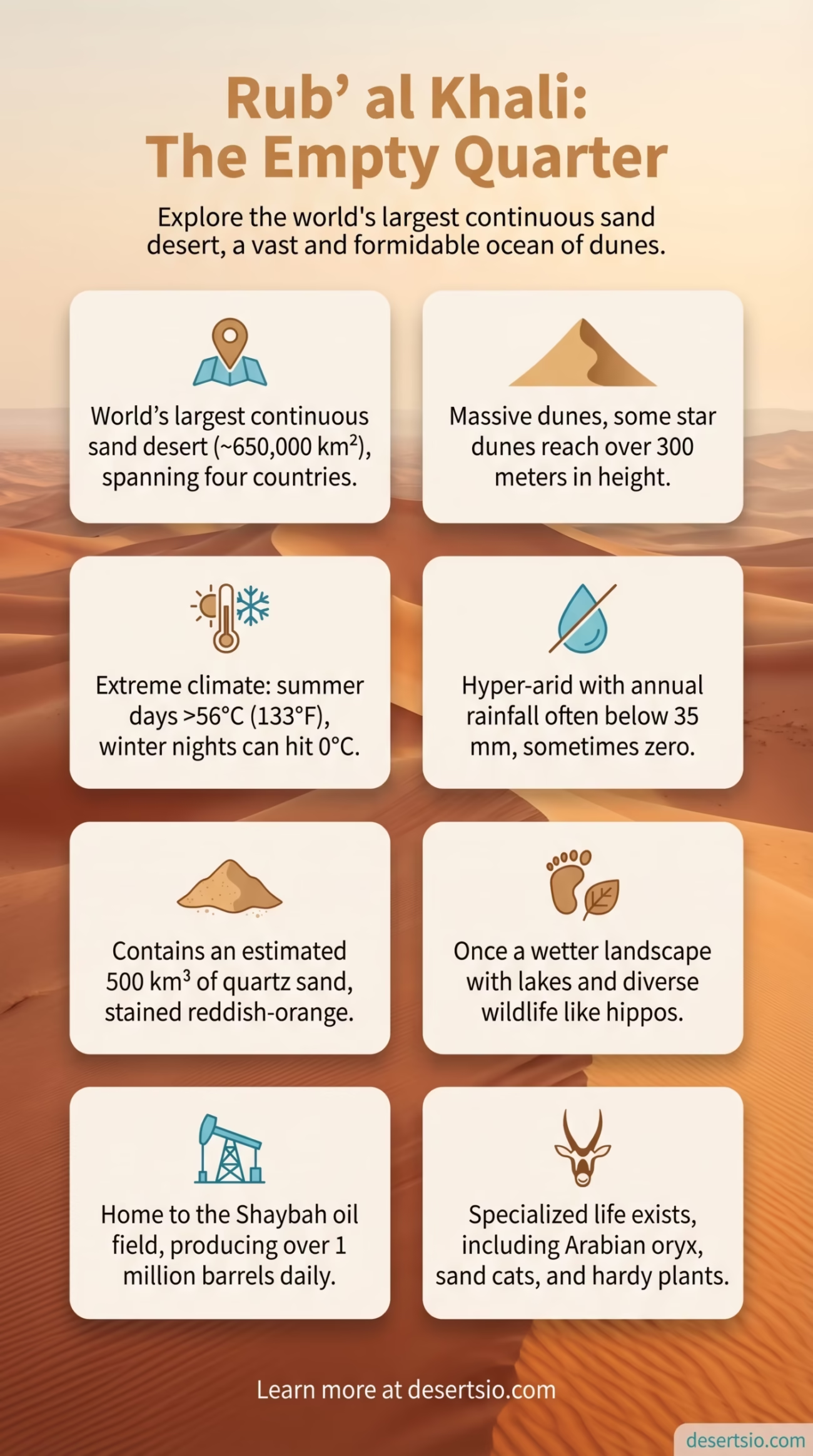
| Location | Arabian Peninsula — Saudi Arabia, UAE, Oman, Yemen |
| Total Area | ~650,000 km² (251,000 sq mi) |
| Desert Type | Subtropical hot sand desert (Erg desert) |
| Average Daytime Temperature | Up to 56°C (133°F) in summer |
| Average Nighttime Temperature | Can drop to 0°C (32°F) in winter nights |
| Annual Rainfall | < 35 mm/year (some areas receive near zero) |
| Highest Sand Dune | ~330 meters (Uruq Suban dune field) |
| Dominant Sand Color | Deep orange-red to pale gold |
| Largest Continuous Sand Body | Largest in the world |
| Estimated Sand Volume | ~500 km³ of sand |
| Elevation Range | Sea level to ~1,000 m in the southwest |
| Primary Countries | Saudi Arabia (~80%), UAE, Oman, Yemen |
| Known Oil/Gas Fields | Shaybah oil field (Saudi Aramco), Makhul structure |
| UNESCO Status | Not designated; subject to ongoing ecological research |
Roughly the size of France — or, to put it another way, larger than the entire state of Texas — the Rub’ al Khali stretches across the southern third of the Arabian Peninsula in a way that is almost difficult to comprehend from a map alone. It is the world’s largest continuous sand desert, covering approximately 650,000 square kilometers. No other sand sea on Earth comes close to that figure. The Sahara is bigger in total area, yes, but its sand (erg) portions are fragmented. Rub’ al Khali is one unbroken ocean of dunes, gravel plains, and salt flats — and it has earned its name: the Empty Quarter.
How Did This Desert Form?
The Rub’ al Khali did not always look like this. Around 35 million years ago, the Arabian tectonic plate began separating from Africa, and the climate of the region shifted dramatically over geological time. The crucial formation period occurred during the Miocene epoch (roughly 23–5 million years ago), when shifting monsoon patterns gradually withdrew from the Arabian interior.
By approximately 2–3 million years ago, the basin — a low-lying sedimentary depression — began accumulating wind-driven sand from surrounding highlands. Sand didn’t pile up overnight; it migrated, grain by grain, shaped by the shamal winds (the dominant northwest wind of the Arabian Peninsula). The basin’s bowl-like topography trapped it all. Over millennia, the sand deepened, dunes grew taller, and what was once a more humid savanna-like environment dried into what travelers today call the Empty Quarter.
Interestingly, lake sediments and fossilized animal bones found beneath the dunes confirm that the region experienced multiple “green periods” — times when rainfall was higher and the landscape supported grasslands and freshwater lakes. The most recent wet phase ended around 5,000–6,000 years ago.
Size in Perspective
Numbers help, but a comparison makes it real. At 650,000 km², the Rub’ al Khali is:
- Larger than France (551,695 km²)
- Bigger than Texas and California combined
- About 7 times the size of Iceland
- Roughly 1.5 times the size of Germany and Poland together
It spans across four countries — Saudi Arabia holds roughly 80% of the total area, with the remainder split between the UAE, Oman, and Yemen. The desert’s southwestern edge reaches elevations approaching 1,000 meters, while its eastern margins nearly touch sea level near the Arabian Gulf coast.
Temperature: Fire by Day, Cold by Night
Sand is a poor insulator. That fact alone explains one of the desert’s most extreme characteristics: the temperature swing.
During summer months, surface sand temperatures can exceed 80°C (176°F), while air temperatures at head height climb above 56°C (133°F). These are not rare spikes — they are routine highs between June and August. In contrast, winter nights (December to February) can bring air temperatures down to 0°C (32°F) or occasionally below in the higher-elevation southwestern regions. A single day in January might begin at 2°C at dawn and reach 28°C by afternoon. That is a swing of more than 25 degrees in one day.
Humidity is almost nonexistent in the interior — often below 5% — which accelerates moisture loss from the body far faster than people expect. Annual rainfall across most of the Rub’ al Khali stays below 35 mm. Some years, certain areas receive nothing at all.
Flora and Fauna: Life at the Edge
The Empty Quarter is not empty of life — it just hides it well. Vegetation is sparse and highly specialized. The Calligonum comosum (a woody shrub locally known as abal) anchors dunes with its root systems and survives on almost no water. Cyperus conglomeratus grasses appear in interdune corridors, and occasional acacia trees manage root depths exceeding 30 meters to reach underground moisture. These are not decorative plants — they are survival machines.
Animal life is similarly adapted and often nocturnal:
- Arabian sand gazelle (Gazella subgutturosa marica) — can go weeks without drinking free water
- Arabian oryx (Oryx leucoryx) — reintroduced to adjacent regions after near-extinction; navigates using keen spatial memory
- Sand cat (Felis margarita) — thick-furred paws allow movement on hot sand
- Dabb lizard (Uromastyx spp.) — herbivorous, highly heat-tolerant
- Saw-scaled viper — one of the desert’s few genuinely dangerous residents
- Various migratory birds — use the edges seasonally as a corridor
And insects — particularly beetles and ants — exist in surprisingly high diversity even in the deep interior. They are, in many ways, the desert’s true permanent residents.
Human Life in the Empty Quarter
Permanent settlement is essentially impossible in the deep interior. The Al Murra tribe — sometimes called the Murrah or the Ahl al-Rub’ — are historically the most closely associated nomadic group with the Rub’ al Khali. Masters of desert navigation, they traversed the Empty Quarter for centuries using stars, wind direction, and memorized dune formations as their maps. Their knowledge of underground water — the qara — hidden beneath certain sand formations was generational and irreplaceable.
Traditional Bedouin camel herding routes crossed the desert seasonally, following brief rain events that triggered short bursts of vegetation. Today, most Al Murra members live in settled communities. But the oral knowledge of desert survival remains culturally alive, if less practically used than before.
The only significant permanent human presence in the interior today is industrial — the Shaybah oil field, operated by Saudi Aramco deep within Saudi territory. Discovered in 1968 and fully developed by 1998, Shaybah produces over 1 million barrels of oil per day and sits atop one of the world’s largest oil reserves. An airstrip was built into the desert just to service it.
The Dunes: Engineering by Wind
Not all dunes are equal. The Rub’ al Khali contains at least five distinct dune morphologies, shaped by prevailing wind patterns and sand supply:
- Star dunes — radial arms extending from a central peak, formed by multidirectional winds; some exceed 300 meters in height
- Linear (longitudinal) dunes — parallel ridges stretching for dozens of kilometers, dominant in the eastern regions
- Crescentic (barchan) dunes — classic crescent shapes, fast-moving, common on the desert’s margins
- Compound dunes — large dunes with smaller dunes superimposed on their flanks
- Interdune corridors — flat, hard-packed areas between dune systems, sometimes salt-crusted
The sand itself is predominantly quartz, stained iron-oxide red to deep orange by centuries of oxidation. In the eastern UAE sections, sand color shifts to lighter gold. From satellite imagery, the color gradient is visible — and striking.
Resources and Modern Significance
Beneath those dunes lies extraordinary wealth. The Rub’ al Khali sits over one of the most hydrocarbon-rich geological formations on Earth. Beyond Shaybah, exploratory drilling in the Omani and Yemeni sections has confirmed additional reserves. Natural gas fields in the UAE’s Liwa region — directly adjacent to the desert’s northern edge — feed into national energy networks.
More recently, the desert has attracted attention for a different kind of energy. Saudi Arabia’s NEOM megaproject and broader Vision 2030 renewable energy goals have placed the Arabian Peninsula’s solar potential under serious analysis. The Rub’ al Khali receives solar radiation levels among the highest on the planet — over 2,400 kWh/m²/year in peak zones. That is roughly double what northern European solar installations receive.
Nearby Deserts and Regional Comparisons
The Rub’ al Khali does not exist in isolation. The broader Arabian Desert — of which it forms the southern core — includes several adjacent arid regions worth knowing:
| Desert / Region | Area | Key Feature |
| An Nafud (Saudi Arabia) | ~64,000 km² | Red sand dunes; northern Arabian Desert |
| Ad-Dahna (Saudi Arabia) | ~45,000 km² | Narrow sand corridor linking Nafud to Rub’ al Khali |
| Wahiba Sands (Oman) | ~12,000 km² | Well-studied dune ecosystem; Omani Bedouin heritage |
| Liwa Oasis Region (UAE) | Part of Rub’ al Khali edge | Massive star dunes; Moreeb dune (300 m) |
| Dasht-e Lut (Iran) | ~51,800 km² | Hottest surface temperatures ever recorded on Earth |
The Dasht-e Lut in Iran is perhaps the closest geological cousin to the Rub’ al Khali — a hyper-arid, tectonically formed basin with extreme temperatures. NASA satellite data recorded surface temperatures of 70.7°C (159°F) in Dasht-e Lut in 2005, making it the hottest land surface ever measured. The Rub’ al Khali runs a close second in terms of recorded surface heat. Both deserts share the same fundamental challenge: heat so intense it transforms the land into something that feels almost extraterrestrial.
Desert Terminology: A Short Glossary
- Erg: A vast, sand-covered desert area — the Rub’ al Khali is the world’s largest erg.
- Shamal: The persistent northwest wind of the Arabian Peninsula that shapes dune migration patterns.
- Qara: Bedouin term for hidden sub-surface water sources in desert terrain.
- Star dune (Draa): A multi-armed dune formed by winds coming from multiple directions.
- Interdune corridor: The flat, often hard-packed terrain between major dune ridges.
Scientific Research and Climate Signals
The Rub’ al Khali has become an important field for paleoclimate research. Ancient lake beds — called playas — buried beneath modern dunes have yielded pollen samples, ostracod fossils, and even hippopotamus bones, confirming that the region once supported diverse megafauna during wetter geological periods. These findings are not just historically interesting. They help scientists model how today’s climate might shift over coming centuries under various warming scenarios.
And the desert is changing. Satellite data from the past two decades shows measurable dune migration — some dunes moving 10–30 meters per year — driven by shifting wind patterns potentially linked to broader atmospheric changes in the Arabian Sea region. Dust storms originating from the Rub’ al Khali also affect air quality as far away as South Asia, a fact now integrated into regional weather modeling systems.
In 2023, the region experienced unusual rainfall events — a pattern increasingly noted across Arabian desert margins — causing temporary flooding in areas that may see no rain for years at a stretch. Whether these events represent a statistical anomaly or a systemic shift remains an active research question.
The Desert’s Unwritten Reputation
Wilfred Thesiger, the British explorer who crossed the Rub’ al Khali twice in the late 1940s with Bedouin companions, described the experience as one of the most physically and mentally demanding of his life — and he had traveled widely in some of the world’s harshest environments. His accounts, published in Arabian Sands (1959), remain among the most detailed firsthand descriptions of the desert’s interior.
What strikes modern readers of those accounts is how unchanged the landscape itself remains. Infrastructure encroaches on the edges. Satellite phones have replaced star navigation for many. But the sand, the heat, the silence at the center of the Empty Quarter — those things persist. The desert, in its deepest reaches, does not particularly acknowledge human presence. It never has.
And that, perhaps more than any statistic, is what defines the Rub’ al Khali.