
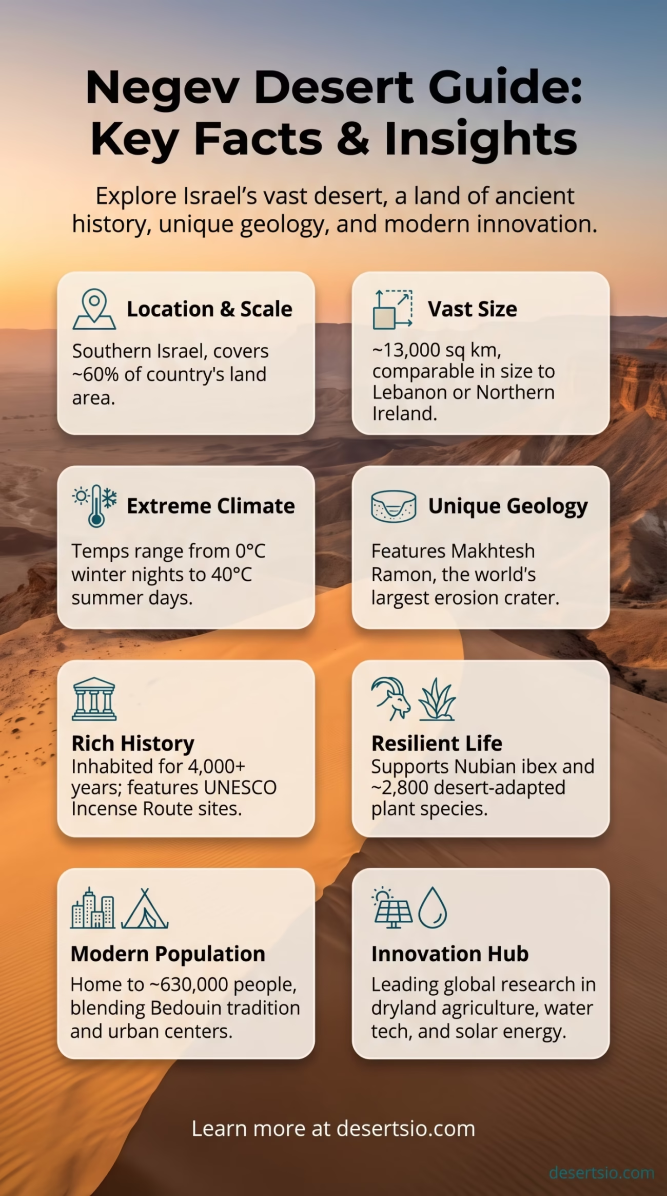
| Location | Southern Israel |
| Area | ~13,000 km² (5,020 sq mi) |
| Type | Semi-arid to hyper-arid desert |
| Annual Rainfall | 20–30 mm (south); up to 200 mm (north) |
| Highest Point | Har Ramon — 1,037 m (3,402 ft) |
| Daytime Temperature | Up to 40°C (104°F) in summer |
| Nighttime Temperature | Can drop to 0°C (32°F) in winter |
| Population | ~630,000 (including Beersheba) |
| Major City | Beersheba (capital of the Negev) |
| Dominant Terrain | Rocky plateaus, wadis, craters, sand dunes |
| UNESCO Recognition | Ancient Negev route — World Heritage Site (2005) |
| Comparable Size | Slightly larger than Lebanon |
The Negev Desert covers more than 60% of Israel’s total land area — and yet, it is one of the most misunderstood deserts on Earth. People hear “desert” and picture an empty, lifeless expanse. The Negev is something else entirely. It holds ancient trade routes, one of the world’s most dramatic geological craters, a surprisingly resilient ecosystem, and a living population that has adapted to its extremes for thousands of years.
Negev Desert: Location and Map View
How Big Is the Negev — Really?
At roughly 13,000 square kilometers, the Negev is slightly larger than Lebanon and nearly three times the size of the U.S. state of Rhode Island. To put it in European terms, it is comparable in size to Northern Ireland. For a country as compact as Israel, this is a striking statistic — more than half the country’s territory is desert.
The desert stretches from the outskirts of Beersheba in the north all the way down to the port city of Eilat on the Red Sea. That’s a distance of roughly 180 kilometers end to end, and the landscape shifts dramatically as you move south — from semi-arid shrubland to barren, rocky hammada terrain and narrow canyon systems.
Formation: A Desert Shaped by Tectonics and Time
The Negev’s geology tells a long story. The region sits at the northern edge of the Arabian-African tectonic boundary, and its landscapes were sculpted over tens of millions of years by a combination of marine sedimentation, tectonic uplift, and erosion. During the Mesozoic Era, much of what is now the Negev lay beneath a shallow sea — which explains the abundance of limestone and chalk formations found throughout the region.
The most striking result of this geological history is the Makhtesh Ramon — a massive erosion crater (not a meteor impact crater, as commonly assumed) stretching 40 kilometers long, 8 kilometers wide, and nearly 500 meters deep. It is the largest makhtesh in the world and a formation type found almost exclusively in the Negev and Sinai. There is nothing quite like it anywhere else on Earth.
The desert’s arid conditions developed gradually over the last 10,000–12,000 years as the Saharan-Arabian dry belt expanded northward following the end of the last glacial period. What was once wetter, more vegetated land slowly transformed into the dry, wind-sculpted terrain seen today.
Temperature: The Desert That Freezes
Many deserts swing between extremes. The Negev takes this to a specific and sometimes surprising level.
During summer, daytime temperatures in the southern Negev regularly reach 38–40°C (100–104°F). The high-altitude plateau around Mitzpe Ramon can be slightly cooler, but solar radiation is intense throughout. Come nighttime in winter — especially at elevation — temperatures can fall to near or below 0°C (32°F). Snow occasionally falls in the highland areas, which catches many people off guard given the desert setting.
Seasonal Temperature Overview:
- Summer (June–August): Daytime highs of 35–40°C; nights around 20–24°C
- Spring/Autumn: Mild days (20–28°C), cooler nights (10–15°C)
- Winter (December–February): Days 10–15°C; nights can drop below 0°C at altitude
- Hamsin winds: Hot, dry dust winds — occasionally push temperatures above 45°C for short periods
Flora and Fauna: Life Finds Its Way
The Negev supports a surprisingly diverse range of species — adapted, in every case, to survive on minimal water and maximum heat. Over 2,800 plant species have been recorded across Israel, with a significant portion found in or at the edges of the Negev. True desert specialists include:
- Retama raetam (white weeping broom) — a shrub that survives by photosynthesizing through its branches rather than leaves
- Desert tulip (Tulipa systola) — blooms briefly after winter rains, a remarkable sight on the rocky slopes
- Zygophyllum dumosum — a low succulent shrub dominant across the Negev highlands
- Various acacia species lining the dry riverbeds (wadis), where occasional water flows underground
Animal life is equally tenacious. The Nubian ibex (Capra nubiana) roams the canyon walls of Makhtesh Ramon with almost unsettling confidence. Arabian leopards were historically present and remain a subject of conservation interest, though verified sightings are extremely rare today. More reliably spotted:
- Desert fox (Vulpes zerda relatives) and Rüppell’s fox
- Sand partridge and various raptor species including the griffon vulture
- Dorcas gazelle — a small, elegant antelope well-adapted to arid zones
- Tristram’s starling — a striking black-and-orange bird endemic to rocky desert habitats of the region
Reptiles thrive here too. The spiny-tailed lizard (Uromastyx aegyptia) and various gecko species are common. And the Saharan horned viper — though rarely encountered — does exist in the sandy sections of the southern Negev.
Human Life in the Negev
The Negev has been inhabited — continuously, in some form — for at least 4,000 years. And that human presence has left a visible mark on the land.
The Bedouin people are the desert’s most historically significant inhabitants. Traditionally semi-nomadic, Negev Bedouin communities developed a deep, practical knowledge of the desert — how to find water, how to graze herds across seemingly barren land, how to build structures that breathe. Today, an estimated 200,000–250,000 Bedouin live in the Negev region, in a mix of recognized towns and traditional encampments. The town of Rahat is the largest Bedouin city in the world.
Beyond the Bedouin, Beersheba — often called the capital of the Negev — has grown into a city of over 210,000 people and serves as an educational and technological hub. Ben-Gurion University of the Negev, based in Beersheba, conducts leading research in dryland agriculture, water technology, and desert ecology — research that has direct applications far beyond Israel’s borders.
Ancient Nabataean cities — Avdat, Shivta, Haluza — are preserved across the desert. These were sophisticated settlements along the Incense Route, the ancient trade network connecting Arabia to the Mediterranean. In 2005, this route and its associated towns were inscribed as a UNESCO World Heritage Site. The Nabataeans also engineered intricate runoff agriculture systems — essentially harvesting rainwater across large catchment areas — a technique now studied by modern engineers facing water scarcity.
The Negev’s Geological Wonders
Makhtesh Ramon gets most of the attention — and deservedly so. But the Negev has four other makhteshim (erosion craters): Makhtesh Gadol, Makhtesh Katan, Makhtesh Saharonim, and Makhtesh Ovda. This concentration of erosion craters in one region is geologically unique on a global scale.
The crater walls expose rock layers spanning hundreds of millions of years. Triassic sandstone sits beside Cretaceous limestone. Fossilized ammonites and marine shells are visible in the exposed strata — physical records of the ancient sea that once covered this land. And the colors are striking: deep reds, ochres, pale whites, and iron-black basalt, all layered in stripes that catch the light differently at different hours.
Water, Agriculture, and Modern Desert Science
Water scarcity in the Negev is not just a local issue — it’s a case study the world is watching. Annual rainfall in the southern Negev drops to as little as 20 mm per year. And yet, agriculture exists here. That’s not a small thing.
Drip irrigation — a technology that originated largely in Israeli agricultural research — has allowed farming to expand in the Negev even under these extreme constraints. The National Water Carrier and subsequent desalination infrastructure have made freshwater access possible in areas that would otherwise be uninhabitable by modern standards.
And the desert is increasingly seen as a site for solar energy production. The Negev receives over 300 sunny days per year, making it one of the best locations in the world for photovoltaic development. Several large-scale solar farms are already operational, and expansion plans are significant — part of a broader shift to use desert geography as an energy resource rather than a liability.
Nearby Deserts and Regional Context
The Negev does not exist in geographic isolation. It sits at a crossroads of several major dryland systems.
- Sinai Desert (Egypt): Directly west and southwest of the Negev, the Sinai Peninsula shares similar geological origins — limestone plateaus, wadis, and sandy coastal zones. The two deserts were once ecologically continuous before modern borders.
- Arabian Desert: To the east, across the Wadi Araba and the Jordan Rift Valley. The Negev transitions almost seamlessly into the northern reaches of the Arabian Desert through Jordan’s Wadi Rum region.
- Judean Desert: Directly north of the Negev, a smaller rain-shadow desert running along the Dead Sea and Jordan River. Receives slightly more rainfall but shares similar arid ecology.
- Syrian Desert (Badia): Further northeast, covering parts of Syria and Jordan. Shares the region’s Saharo-Arabian climate belt but is geographically distinct.
Comparing the Negev to the Atacama Desert of South America makes for an interesting exercise. Both are relatively small deserts by global standards. Both sit in regions with ancient human civilizations that mastered water harvesting. Both experience extreme temperature swings. The Atacama is significantly drier (some parts receive virtually zero rainfall), but the Negev’s unique makhtesh formations and its dense human history give it a character that is genuinely its own.
Why the Negev Matters Now
Deserts are expanding globally — a process driven largely by climate change and land degradation. The Negev sits on the front line of this shift. Research emerging from Ben-Gurion University and the Blaustein Institutes for Desert Research (based at Kibbutz Sde Boker, where Israel’s founding leader once chose to retire — precisely because he believed the desert held the country’s future) is contributing to global understanding of dryland management, renewable energy in arid zones, and sustainable water use.
The desert also plays an increasingly visible role in astrobiology and space research. Its extreme, Mars-analog terrain — especially around Makhtesh Ramon — has been used by international research teams to simulate conditions on Mars. And the Ramon Crater area hosts an analog astronaut habitat where researchers test protocols for future planetary exploration missions.
Thirteen thousand square kilometers of rock, sand, ancient history, extreme climate, and cutting-edge science. The Negev is a desert — but calling it “just a desert” misses almost everything interesting about it.