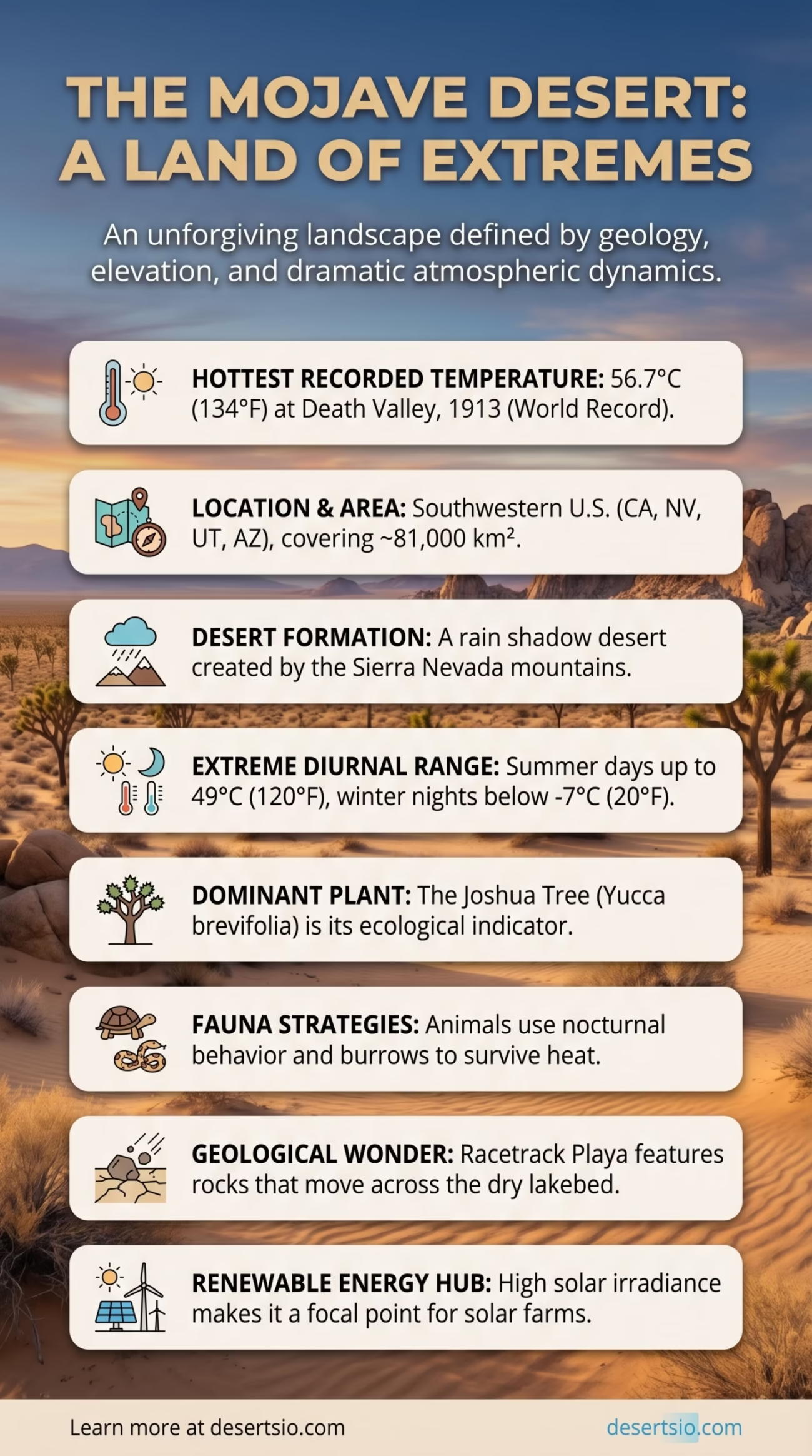
| Location | Southwestern United States — California, Nevada, Utah, Arizona |
| Area | ~81,000 km² (approximately 31,300 square miles) |
| Desert Type | Hot desert / Rain shadow desert |
| Elevation Range | −86 m (Badwater Basin) to 3,633 m (Charleston Peak) |
| Average Annual Rainfall | Less than 250 mm (under 10 inches) |
| Daytime Temperature (Summer) | Up to 49°C (120°F) |
| Nighttime Temperature (Winter) | Can drop below −7°C (20°F) |
| Dominant Plant | Joshua Tree (Yucca brevifolia) |
| Major Protected Areas | Mojave National Preserve, Joshua Tree National Park, Death Valley National Park |
| Largest City Nearby | Las Vegas, Nevada |
| Annual Visitors | Over 7 million (combined national park units) |
| Hottest Recorded Temperature | 56.7°C (134°F) — Death Valley, 1913 (world record) |
The Mojave Desert holds a world record most people have never thought about: the hottest air temperature ever reliably recorded on Earth’s surface — 56.7°C (134°F) at Furnace Creek, Death Valley, on July 10, 1913. That single data point tells you a lot. This is not a gentle, cinematic desert. It is an extreme landscape shaped by geology, elevation, and atmospheric dynamics working together in precise and unforgiving ways.
- Mojave Desert: Location and Map View
- Where Exactly Is the Mojave?
- Formation: How a Rain Shadow Became a Desert
- How Big Is the Mojave — and What Does That Actually Mean?
- Temperature: The Day-Night Divide
- Seasonal Temperature Ranges Overview
- Flora: The Joshua Tree and Everything Around It
- Fauna: Survival Strategies in Extreme Heat
- Human Life in the Mojave: Ancient and Modern
- The Mojave and Renewable Energy
- Nearby Deserts: The Mojave in Its Regional Context
- Geological Highlights Worth Knowing
- Desert Glossary
Mojave Desert: Location and Map View
Where Exactly Is the Mojave?
The Mojave Desert sits in the southwestern corner of the United States, primarily within California but extending into Nevada, Utah, and Arizona. It is bounded by the Great Basin Desert to the north, the Sonoran Desert to the south and east, and the Sierra Nevada and Transverse Ranges to the west. These mountain ranges are not just a backdrop — they are the reason the Mojave exists at all.
Geographically, the Mojave occupies a transitional zone between the cold Great Basin and the hot Sonoran. This positioning gives it a unique character: it experiences the heat extremes of a hot desert while also enduring cold winters that other hot deserts rarely see.
Formation: How a Rain Shadow Became a Desert
The Mojave’s existence is largely the result of orographic lift — a process where moist air from the Pacific Ocean rises over the Sierra Nevada and the Coast Ranges, cools, and drops its precipitation on the western slopes. By the time that air mass descends on the eastern side, it is dry and warm. This is the classic rain shadow effect, and it has been operating here for millions of years.
Tectonic activity also played a defining role. The Basin and Range Province — a geologic region characterized by alternating mountain ranges and flat valleys formed by crustal stretching — created the dramatic topographic contrasts visible across the Mojave today. Fault-block mountains rise abruptly from dry playas (flat, dry lake beds), and ancient volcanic fields dot the landscape. The Cima Volcanic Field, for example, contains more than 40 cinder cones and covers roughly 600 km², with the most recent eruptions dating to around 7,500 years ago.
How Big Is the Mojave — and What Does That Actually Mean?
At approximately 81,000 km², the Mojave is the smallest of North America’s four major deserts — but “smallest” is relative. It is larger than the entire country of Panama and nearly twice the size of Switzerland. Within the continental United States context, it would comfortably cover all of South Carolina with room to spare.
Size alone doesn’t capture its density of features. The Mojave contains:
- Death Valley — the lowest point in North America at −86 meters below sea level
- Kelso Dunes — one of the tallest dune systems in the western U.S., rising up to 200 meters
- Dry lake beds (playas) covering hundreds of square kilometers
- Extensive alluvial fans that spread from the base of mountain ranges like geological skirts
- The Devil’s Golf Course — a salt pan so jagged that only the devil, as the old saying goes, could play golf on it
Temperature: The Day-Night Divide
Few environments on the planet demonstrate diurnal temperature range as dramatically as the Mojave. In summer, ground surface temperatures in open desert areas can reach 70°C (158°F), even while air temperatures “only” hit 49°C. Come nightfall, the dry air — which holds almost no humidity to retain heat — rapidly releases warmth into the atmosphere.
In winter, this dynamic flips. Daytime highs may sit around 15–18°C at lower elevations, while nights regularly drop to −5°C or colder. At higher elevations — and the Mojave has plenty, with ranges exceeding 3,000 meters — snowfall is not unusual. Charleston Peak, part of the Spring Mountains in Nevada, receives an average of 254 cm of snow per year. That number surprises most people who picture the Mojave purely as a scorched wasteland.
Seasonal Temperature Ranges Overview
| Season | Average Daytime High | Average Nighttime Low |
| Summer (July) | 43–49°C (110–120°F) | 27–32°C (80–90°F) |
| Autumn (October) | 26–30°C (79–86°F) | 10–14°C (50–57°F) |
| Winter (January) | 13–18°C (55–65°F) | −5 to 2°C (23–36°F) |
| Spring (April) | 25–30°C (77–86°F) | 8–13°C (46–55°F) |
Flora: The Joshua Tree and Everything Around It
The Joshua tree (Yucca brevifolia) is the Mojave’s most recognized resident — and also its best ecological indicator. Its presence is so closely tied to the Mojave’s specific climate conditions that botanists use it as a bioindicator for the desert’s boundaries. Where Joshua trees grow, you are in the Mojave. Where they stop, you have crossed into another ecosystem.
Beyond Joshua trees, the Mojave supports a surprisingly layered plant community:
- Creosote bush (Larrea tridentata) — possibly the longest-lived plant in the world; a colony in the Mojave known as “King Clone” is estimated to be approximately 11,700 years old
- Blackbrush (Coleogyne ramosissima) — dominates mid-elevation zones
- Desert willows, smoke trees, and palo verde — found along dry washes where subsurface water is slightly more accessible
- Mojave yucca (Yucca schidigera) — shorter and bushier than the Joshua tree, common across rocky slopes
- Desert annual wildflowers — after rare wet winters, the Mojave erupts in brief but spectacular wildflower blooms that attract visitors from across the country
One note worth adding: Joshua trees are under pressure. A 2019 study estimated that rising temperatures could eliminate up to 90% of the Joshua tree’s current habitat by the end of the century if emissions trajectories remain unchanged. This has become one of the more closely watched ecological stories in the American Southwest.
Fauna: Survival Strategies in Extreme Heat
Animals that thrive in the Mojave tend to follow one of two strategies: avoid the heat or exploit the cool. Nocturnal behavior is widespread. Many species spend the brutal daytime hours underground or in rocky shade, emerging only after sunset.
Notable species include:
- Desert tortoise (Gopherus agassizii) — a threatened species that spends up to 95% of its life underground; can store water in its bladder during dry periods
- Sidewinder rattlesnake (Crotalus cerastes) — moves in a lateral motion across sand to minimize contact with hot surfaces
- Gila woodpecker and ladder-backed woodpecker — nest inside Joshua trees and cacti, creating cavities later used by other species
- Kit fox — the smallest wild canid in North America; its oversized ears serve as radiators to dissipate heat
- Bighorn sheep — inhabit rocky mountain zones and can go days without water by metabolizing moisture from plants
- Chuckwalla lizard — a herbivore that inflates its body to wedge itself into rock crevices when threatened
And the golden eagle. It soars above all of this — using thermals rising from sun-baked rock to stay aloft with minimal effort. Patient. Efficient. Utterly at home.
Human Life in the Mojave: Ancient and Modern
People have lived in and around the Mojave for at least 12,000 years. The Mojave people (Hamakhava), after whom the desert is named, inhabited the lower Colorado River valley and were skilled traders connecting coastal and inland cultures. The Chemehuevi, Serrano, and Cahuilla peoples also maintained deep connections to this landscape — developing sophisticated knowledge of water sources, medicinal plants, and seasonal movement patterns that allowed them to survive in conditions modern infrastructure barely manages to handle.
Today, the Mojave is home to a jarring contrast: one of the most infrastructure-heavy regions of the American West alongside vast stretches of near-total wilderness. Las Vegas — with a metropolitan population exceeding 2.2 million — sits on the Mojave’s northern edge and draws water primarily from the Colorado River through the Southern Nevada Water Authority. The city’s water consumption and long-term sustainability is one of the most actively debated resource management issues in the United States right now.
Smaller communities like Barstow, Victorville, and Needles are scattered across the desert floor, many serving as service hubs for travelers on Interstate 15 and Interstate 40. Edwards Air Force Base and Marine Corps Air Ground Combat Center at Twentynine Palms also occupy significant portions of Mojave land.
The Mojave and Renewable Energy
Here is where geology and policy collide in an interesting way. The Mojave receives some of the highest solar irradiance values in North America — averaging over 6.5 kWh/m²/day in peak areas. This has made it a focal point for utility-scale solar development. The Ivanpah Solar Electric Generating System, located near the California-Nevada border, uses 173,500 heliostats (mirror units) to concentrate sunlight on three towers and generates approximately 392 megawatts of electricity — enough to power around 140,000 homes.
Wind farms also operate along passes in the western Mojave, particularly in the San Gorgonio Pass near Palm Springs. The tension between renewable energy development and desert conservation has become a defining land-use debate in California — with environmental groups, Indigenous communities, and energy developers all staking positions over who has the right to shape what the Mojave looks like in 50 years.
Nearby Deserts: The Mojave in Its Regional Context
The Mojave does not exist in isolation. It is part of a larger mosaic of North American deserts, each with distinct characteristics:
| Desert | Type | Key Difference from Mojave |
| Sonoran Desert | Hot desert | Bimodal rainfall (summer + winter); iconic saguaro cactus; warmer winters |
| Great Basin Desert | Cold desert | Higher elevation; precipitation mostly as snow; sagebrush dominant |
| Chihuahuan Desert | Hot desert | Summer monsoon-driven; primarily in Mexico; gypsum dunes at White Sands |
The Sonoran to the south shares some overlap with the Mojave — both contain yucca species and get hot summers — but the Sonoran’s famous tall saguaro cacti (Carnegiea gigantea) do not grow in the Mojave. Too cold in winter. That temperature floor is a hard boundary for the saguaro.
The Great Basin to the north is sometimes confused with the Mojave due to geographic proximity, but they are fundamentally different ecosystems. The Great Basin is a cold desert — dominated by sagebrush, receiving most of its precipitation as snow, and experiencing far less extreme summer heat. Driving north from Las Vegas into Nevada, the shift is subtle at first, then unmistakable.
Geological Highlights Worth Knowing
The Mojave’s geology is genuinely extraordinary — even by desert standards. A few standout features:
- Racetrack Playa — a dry lakebed in Death Valley where rocks measuring up to 320 kg appear to move on their own, leaving tracks across the cracked mud. The mechanism was confirmed in 2014: thin ice sheets forming on winter nights, combined with light wind, allow rocks to slide across a water film beneath the ice.
- Titus Canyon — a narrow slot canyon carved through limestone, revealing rock layers dating back 500 million years
- Kelso Dunes — classified as “booming dunes” that produce a low rumbling sound when dry sand avalanches down their slopes, caused by the synchronized movement of sand grains
- Ubehebe Crater — a volcanic maar crater approximately 600 meters wide and 200 meters deep, formed by a violent steam explosion between 300 and 20,000 years ago (geologists still debate the precise date)
Desert Glossary
Playa — A flat-floored depression at the bottom of a desert basin, often covered by fine sediment; becomes temporarily flooded after rare rainfall events.
Rain Shadow — A dry area on the leeward side of a mountain range where warm, moist air has already released its precipitation on the windward slope.
Alluvial Fan — A fan-shaped deposit of sediment washed down from mountains and spread across a valley floor; a dominant landform across much of the Mojave.
Inselberg — An isolated rocky hill or small mountain rising abruptly from a flat desert plain; sometimes called a “monadnock” in older geological literature.
Maar — A broad, low-relief volcanic crater formed by an explosive eruption caused by groundwater or surface water coming into contact with magma.
The Mojave is, by almost any measure, the most scientifically studied desert in North America — and yet it continues to produce new findings. From the 2014 moving-rocks discovery to ongoing research on Joshua tree migration patterns under climate pressure, this desert keeps asking questions that researchers are still working to answer. And that, perhaps more than any single statistic, is the most compelling thing about it.
