| Location | Emery County, Utah, USA |
| Area | ~620,000 acres (~2,500 km²) |
| Elevation | 1,370 – 2,100 m (4,500 – 6,900 ft) |
| Desert Type | Cold Desert (High Desert) |
| Annual Precipitation | ~150–250 mm (6–10 inches) |
| Average Summer High | ~38°C (100°F) |
| Average Winter Low | ~-10°C (14°F) |
| Daytime vs. Nighttime Temp Difference | Up to 25°C (45°F) in a single day |
| Primary Rock Formation | Entrada Sandstone, Mancos Shale, Wingate Sandstone |
| Dominant Drainage | San Rafael River |
| Nearest Major City | Price, Utah (~48 km north) |
| Geological Age | Jurassic-era formations (~150–200 million years old) |
| Notable Sub-regions | San Rafael Swell, Sinbad Country, the Reef, the Wedge |
| Protected Status | Partially managed by Bureau of Land Management (BLM) |
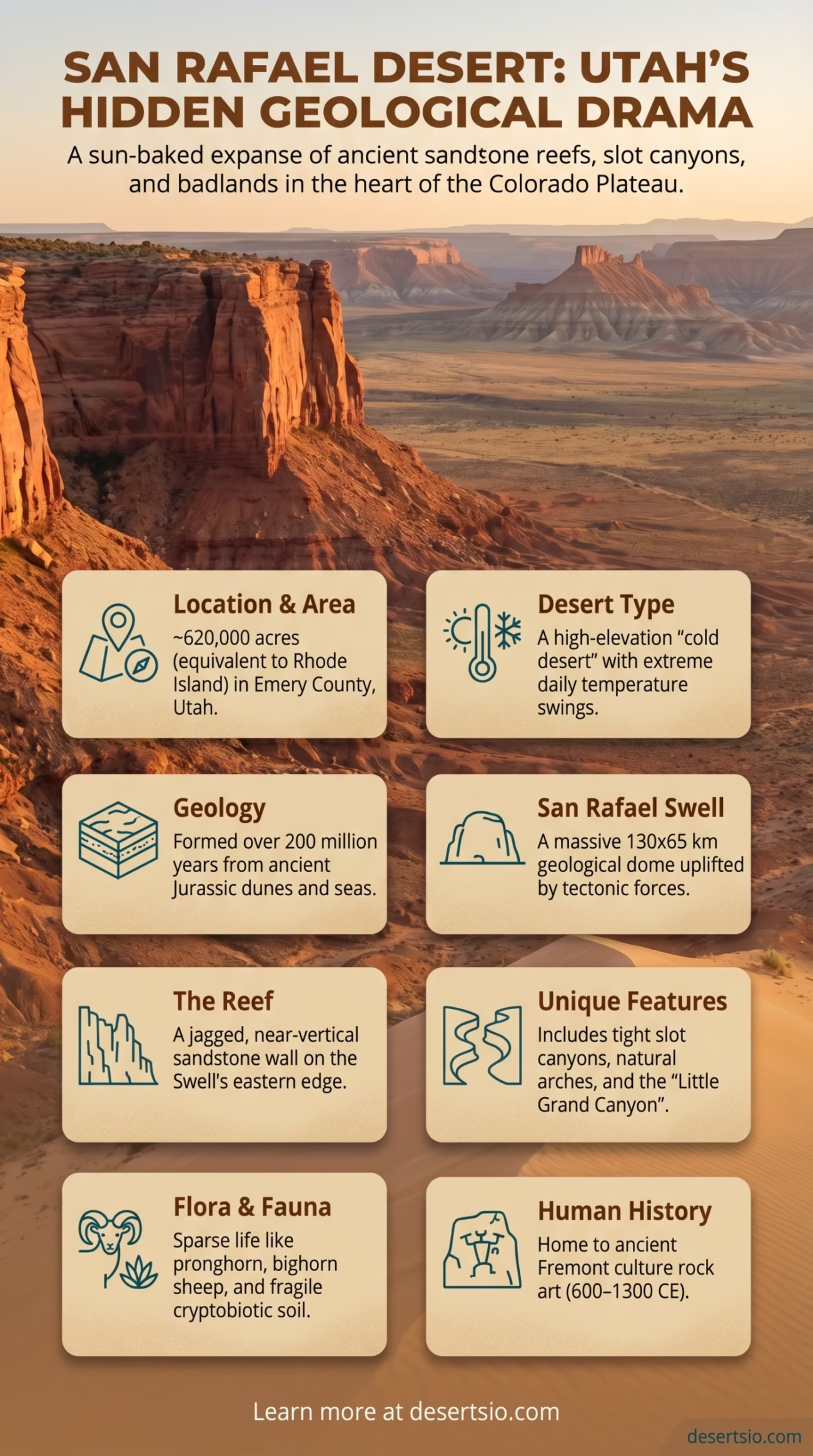
The San Rafael Desert sits in the heart of Utah’s Colorado Plateau — a sun-baked, wind-carved expanse where the ground itself feels ancient. It is not the Sahara. It doesn’t get the headlines. But geologically speaking, few places on Earth pack this much raw drama into a single landscape. Towering sandstone reefs, slot canyons, badland mazes, and wide open sage flats all coexist within a region that most travelers drive past without stopping.
And that, honestly, is what makes it worth knowing.
How the San Rafael Desert Formed
The landscape here is the result of roughly 200 million years of geological activity — not one dramatic event, but a slow, relentless layering of time. During the Jurassic period, this region sat near a vast system of sand dunes and shallow inland seas. Over millions of years, sediment compressed into the distinctive red, orange, and cream-colored sandstone formations visible today.
The defining structure is the San Rafael Swell — a massive anticlinal dome of rock that was pushed upward by tectonic forces roughly 50–70 million years ago. Erosion then stripped the top layers away, exposing the older, harder rock beneath. What remains is an uplifted oval of layered strata, about 130 km long and 65 km wide, rimmed on its eastern edge by the dramatic San Rafael Reef — a jagged, near-vertical wall of Navajo Sandstone that looks almost like a natural fortification.
Entrada Sandstone, Wingate Sandstone, and Mancos Shale are the primary geological players here. Each layer tells a different chapter of Earth’s history — shallow seas, desert dunes, river deltas. Together, they produce a color palette that shifts from deep red to pale lavender depending on the light.
How Big Is the San Rafael Desert?
The broader San Rafael Desert region, including the Swell and surrounding badlands, covers approximately 620,000 acres — roughly equivalent to the entire state of Rhode Island, or about twice the size of Luxembourg. If you include the full San Rafael Swell geographic zone, the figure climbs closer to 2,500 square kilometers.
That’s a significant landmass for a desert that rarely appears on international radar. For context, it’s about one-tenth the size of the nearby Great Basin Desert — but it packs far more geological variety per square kilometer than almost anywhere else in the American Southwest.
Temperature: A Desert of Extremes
The San Rafael Desert is classified as a cold desert — a label that surprises most people. Summer temperatures regularly hit 38°C (100°F) during the day, yet the same night can drop to 13–15°C (55–59°F). In winter, daytime temperatures hover around 4–8°C (39–46°F), while nights frequently fall to -10°C (14°F) or below.
The daily temperature swing — sometimes as dramatic as 25°C (45°F) within a single 24-hour period — is one of the desert’s most physically defining characteristics. That kind of thermal stress accelerates rock weathering and shapes the erosion patterns you see in the canyon walls. It also means that any creature living here must be built for both extremes, not just one.
Flora and Fauna of the San Rafael Desert
Life here is sparse — but far from absent. The plant communities of the San Rafael Desert are largely shaped by elevation and soil chemistry. On the lower bajadas and shale flats, blackbrush (Coleogyne ramosissima) dominates. Higher up, sagebrush (Artemisia tridentata) takes over, mixed with pinyon pine and Utah juniper at the elevated fringes of the Swell.
- Indian ricegrass — a drought-adapted native grass that stabilizes sandy soils
- Prickly pear cactus (Opuntia polyacantha) — found across rocky flats
- Cryptobiotic soil crust — a living layer of cyanobacteria, lichens, and mosses that holds desert soil together (extremely fragile; even a single footprint can destroy decades of growth)
Fauna is equally adapted to aridity. The desert supports populations of pronghorn antelope — one of the fastest land animals in North America — alongside desert bighorn sheep, which navigate the sheer sandstone walls of the Reef with remarkable ease. Smaller residents include:
- Great Basin rattlesnake — a common but generally reclusive presence
- Collared lizard (Crotaphytus collaris) — recognizable by its vivid color and bipedal running style
- Golden eagle and peregrine falcon — apex aerial predators nesting on the canyon walls
- Kit fox — active primarily at night, and perfectly suited to the temperature swings
Human Life in the San Rafael Desert
Permanent settlement in the San Rafael Desert is minimal, and has always been. The terrain simply doesn’t support large populations — water is scarce, agriculture is near impossible on most soil types, and the Mancos Shale badlands are difficult to traverse even today.
But humans have been here for a very long time. Fremont culture people inhabited this region from roughly 600 to 1300 CE, leaving behind petroglyphs at sites like Sego Canyon and the Buckhorn Wash Panel — one of the most impressive rock art galleries in the American West. These images — life-sized anthropomorphic figures with hollow eyes and elaborate headdresses — remain scientifically intriguing and are still not fully understood.
Later, Ute and Paiute peoples used the region seasonally, following game and plant resources across the Colorado Plateau. European-American ranchers arrived in the mid-1800s, and some cattle grazing continues in the region today under BLM permits.
The small towns of Green River (population ~950) and Castle Dale (population ~1,600) sit at the desert’s edges, serving as the primary human anchors for this otherwise empty terrain.
Geology in Detail: The Reef and the Swell
Few geological features in the American Southwest are as visually striking as the San Rafael Reef. It forms the eastern boundary of the Swell — a nearly continuous wall of upturned Navajo and Wingate Sandstone strata, tilted almost vertically by the same tectonic forces that domed the Swell itself. In places, this reef rises 300 meters (nearly 1,000 feet) above the surrounding desert floor.
Inside the Swell, erosion has carved a labyrinth — slot canyons, natural arches, dry washes, and isolated mesas. Little Wild Horse Canyon is one of the most-visited slot canyons in Utah, featuring narrows as tight as 60 centimeters in some stretches. Nearby, Bell Canyon runs parallel and creates a popular loop with a distinctly different character.
The Wedge Overlook — sometimes called “Utah’s Little Grand Canyon” — offers a view into the San Rafael River canyon, which drops roughly 460 meters (1,500 feet) below the rim. The Colorado River carved the Grand Canyon; the San Rafael River carved this. Smaller scale, same process, same drama.
Nearby Deserts and Regional Context
The San Rafael Desert doesn’t exist in isolation — it sits within the larger Colorado Plateau desert ecosystem, surrounded by several related and distinct desert landscapes worth understanding in context.
| Desert / Region | Distance from San Rafael | Key Difference |
| Great Basin Desert | ~100 km northwest | Larger, basin-and-range topography, more shrub-steppe |
| Canyonlands / Needles | ~160 km southeast | More deeply eroded, red rock canyon country, NPS protected |
| Escalante Desert (Grand Staircase) | ~200 km south | Younger geological layers, more remote, hoodoo formations |
| Moab Desert Region | ~120 km east | Higher tourism, iconic arches, Entrada Sandstone prominence |
| Painted Desert (Arizona) | ~350 km south | More colorful badlands, Triassic-era strata, warmer climate |
Of these, the Escalante Desert and the San Rafael Desert share the closest geological DNA — both are cold, high-elevation Colorado Plateau deserts built on layered Jurassic and Cretaceous strata. The difference is largely one of topography: Escalante trends toward deeply incised canyons and hoodoo fields, while the San Rafael leans toward reef walls, open swell country, and shale badlands.
A comparison worth making: the Painted Desert of Arizona is often cited alongside the San Rafael when discussing color-saturated desert landscapes. Both showcase sedimentary geology in vivid tones. But the Painted Desert’s colors come from Triassic-era Chinle Formation mudstones — older than the San Rafael’s Jurassic sandstones — and it lacks the vertical reef architecture that defines the Swell’s eastern boundary.
Current Status and Conservation
The San Rafael Desert is managed primarily by the Bureau of Land Management (BLM), which oversees the majority of the region’s surface area. This means the land is open to multiple uses — grazing, recreation, mineral exploration — rather than strict preservation.
In recent years, off-highway vehicle (OHV) use has become one of the most significant land management challenges. Cryptobiotic soil crust — that fragile living layer mentioned earlier — can take 50–250 years to recover from a single tire track. The BLM has designated specific OHV corridors to minimize damage, but enforcement across such a large, remote area is inherently difficult.
There have been ongoing discussions about elevated protection for the San Rafael Swell, including proposals for national monument or wilderness designation. These conversations reflect a broader national debate about how to balance public land access with ecological preservation — and the San Rafael has been at the center of that discussion for decades.
Uranium mining has a historical footprint in this region. During the Cold War uranium boom of the 1950s, hundreds of small mines were opened across the Colorado Plateau, including within the San Rafael area. Many remain partially unreclaimed today, and legacy contamination at certain sites continues to be monitored by state and federal agencies.
What Makes the San Rafael Distinctive
The San Rafael Desert doesn’t compete with the Grand Canyon or Zion for visitor numbers — and it doesn’t need to. What it offers is something harder to find: scale without crowds, geology without guardrails, and solitude that still feels genuinely possible.
- Buckhorn Wash Pictograph Panel — one of the best-preserved Fremont rock art sites in North America
- Little Wild Horse / Bell Canyon Loop — a 13 km slot canyon circuit through some of the tightest narrows in Utah
- The Wedge Overlook — a canyon rim with a 460-meter drop and zero entrance fee
- Goblin Valley State Park (adjacent) — a field of eroded Entrada Sandstone hoodoos unlike anything else on the plateau
- Sinbad Country — a remote interior region of the Swell, rarely visited, named by early ranchers who felt lost inside it
“Sinbad Country” — that name alone tells you something about how this landscape was perceived by those who worked it. Not inviting. Not hospitable. A maze you entered carefully.
Desert Glossary: Key Terms for the San Rafael Region
Anticline — An arch-shaped fold in rock strata where layers curve upward; the San Rafael Swell is a classic large-scale anticline.
Cryptobiotic Crust — A living biological soil crust composed of cyanobacteria, fungi, algae, mosses, and lichens that plays a critical role in stabilizing desert soils and fixing nitrogen.
Entrada Sandstone — A Jurassic-age geological formation responsible for many of Utah’s iconic arches, fins, and hoodoos, including those at Arches National Park and Goblin Valley.
Bajada — A broad, gently sloping surface formed by the merging of alluvial fans at the base of a mountain or desert ridge.
Mancos Shale — A Cretaceous marine shale deposit that forms the grey, swelling badland terrain found in parts of the San Rafael Desert; highly erosion-prone and nearly impassable when wet.