
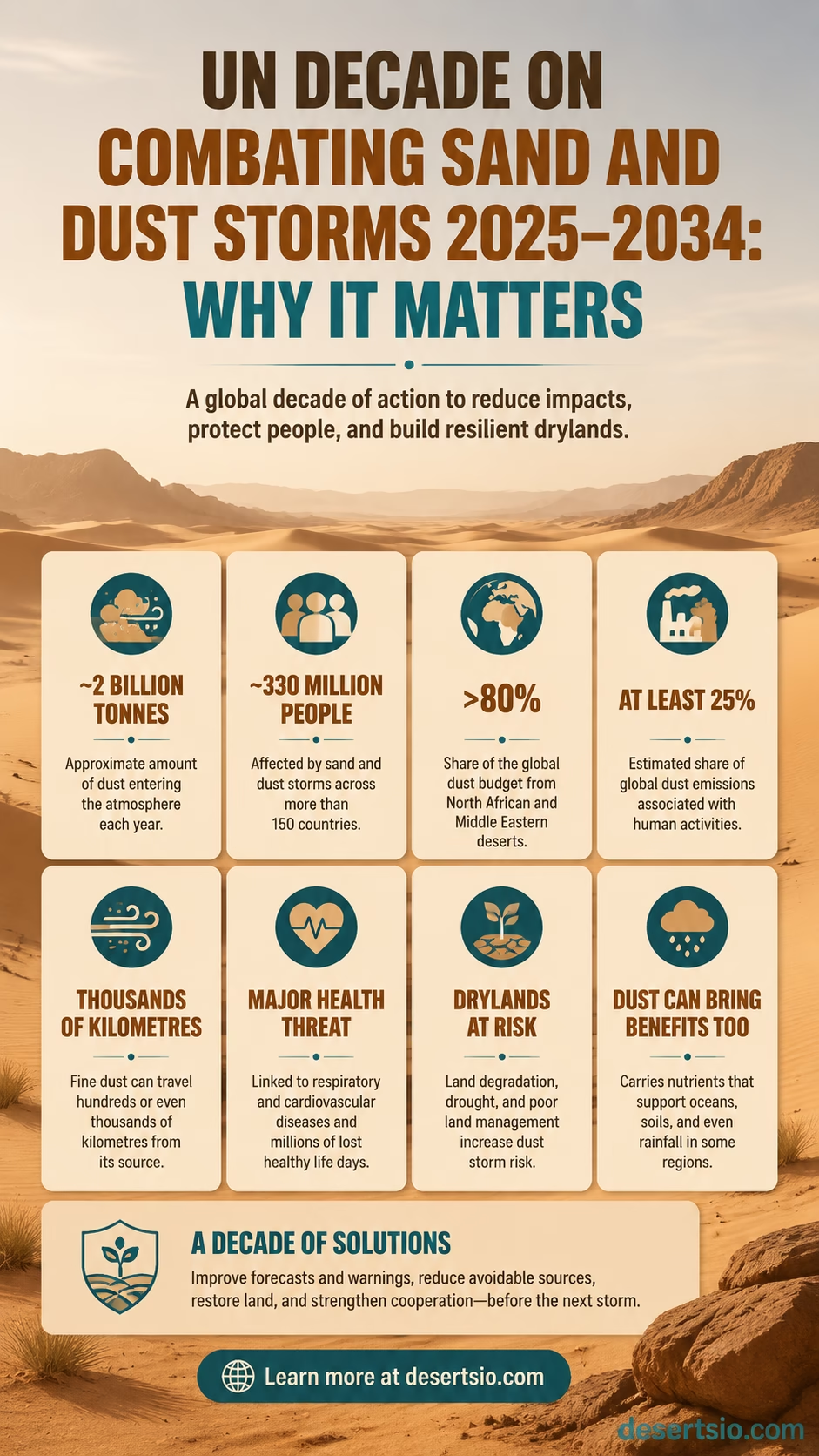
About 2 billion tonnes of dust enter Earth’s atmosphere in a typical year, and the finest particles can travel hundreds or even thousands of kilometres from their source. Around 330 million people in more than 150 countries are affected by sand and dust storms. Those numbers help explain why the United Nations designated 2025–2034 as the Decade on Combating Sand and Dust Storms. The subject reaches far beyond dramatic walls of desert dust: it connects wind erosion, exposed soils, dry lakebeds, land condition, atmospheric transport, air quality, forecasting and the way drylands are managed before a storm ever begins.
The Decade does not aim to remove dust from the atmosphere or suppress a natural desert process. Mineral dust is part of Earth’s normal system. The practical task is narrower: identify where damaging dust comes from, reduce avoidable human-amplified sources, improve forecasts and warnings, and make land management part of sand and dust storm risk reduction.
The Scale In Numbers
~2 billion tonnes
Approximate amount of dust entering the atmosphere each year.
~330 million
People affected across more than 150 countries.
>80%
Share of the global dust budget originating from North African and Middle Eastern deserts.
At least 25%
Estimated share of global dust emissions associated with human activities.
Why Sand and Dust Storms Needed A UN Decade
Dust storms are not new. What changed is the understanding of their geographic reach and interconnected causes. A patch of erodible ground may sit in one region while the resulting dust plume affects air quality, visibility, agriculture or transport far away. Fine mineral particles do not stop at administrative borders.
That makes sand and dust storms an unusual dryland issue. The source may involve soil, vegetation and water management; the transport takes place in the atmosphere; and the effects can appear hundreds or thousands of kilometres downwind. Treating only the visible storm misses much of the system.
Source area and impact area may be very far apart. A dust-management system therefore has to connect land observations with atmospheric forecasts and downwind exposure.
Part Of The Dust Is Natural
Large deserts naturally supply mineral dust. The Sahara, Arabian Desert and Gobi contain broad areas where fine sediment can become airborne when surface conditions and wind align. The Bodélé Depression in Chad is a particularly active natural dust source and remained the area with the highest annual mean dust concentrations in the 2025 global assessment.
Natural desert dust also performs ecological work. Airborne minerals can move nutrients between continents, reach ocean waters and settle on distant soils. So a simple target of “less dust everywhere” would make little scientific sense.
Part Of The Dust Can Be Human-Amplified
The story changes when human activity leaves land more erodible than it would otherwise be. Loss of vegetation cover, unsuitable cultivation, heavy grazing pressure, disturbed soil and poor water management can expose fine particles to wind. Drying lakebeds can become especially productive dust sources because they often contain silt, clay and salts that were once covered by water.
| Source Type | Typical Material | Human Influence | Management Relevance |
|---|---|---|---|
| Natural desert basin | Mineral dust, silt and clay | Often limited | Mainly monitoring and forecasting |
| Dry lakebed | Fine sediment, clay and salts | Can be high where water balance has been altered | Water and surface management may matter |
| Degraded rangeland | Loose topsoil | Can be substantial | Vegetation and grazing management |
| Cropland | Topsoil and fine mineral particles | Often management-sensitive | Soil cover and erosion control |
| Dune field | Mostly sand-sized grains | Varies by setting | Local stabilization only where appropriate |
The Real Problem Begins Before The Storm
Once a large dust plume is airborne, options become limited. Forecasts can provide warning and reduce exposure, but they cannot put millions of tonnes of sediment back on the ground. Prevention begins earlier—with the condition of the land that the wind encounters.
- Vegetation structure: plants interrupt airflow close to the surface and help protect loose soil.
- Surface roughness: stones, vegetation and other rough elements reduce near-ground wind efficiency.
- Soil moisture: wetter particles generally resist wind erosion better than dry, loose material.
- Soil condition: crusting, aggregate stability and disturbance affect whether particles can move.
- Land cover: exposed surfaces usually offer the wind more material than well-protected ground.
The wind itself is not usually the manageable part. In human-amplified source areas, the more workable question is what condition the wind finds when it reaches the ground.
From Dust Source To Downwind Impact
A sand and dust storm can be viewed as a chain rather than one event. That chain explains why the UN Decade brings together land science, meteorology, remote sensing, public warning systems and dryland management.
| Stage | What Happens | What Can Be Measured Or Managed |
|---|---|---|
| Surface change | Vegetation declines or fine sediment becomes exposed | Land cover, soil condition, moisture, land use |
| Wind erosion | Wind begins moving erodible material | Wind speed, surface roughness, soil stability |
| Dust emission | Fine particles enter the atmosphere | Emission models, ground observations, source maps |
| Atmospheric transport | Dust moves away from its source | Satellites, weather models, aerosol forecasts |
| Exposure | Dust reaches communities, farms and infrastructure | PM10, PM2.5, visibility and air-quality observations |
| Response | Warnings and operational decisions reduce exposure | Lead time, forecast accuracy and warning coverage |
What The 2025–2034 Decade Is Meant To Change
The United Nations General Assembly proclaimed the 2025–2034 United Nations Decade on Combating Sand and Dust Storms through Resolution 78/314. Its practical value depends on whether work moves from describing dust after it appears toward managing the whole source-to-impact chain.
Map Active Dust Sources More Precisely
Two dust plumes can look similar from space while coming from very different surfaces. One may begin in a natural desert depression; another may come from a disturbed field, degraded rangeland or exposed lakebed. Source attribution matters because the appropriate response changes with the source.
Modern source mapping combines satellite observations with land-cover information, soil data, wind conditions and dust-emission modelling. Ground measurements remain useful because a satellite image can show where dust appears without fully describing the surface processes underneath it.
Move Monitoring From The Sky Back To The Land
A notable direction in current UNCCD work is the push toward land-focused monitoring. Atmospheric dust concentration tells scientists what became airborne. Land observations can help explain why.
- Vegetation structure and cover
- Wind and soil moisture
- Surface condition and roughness
- Land-use information
- In-situ wind-erosion measurements
- Remote-sensing observations
- Dust-emission modelling
Put together, those measurements can distinguish a recurring natural dust source from a landscape where erosion has become more responsive to management.
Stabilize Manageable Source Areas
Where human activity has amplified wind erosion, reducing emissions may involve restoring vegetation structure, protecting soil, adjusting land use or improving water management. The method has to fit the landscape. A dry lakebed, cropland and semi-arid grazing area do not respond to the same treatment.
This is also where a common misconception needs clearing up: combating dust storms does not mean planting trees across natural deserts. In many arid environments, inappropriate planting can consume scarce water or alter native ecosystems. Source stabilization has to match local ecology, soil and water availability.
Improve Forecasting and Early Warning
The Decade does not start from zero. The World Meteorological Organization established its Sand and Dust Storm Warning Advisory and Assessment System (SDS-WAS) in 2007. It coordinates research, observations and operational forecasting across several regions.
Four active regional systems currently coordinate work through centres associated with the Gulf region, Northern Africa–Middle East–Europe, Asia and the Americas. Forecasting matters because even a storm that cannot be prevented can often be detected before its main plume reaches populated areas.
A forecast and a warning are not quite the same thing. A forecast estimates where and when dust may occur. An effective warning turns that forecast into information people and services can act on.
Why Deserts Are Central To The Decade—But Not The Whole Story
The largest global dust sources occur mainly in arid and semi-arid environments, which is why deserts sit near the centre of this subject. WMO estimates that more than 80% of the global dust budget originates from deserts in North Africa and the Middle East.
Yet a sand and dust storm map is not simply a desert map. Playas, shrinking lakes, cultivated soils, dry river deposits and degraded rangelands can also release large quantities of sediment. Some of the most active sources are broad depressions where fine material accumulated over long periods and can be mobilized efficiently once dry.
That distinction matters for desert science. A healthy natural desert can produce dust without being degraded. Conversely, land outside a classic desert can become an active dust source after vegetation loss or prolonged drying.
Sand Storm and Dust Storm Are Not The Same Process
The terms often appear together, but sand and dust behave differently in moving air. Grain size is the main reason.
| Property | Wind-Blown Sand | Atmospheric Dust |
|---|---|---|
| Particle size | Generally coarser | Much finer |
| Typical movement | Often hops or rolls near the surface | Can remain suspended in air |
| Typical distance | More concentrated near the source | Can cross regions, continents and oceans |
| Main local effect | Abrasion, burial and reduced visibility | Air quality, visibility and long-range deposition |
| Monitoring emphasis | Surface transport and local wind | Aerosols, atmospheric transport and particulate matter |
In wind-eroded landscapes, the two processes can interact. Moving sand grains strike the surface and can release smaller particles that then enter suspension. Once aloft, the finest dust may remain in the atmosphere long after coarse sand has returned to the ground.
Why Dust Becomes An Air-Quality Issue Far From Deserts
Distance does not necessarily remove the smallest particles. During major events, dust can raise concentrations of PM10 and, depending on the plume and particle distribution, PM2.5. PM10 refers to particles with aerodynamic diameters of 10 micrometres or less; PM2.5 refers to the finer fraction at 2.5 micrometres or less.
These size classes matter because smaller particles can travel farther through the atmosphere and penetrate more deeply into the respiratory system. Dust composition also varies from one source to another. Mineralogy, salts and material picked up along a transport path can all influence the properties of a plume.
This is why source mapping and atmospheric forecasting need to work together. Knowing that dust is arriving is useful; knowing where it came from and how its concentration may change is better.
Agriculture Connects The Source and Impact Sides
Agriculture can sit on both sides of the dust equation. Poorly protected soil may become a source of wind erosion, while farms downwind can receive the resulting dust. Loss of fertile topsoil can reduce the productive layer where roots, nutrients and organic matter are concentrated.
- At the source: wind can remove fine soil particles and organic material.
- During transport: airborne dust can sharply reduce visibility.
- At the receiving area: sediment can settle on crops, soil, machinery and water systems.
- Over repeated events: exposed land may lose surface quality faster if protective cover is not restored.
Yet dust deposition is not universally harmful. Mineral particles can deliver nutrients to distant ecosystems. Again, context matters—a recurring theme in desert processes, and one reason blanket statements about dust are rarely useful.
One Dust Source Can Affect Several Regions
Long-range transport is the main reason sand and dust storms require coordination beyond individual source areas. Large atmospheric circulation patterns can carry fine sediment along recurring dust corridors.
| Broad Source Region | Common Transport Direction Or Receiving Area | Why It Matters |
|---|---|---|
| Sahara and North Africa | Atlantic Ocean, Mediterranean and at times the Americas | One of Earth’s dominant mineral-dust systems |
| Arabian Peninsula and nearby drylands | Across Western Asia and adjoining seas | Dense population centres can lie near active source regions |
| Gobi and Mongolian drylands | Northern and eastern China and farther across East Asia | Strong spring events can cover very large areas |
| Central Asian dry basins | Across surrounding inland regions | Natural drylands and exposed lake sediments can both contribute |
The material seen over a city may therefore tell a story that began much farther away. Source, transport and exposure are separate geographic steps.
What 2025 Revealed During The Decade’s First Year
WMO’s 2026 Airborne Dust Bulletin found that the global average annual mean dust surface concentration in 2025 was similar to 2024. That global average, though, hid strong regional contrasts.
- The Bodélé Depression in Chad remained the area with the highest annual mean dust concentration worldwide.
- North Africa and the Middle East experienced several major dust intrusions.
- In April 2025, dust moving from Mongolia into China produced the country’s most severe sand and dust storm in about a decade when assessed by intensity, duration and geographic reach.
- El Paso, Texas recorded 50 days with dust weather in 2025, more than twice its annual average.
There is an important lesson in those observations. A stable global average does not mean every region had an ordinary year. Global dust statistics can flatten local extremes, so progress during the Decade cannot be judged from one worldwide number alone.
The 2026 Shift Toward Source Management
The Decade entered a more operational phase in 2026. UNCCD work prepared for its seventeenth Conference of the Parties included an updated approach to source detection and a proposed Global Implementation Initiative for Sand and Dust Storms, or GISDS.
The proposed initiative concentrates on anthropogenic source management—the part of the dust system where changes to land condition, vegetation, soil and water use can potentially reduce wind erosion. Its proposed source-focused action period runs from 2026 to 2035, extending one year beyond the formal 2025–2034 UN Decade.
Four Areas Of Source-Focused Work
| Area | What It Would Do | Desert And Dryland Relevance |
|---|---|---|
| Land-focused monitoring and assessment | Combine ground measurements, vegetation indicators, land-use data, soil condition, wind, moisture, remote sensing and dust models. | Shows what is happening at the source rather than measuring only airborne dust. |
| Source-area stabilization and restoration | Use land and water methods suited to soil, vegetation structure and surface roughness. | Targets manageable source areas without treating all deserts as degraded land. |
| Science connected to source management | Bring wind-erosion science, dust modelling and land observations closer together. | Helps turn source maps into practical land decisions. |
| Coordinated response and capacity | Link regional cooperation, finance, early warnings and land monitoring. | Useful where dust sources and affected populations lie in different places. |
This source-first approach marks an important technical change. Measuring airborne dust remains necessary, but the desired outcome becomes more specific: less wind erosion and lower emissions from manageable sources, not merely a different atmospheric concentration on one particular day.
COP17 Places The Decade In An Active Implementation Window
UNCCD COP17 opened in Ulaanbaatar, Mongolia, on 17 August 2026 and is scheduled to run through 28 August. A dedicated high-level sand and dust storm event is scheduled for 25 August, with the proposed GISDS initiative, sustainable land management, land restoration, drought resilience, partnerships and financing among its main subjects.
Because that event is still ahead, its results should not be assumed. What is already clear is the direction of work: the Decade is moving from broad recognition of sand and dust storms toward source detection, field interventions, monitoring and measurable land outcomes.
Technology Is Changing How Dust Sources Are Seen
Dust monitoring once depended heavily on ground observations and conventional weather models. Those tools remain essential, but satellite remote sensing and machine learning now offer additional ways to locate active sources and estimate plume behaviour.
WMO’s 2026 assessment describes two developing uses of artificial intelligence. One feeds AI-generated weather forecasts into dust models. Another trains large systems on long atmospheric records such as reanalysis datasets and satellite observations. Results are mixed by event type: one approach may handle fast local storms well while another performs better for large plumes travelling over several days.
AI does not replace observations. Dust forecasting still depends on knowing surface conditions, wind, atmospheric structure and whether a model correctly represents dust emission and transport.
Why Source Detection Is Harder Than It Sounds
A source map is not permanent. Dust-source activity can change with rainfall, drought, vegetation, cultivation, water levels and surface disturbance. A basin that emits little dust during one period may become highly active later when its surface dries and breaks apart.
Satellites introduce another wrinkle: clouds can hide the ground, and atmospheric dust can obscure the exact surface from which it came. Researchers therefore combine several types of evidence rather than relying on a single image.
- Detect a dust plume or high aerosol concentration.
- Reconstruct wind direction and atmospheric transport.
- Identify candidate source surfaces upwind.
- Compare land cover, soil, moisture and vegetation conditions.
- Confirm recurring activity through repeated observations where possible.
Only then does a map become useful for deciding whether a source is mainly natural, human-amplified or some mixture of both.
The Decade Cannot Make Natural Desert Dust Disappear
This boundary is easy to miss. Natural dust emission is not a defect in desert landscapes. The Sahara was exporting mineral dust long before modern land management, and large dry basins will continue producing dust whenever suitable sediment and wind occur together.
Nor can every storm be prevented. A powerful synoptic wind event or thunderstorm outflow can raise dust even from land in relatively good condition. Forecasting, warnings and exposure reduction remain necessary because source management has physical limits.
The realistic target is narrower: reduce avoidable emissions where land condition can be improved, identify natural sources more accurately, and make unavoidable events easier to anticipate.
Land and Water Decisions Can Matter More Than Storm Suppression
Some of the most instructive dust sources are dry or shrinking lakebeds. Lakes and inland basins collect fine sediment because water carries clay, silt and dissolved minerals toward low points in the landscape. When water retreats, material that once sat beneath the surface becomes exposed to wind.
A new dry surface can therefore connect hydrology directly to atmospheric dust. Water balance changes first. Dust comes later.
That sequence explains why sand and dust storm management can involve much more than meteorology. In certain places, water allocation, vegetation cover, soil protection and land disturbance determine how much erodible material exists before the wind arrives.
How Progress Should Be Measured By 2034
Counting storms alone would be a poor way to judge the Decade. Weather varies too much. A year with fewer strong winds could produce fewer storms even if land condition had not improved at all. The reverse can happen too.
A more useful test combines land, atmosphere and exposure indicators.
| Indicator | What Better Performance Would Look Like |
|---|---|
| Source mapping | More active source areas identified and repeatedly monitored |
| Land condition | Improved vegetation structure, soil stability or surface cover in manageable source areas |
| Wind erosion | Measured reductions in erosion where interventions have been applied |
| Dust emission | Lower emissions from treated human-amplified sources under comparable weather conditions |
| Forecast accuracy | Better prediction of plume timing, concentration and route |
| Warning lead time | More time between reliable detection and expected exposure |
| Regional coverage | More affected areas connected to operational observations and warnings |
| Data exchange | Faster sharing of observations across major dust corridors |
| Impact monitoring | Better measurement of air quality, agriculture, transport and ecosystem effects |
The Hardest Result To Measure Is A Storm That Never Became As Severe
Prevention creates a scientific measurement problem. Suppose vegetation recovers across a dust-prone area and the next five years produce fewer major emissions. Was the land treatment responsible, or were the winds simply weaker?
Researchers need comparable observations of wind, moisture, vegetation, soil condition and dust emission to separate management effects from ordinary weather variability. Long observation records matter here. One quiet season proves very little.
The same logic applies to global averages. A drop in worldwide atmospheric dust could reflect weather patterns rather than successful source restoration. For that reason, the most useful measurements are often local and process-based: did a treated source lose less soil under similar wind conditions?
The Decade Changes How Desert Dust Should Be Understood
For desert science, perhaps the most useful distinction is between a natural arid landscape and a degraded dust-producing surface. They are not synonyms.
| Landscape | Dust Meaning | Likely Response |
|---|---|---|
| Natural desert basin | Part of the normal aeolian system | Observe, forecast and manage exposure |
| Healthy dryland with native vegetation | Usually more resistant to erosion than disturbed ground | Protect existing land condition |
| Degraded dryland | May produce avoidable additional emissions | Restore cover and reduce erosion where feasible |
| Exposed lakebed | Can become a highly efficient fine-dust source | Assess water history, sediment and stabilization options |
| Managed agricultural soil | Erosion depends strongly on surface condition and timing | Use soil-cover and wind-erosion practices suited to the crop system |
Combating sand and dust storms does not mean combating deserts. Natural deserts are functioning landscapes. The manageable problem appears where erosion, exposure or land degradation creates dust impacts that can realistically be reduced.
What Should Be Different By 2034?
Dust will still leave the Sahara, move across the Gobi and rise from dry basins after the UN Decade ends. That is expected. The useful test lies elsewhere.
- Major dust sources should be mapped with better land-surface information.
- Human-amplified sources should be easier to distinguish from natural desert emissions.
- More dryland monitoring should measure vegetation, soil condition and wind erosion at the source.
- Forecast systems should provide better information about plume timing, concentration and transport.
- Warnings should reach more exposed communities with enough lead time to be useful.
- Land restoration projects in dust-prone areas should report measured erosion and emission outcomes, not simply the area treated.
- Dry lakebeds, rangelands and agricultural soils should be managed according to their specific source behaviour rather than treated as one generic dust problem.
By 2034, the clearest measure of progress will not be a dust-free atmosphere. It will be a better ability to tell where dust originated, why that surface became active, what portion could be managed, where the plume will travel and how exposure can be reduced before it arrives. That is the practical reason a decade devoted to sand and dust storms matters.