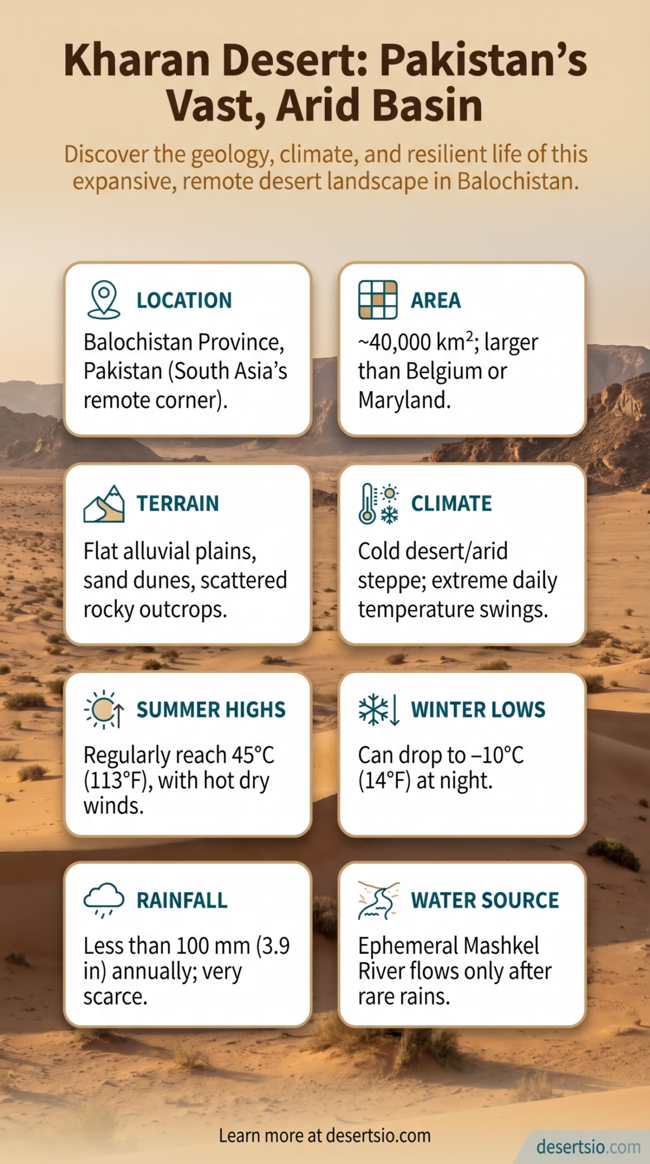
| Location | Balochistan Province, Pakistan |
| Area | Approximately 40,000 km² (15,444 sq mi) |
| Type | Cold desert / Arid steppe |
| Average Elevation | 900–1,100 meters (2,953–3,609 ft) above sea level |
| Annual Rainfall | Less than 100 mm (3.9 in) per year |
| Daytime Temperature | Up to 45°C (113°F) in summer |
| Nighttime Temperature | Can drop to −10°C (14°F) in winter |
| Dominant Terrain | Flat alluvial plains, scattered rocky outcrops, sand dunes |
| Primary River | Mashkel River |
| Neighboring Regions | Chagai Desert (north), Rann of Kutch (southeast), Dasht Desert (west) |
| Notable Feature | Site of Pakistan’s 1998 nuclear tests (Ras Koh Hills, edge of the basin) |
| Main Settlements | Kharan city, Washuk, Panjgur (periphery) |
The Kharan Desert sits in one of the most remote corners of South Asia — a vast, sun-scorched basin in Pakistan’s Balochistan province that most people have never heard of, yet spans roughly 40,000 square kilometers. That puts it comfortably larger than the entire country of Switzerland (41,285 km²), though the comparison feels almost absurd. Switzerland has glaciers and lake towns; Kharan has silence, dust, and an extraordinary geological story.
How Big Is the Kharan Desert, Really?
At ~40,000 km², the Kharan Desert is larger than Belgium, the Netherlands, or the state of Maryland. It forms a broad, low-lying depression — sometimes called the Kharan Basin — enclosed by mountain ranges on multiple sides. The Chagai Hills frame the north. The Siahan Range runs along the south. This topographic bowl shape is no coincidence; it is directly tied to how the desert formed in the first place.
For context: the entire Balochistan province is about 347,190 km², making it Pakistan’s largest province by area. The Kharan Desert occupies roughly 11–12% of that provincial total — a large portion of the territory.
Formation: A Basin Born from Tectonic Forces
The Kharan Basin is a tectonic depression — shaped over millions of years by the collision of the Indian and Eurasian plates. As the surrounding mountain ranges were pushed upward, the basin floor subsided. Sediment eroded from the highlands accumulated on the basin floor over geological time, creating the flat alluvial plains that define the landscape today.
Arid conditions intensified during the Holocene — roughly the last 10,000 years — as monsoon patterns weakened in this part of the subcontinent. The Makran coast to the south and the high-altitude barriers to the north block moisture from both the Arabian Sea and the central Asian systems. What arrives is almost nothing. Less than 100 mm of rain per year. In particularly dry years, that number can fall to 50 mm or below.
The Mashkel River is the one significant watercourse that crosses the basin — but even it is ephemeral through much of the year, flowing only after seasonal rain events. It drains into the Hamoun-e-Mashkel lake system on the Iran‑Pakistan border, a terminal drainage basin with no outlet to the sea.
Temperature: Extreme Swings, Day and Night
Kharan’s climate is brutally continental. The desert sits at an elevation of 900–1,100 meters, which adds a sharp cold edge to its winters that purely low-lying hot deserts don’t experience.
- Summer daytime highs: Regularly reach 45°C (113°F), sometimes pushing past that
- Winter nighttime lows: Drop to −10°C (14°F), occasionally colder in exposed areas
- Diurnal temperature range: Even in summer, nights can be 20–25°C cooler than peak daytime heat
- Wind: Hot, dry winds blow frequently in summer, increasing evaporation rates dramatically
- Humidity: Extremely low year-round, often below 20% in summer months
That swing — from 45°C in the afternoon to a cool desert night — is one of Kharan’s defining physical characteristics. It is what makes survival here a study in adaptation, whether you’re a lizard, a shrub, or a nomadic herder.
Flora and Fauna: Sparse, Resilient, and Underestimated
The vegetation of the Kharan Desert is sparse but purposeful. Species here don’t compete for space — they compete for water, and they’ve been at it for thousands of years.
Notable Plant Species
- Haloxylon salicornicum (locally called lana) — a salt-tolerant shrub dominant across saline flats
- Calligonum polygonoides — a leafless shrub with photosynthesizing green stems, effective in sand stabilization
- Prosopis cineraria (jand tree) — deep-rooting, drought-resistant, provides shade and fodder
- Tamarix species — found along dry riverbeds and drainage channels
- Salsola species — annual herbs that colonize disturbed ground after rare rain events
Wildlife
- Chinkara gazelle (Gazella bennettii) — one of the most commonly spotted mammals; well-adapted to extreme aridity
- Sand fox (Vulpes rüppellii and V. vulpes) — nocturnal hunters, rarely seen in daylight
- Spiny-tailed lizard (Uromastyx hardwickii) — a significant herbivorous reptile, locally called sanda
- Houbara bustard (Chlamydotis macqueenii) — a migratory bird, and a legally protected species in Pakistan
- Various desert snakes and scorpions — active primarily at night when temperatures drop
The Houbara bustard deserves a specific mention. This medium-sized migratory bird passes through Balochistan’s arid zones — including the Kharan region — seasonally, and its conservation status is actively monitored due to hunting pressures across its Central Asian flyway. Pakistan has introduced legal protections, though enforcement in remote areas like Kharan remains challenging.
Human Life in the Kharan Desert
People have lived in and around Kharan for centuries. The region is dominated by Baloch tribal communities, most notably the Nusherwani, Mengal, and various sub-tribal groups who have historically organized their lives around seasonal migration — moving herds of camels, goats, and sheep between grazing zones as conditions allowed.
Kharan city serves as the administrative center, but it’s a small town by any standard — population estimates hover around 15,000–20,000 for the town itself, though the surrounding district’s population is larger. The district of Kharan covers approximately 72,572 km², and its total population was recorded at around 357,000 in the 2017 Pakistani census. That’s a population density of roughly 4.9 people per km² — very low.
Water access is the dominant challenge. Most communities depend on karez systems — ancient horizontal wells that tap into underground aquifers — along with seasonal surface water from the Mashkel River and its tributaries. These karez networks are centuries old, some pre-dating recorded local history, and they remain critical infrastructure even today.
And then there’s gold. Mineral surveys have identified significant deposits of gold, copper, and lead-zinc ores in parts of the Kharan district. Exploration activity has increased in recent years, drawing outside investment into a region that has historically been economically marginalized.
Neighboring Deserts and Regional Context
The Kharan Desert doesn’t exist in isolation. It’s part of a broader arid zone that stretches across western Pakistan and eastern Iran — a belt of interconnected desert systems each with their own character.
| Desert | Location | Key Characteristic |
| Chagai Desert | North of Kharan, Balochistan | Rocky, volcanic terrain; extreme aridity; borders Afghanistan |
| Dasht Desert | West of Kharan, toward Iran border | Flat gravelly plains; part of the Makran system |
| Thar Desert | Eastern Pakistan / NW India | Sand dune dominated; larger population; more rainfall |
| Lut Desert (Iran) | West, across the border | One of Earth’s hottest surfaces; UNESCO World Heritage Site |
| Rann of Kutch | Southeast, India/Pakistan border | Seasonal salt marsh; unique ecology |
The Chagai Desert to the north is particularly interesting in comparison. Both are extreme, both are sparsely populated — but Chagai is rockier, higher in parts, and geologically distinct with its volcanic features. The two regions share similar tribal communities and similar water scarcity problems, yet the landscapes feel different on the ground: Kharan’s basin floor is flatter, with more sand and alluvial deposits; Chagai is rougher, more angular.
Further west, Iran’s Lut Desert — the Dasht-e Lut — is a useful comparison point for understanding aridity extremes in the broader region. The Lut holds the record for the highest land surface temperature ever recorded by satellite: 70.7°C (159.3°F) in 2005. Kharan doesn’t reach those extremes, but it shares the same regional climatic drivers: blocked moisture, high elevation aridity, and intense solar radiation.
Desertification Pressures and Environmental Concern
Desertification in an already-desert region sounds redundant — but it isn’t. The concern here is the degradation of the marginal semi-arid zones surrounding the core desert, areas that once supported vegetation, seasonal grazing, and limited dryland farming.
Overgrazing is the primary driver. When livestock numbers exceed what fragile desert vegetation can support — and this has happened consistently across Balochistan over the last few decades — the plant cover disappears, topsoil loosens, and wind erosion accelerates. The result is a slow, almost imperceptible expansion of bare ground into formerly productive land.
Climate projections for this part of South Asia are not encouraging. The IPCC’s Sixth Assessment Report (AR6) highlights the Hindu Kush-Karakoram-Himalayan region and adjacent arid zones as areas facing increased temperature anomalies and rainfall variability. For places like Kharan — already operating at the edge of what can sustain life — even small shifts in precipitation patterns carry serious consequences.
Key Environmental Pressures on the Kharan Desert Region
- Overgrazing by camels, goats, and sheep — degrading shrub cover across the basin
- Groundwater depletion from increasing extraction via tube wells
- Wind erosion accelerating as vegetation thins along the basin margins
- Increased frequency of dust storms reported across western Balochistan
- Limited reforestation or land restoration programs active in the area
A Desert That Carries Weight
The Kharan Desert is not famous in the way the Sahara or the Gobi are famous. It doesn’t draw tourists or generate coffee-table books. But it is a geologically fascinating, ecologically intricate, and humanly significant landscape — one that has shaped the lives of Baloch communities for generations and continues to do so under increasing pressure from both climate and economic change.
Its mineral wealth may redefine how the outside world pays attention to it. Gold and copper deposits have a way of drawing interest that ecology and culture rarely manage. Whether that attention brings meaningful development to the communities who have called this basin home for centuries — or simply extracts value and moves on — remains one of the genuinely open questions about Kharan’s near future.
Flat. Harsh. Underestimated. The Kharan Desert rewards those who look closely.