| Location | Horn of Africa — northern Somalia, eastern Ethiopia, Djibouti |
| Area | ~77,000 km² (approximately 29,730 sq mi) |
| Size Comparison | Larger than the entire country of Sri Lanka (~65,610 km²); roughly the size of South Carolina (USA) |
| Desert Type | Hot semi-arid / arid shrubland desert |
| Average Daytime Temperature | 35–45°C (95–113°F) in summer months |
| Average Nighttime Temperature | 15–22°C (59–72°F) — a swing of up to 25°C between day and night |
| Annual Rainfall | Less than 150 mm per year in core zones |
| Elevation | Mostly below 500 m; coastal plains near sea level |
| Primary Vegetation | Acacia scrub, dry shrubland, sparse grasses |
| Key Wildlife | Somali wild ass, Dorcas gazelle, Speke’s gazelle, sand fox, various raptors |
| Human Population | Sparse; primarily Somali and Afar nomadic pastoralists |
| Bordering Features | Gulf of Aden to the north, Ethiopian Highlands to the west, Ogaden region to the south |
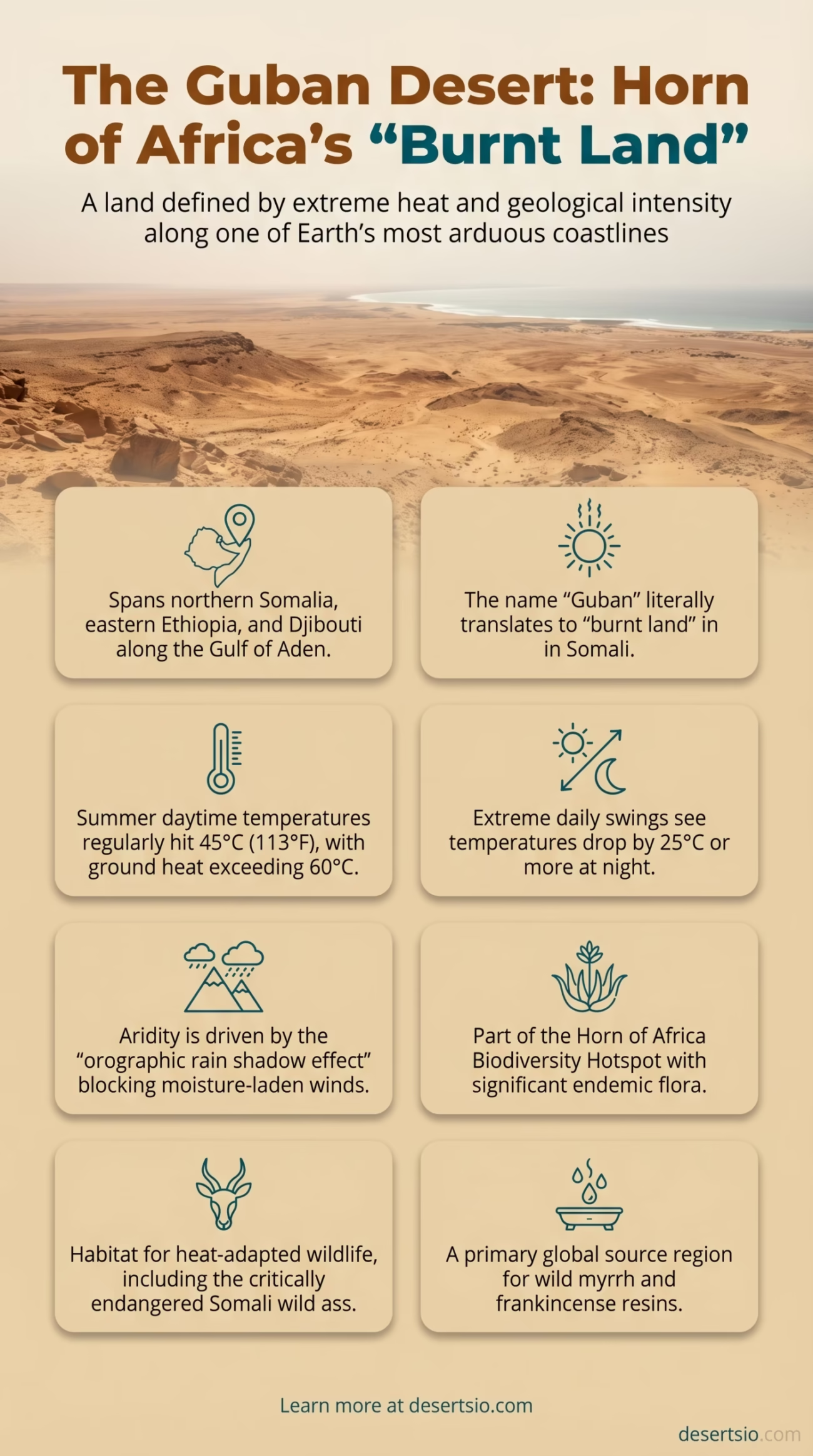
The Guban Desert stretches along one of the most geographically intense coastlines on Earth — the southern shore of the Gulf of Aden, carving through northern Somalia and bleeding into eastern Ethiopia and Djibouti. Guban literally translates to “burnt land” in Somali, and anyone who understands the thermal conditions here will tell you that name is not poetic exaggeration. It’s fact.
This is a desert defined by extremes. Scorching coastal winds, near-zero rainfall for months at a stretch, and a landscape that shifts from salt flats to thorny scrub without much warning. And yet — life persists here, both wild and human.
Guban Desert: Location and Map View
How the Guban Formed
The Guban’s formation ties directly to the East African Rift System and the broader tectonic activity reshaping the Horn of Africa over millions of years. As the African and Arabian tectonic plates gradually separated, the land that now forms the Somali coastal plain was pushed lower — creating a long, narrow depression running roughly parallel to the Gulf of Aden coastline.
That geological depression does something critical: it traps heat. The surrounding highlands — including the Golis Range to the south — act as a barrier, blocking moisture-laden winds from reaching the coastal lowlands. Precipitation that might otherwise fall is intercepted well before it reaches the Guban. This orographic rain shadow effect is a primary driver of the desert’s aridity.
Add to this the kharif — a hot, dry seasonal wind blowing from the southwest during summer months — and you have a landscape being cooked from above and baked by reflected ground heat simultaneously. The result is one of the most consistently harsh thermal environments in Africa.
Temperature: Day, Night, and the Gap Between Them
Few deserts in Africa experience the kind of daily thermal whiplash the Guban delivers. Daytime temperatures in July and August — the peak of the dry season — regularly reach 45°C (113°F). Ground surface temperatures can exceed 60°C. That’s hot enough to cause rapid dehydration in both animals and humans within hours of unprotected exposure.
Nights are a different world. Temperatures drop sharply, often falling to 15–18°C (59–64°F) between midnight and dawn. That’s a swing of 25°C or more within a single 24-hour cycle — a fluctuation that shapes everything from which plants can grow here to how animals time their activity. Most of the Guban’s wildlife is instinctively crepuscular or nocturnal, moving at dusk and dawn when temperatures sit in a survivable middle range.
How Big Is the Guban — Really?
At approximately 77,000 km², the Guban is not Africa’s largest desert by any measure — but its scale still surprises most people when they see it mapped. It is larger than Sri Lanka (65,610 km²) and comparable in size to the U.S. state of South Carolina. Running along a coastal strip roughly 1,000 km long and averaging 50–100 km wide, it forms a distinctive band separating the Gulf of Aden from the Somali highlands.
That elongated shape — narrow and coastal rather than vast and interior — makes the Guban somewhat unusual among African deserts. It behaves more like a coastal arid corridor than a classic open desert basin.
Flora: Surviving in the Burnt Land
Vegetation in the Guban is sparse, but not absent. The dominant plant communities belong to the Somali-Masai Acacia-Commiphora bushland biome — a dryland ecosystem known for its high rate of plant endemism.
Key plant species found across the Guban include:
- Acacia tortilis (umbrella thorn acacia) — the most recognizable tree silhouette; deep roots tap water far below the surface
- Commiphora species (myrrh-producing trees) — economically significant; Somalia is one of the world’s largest producers of wild myrrh
- Euphorbia species — succulent shrubs adapted to near-zero rainfall periods
- Stipagrostis grasses — ephemeral grasses that germinate rapidly after rare rainfall events
- Salvadora persica (toothbrush tree) — a salt-tolerant shrub common in the coastal lowlands
It’s worth noting that the Guban sits within the Horn of Africa Biodiversity Hotspot — one of only 36 globally recognized biodiversity hotspots. Despite its aridity, the region holds a disproportionately high number of endemic plant species relative to its size.
Fauna: What Lives in 45°C Heat?
Survival here demands specialization. The Guban and its surrounding arid zones support a range of mammals, birds, and reptiles — many of them highly adapted to heat and water scarcity.
Mammals
- Somali wild ass (Equus africanus somaliensis) — critically endangered; one of the rarest equids on Earth
- Speke’s gazelle — endemic to the Horn of Africa; inflatable nasal sac produces alarm calls
- Dorcas gazelle — highly heat-tolerant; can go weeks without drinking water
- Sand fox (Vulpes rueppellii) — nocturnal; large ears dissipate body heat
- Striped hyena — opportunistic scavenger; ranges widely through arid zones
Birds and Reptiles
- Somali ostrich (Struthio molybdophanes) — a recently reclassified species distinct from the common ostrich
- Lappet-faced vulture — dominant scavenger; significant wingspan up to 2.9 m
- Various monitor lizards — Varanus species exploit rocky outcrops along the desert edge
- Agama lizards — extremely common; males display vivid orange-red coloration during breeding season
- Cobra species including the Egyptian cobra — patient ambush hunters
Human Life in the Guban
The Guban has never been truly empty of people. For centuries — arguably millennia — the Somali nomadic pastoralists have moved through this landscape with precision, reading seasonal rainfall patterns, tracking grazing conditions, and navigating between the coastal lowlands and the highland plateaus in a rhythm calibrated to the desert itself.
The primary groups inhabiting the Guban region belong to Somali clan networks, particularly those of the Isaaq and Dir confederacies. Their livelihood traditionally revolves around camel herding — and camels are not incidental to life here, they are central to it. A camel can lose up to 30% of its body weight in water and recover fully after a single drink; no other large domestic animal survives the Guban’s conditions as effectively.
The Afar people occupy the western fringes of the Guban near Djibouti and eastern Ethiopia — a separate ethnic group with their own nomadic traditions, language (Afar, part of the Cushitic family), and deep knowledge of the desert’s edge zones.
Permanent settlements in the Guban are limited. Berbera, on the Gulf of Aden coast, is the main urban center near this desert — a port city with a long trading history stretching back to ancient times, when the region exported frankincense, myrrh, and livestock to Arabian Peninsula markets. That trade still continues today in some form.
Desertification and Climate Pressures
The Guban’s boundaries are not static. Desertification — the process by which productive land degrades into desert-like conditions — is actively expanding arid zones throughout the Horn of Africa. The Intergovernmental Panel on Climate Change (IPCC) has flagged East Africa as one of the regions most vulnerable to increasing aridity through the 21st century.
In practical terms, this means:
- Reduced rainfall reliability — the two rainy seasons (the gu in spring and the deyr in autumn) that nomadic communities depend on are becoming less predictable
- Increased frequency of extreme heat events — data from meteorological stations in Berbera show a measurable rise in maximum temperatures over the past three decades
- Overgrazing pressure — as usable grazing land contracts, livestock densities in remaining productive zones increase, accelerating soil degradation
- Invasive species spread — Prosopis juliflora (mesquite), introduced decades ago as a shade tree, has spread aggressively across Somali and Ethiopian arid lands, outcompeting native vegetation
The 2022–2023 Horn of Africa drought — described by the UN as the worst in 40 years — brought these pressures into sharp focus. Over 22 million people across Ethiopia, Somalia, and Kenya faced acute food insecurity as a direct result of five consecutive failed rainy seasons. The Guban region was not spared.
Neighboring Deserts and Regional Context
The Guban does not exist in isolation. It is part of a broader arid system that dominates the Horn of Africa and connects to larger desert zones across the continent.
| Desert / Arid Region | Location | Relationship to Guban |
| Ogaden Desert | Eastern Ethiopia / southern Somalia | Directly adjacent to the south; shares flora and fauna; part of the same arid corridor |
| Chalbi Desert | Northern Kenya | Further south; similar semi-arid scrubland character; part of the East African arid belt |
| Danakil Desert | Ethiopia / Eritrea / Djibouti | Northwest neighbor; one of the hottest and lowest places on Earth; volcanically active |
| Arabian Desert | Arabian Peninsula | Across the Gulf of Aden; shares climatic influences including dry northeastern winds |
Of these, the Ogaden is the most ecologically continuous with the Guban — many wildlife species range freely between the two, and the same nomadic pastoralist communities move seasonally across both zones. The Danakil Desert, while geologically distinct and far more extreme (temperatures there regularly exceed 50°C), shares the same tectonic roots and represents a useful comparison point for understanding the rift-driven aridity of the entire Horn region.
The Myrrh Connection: An Overlooked Economic Story
Here’s something most people don’t associate with a remote coastal desert: the Guban region is one of the world’s primary sources of wild myrrh and frankincense. Commiphora and Boswellia species — the trees that produce these resins — grow across the arid shrublands of northern Somalia and the adjacent highlands. Somalia currently produces an estimated 30–40% of the world’s frankincense supply.
This is not a relic trade. Global demand for essential oils, natural cosmetics, and traditional medicine has driven frankincense prices upward over the past decade. And unfortunately, that demand — combined with unsustainable tapping practices — is stressing wild Boswellia populations. Some studies estimate that Boswellia population density in key zones has declined by over 50% since the 1980s.
Guban Desert: Terminology Worth Knowing
- Guban — Somali word meaning “burnt” or “scorched”; the colloquial and geographical name for this coastal arid zone
- Kharif — the hot, dry southwest seasonal wind affecting the Guban during summer; different from the monsoon kharif of South Asia
- Gu — the main rainy season in Somalia (approximately April–June); critical for pastureland recovery
- Deyr — the shorter secondary rainy season (October–November); less reliable than the gu
- Xeel — traditional Somali communal resource-management system governing access to water and pasture; historically effective in arid-zone governance
- Orographic effect — the process by which mountains force air upward, causing rain to fall on the windward side and leaving the leeward side dry — the core mechanism behind the Guban’s aridity
Why the Guban Matters Beyond Its Borders
The Guban is a place that rarely appears on global lists of “great deserts” — it lacks the dune seas of the Sahara, the extreme cold of the Gobi, or the cinematic scale of the Namib. But its ecological, cultural, and economic significance to the Horn of Africa is hard to overstate.
It is part of a biodiversity-rich area. It supports nomadic communities whose land knowledge has developed over thousands of years. It also faces major environmental challenges — desertification, climate-driven drought, and biodiversity loss.
It is part of a biodiversity-rich area. It supports nomadic communities whose land knowledge has developed over thousands of years. It also faces major environmental challenges — desertification, climate-driven drought, and biodiversity loss.
And the name still says it plainly: burnt land. The Guban doesn’t pretend to be anything other than what it is.