| Location | Eastern Israel and the West Bank, between Jerusalem and the Dead Sea |
| Area | Approximately 1,500 km² (580 sq mi) |
| Elevation Range | −430 m (Dead Sea shore) to ~1,000 m above sea level |
| Annual Rainfall | 50–100 mm in the west; less than 50 mm near the Dead Sea |
| Average Daytime Temperature | Summer: 35–40°C (95–104°F); Winter: 10–15°C (50–59°F) |
| Average Nighttime Temperature | Summer: 20–25°C (68–77°F); Winter: 2–5°C (35–41°F) |
| Desert Type | Rain shadow desert (semi-arid to arid) |
| Bordering Body of Water | Dead Sea (lowest point on Earth, −430 m) |
| Key Geological Feature | Part of the Syrian-African Rift Valley |
| Notable Sites | Masada, Qumran, Ein Gedi, Mar Saba Monastery |
| Human Presence | Bedouin tribes (Ta’amireh, Jahalin), ancient monasteries, small settlements |
| Flora Zones | Steppe vegetation in the west; near-barren rocky terrain near the Dead Sea |
| UNESCO Status | Masada listed as UNESCO World Heritage Site (2001) |
Judaean Desert: Location and Map View
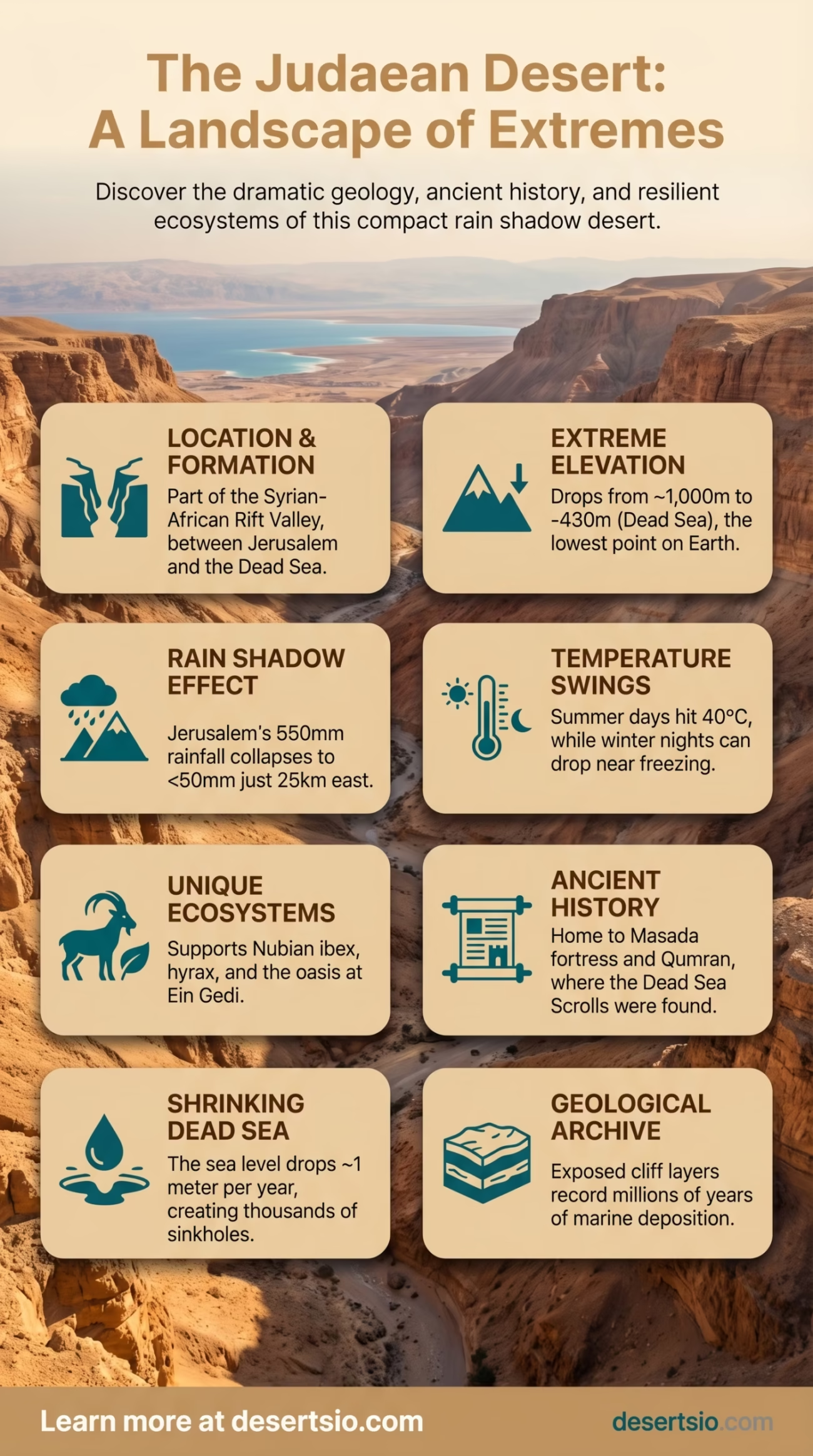
The Judaean Desert does not ease you in. It drops — sharply, dramatically — from the hills of Jerusalem eastward toward the Dead Sea, losing over 1,200 meters in elevation across just 25 kilometers of terrain. That abruptness is not accidental. It is the direct result of one of the most geologically active systems on the planet: the Syrian-African Rift Valley, the same fault line responsible for the formation of the Dead Sea itself.
Rainfall in Jerusalem averages around 550 mm per year. Travel 25 km east into the desert, and that number collapses to fewer than 50 mm. This is what makes the Judaean Desert a rain shadow desert — the Judaean Hills block Mediterranean moisture almost completely, leaving the eastern slope parched.
How Was the Judaean Desert Formed?
The desert’s formation is tied directly to the tectonic pulling apart of the African and Arabian plates. As the rift widened — a process that began roughly 25–30 million years ago — the land to the east of the Judaean Hills sank. The Dead Sea basin, sitting at the lowest exposed point on Earth (−430 meters below sea level), is the deepest expression of this geological collapse.
Rain shadow dynamics did the rest. The Judaean Mountains intercept nearly all incoming Mediterranean precipitation before it reaches the eastern slope. What little moisture arrives evaporates quickly across the exposed limestone and chalk terrain. Over millennia, wind erosion, flash flooding, and extreme thermal stress sculpted the landscape into the wadi-cut, cliff-riddled terrain visible today.
The rock itself is mostly Cretaceous limestone and chalk, soft enough to erode into dramatic canyon formations but hard enough to preserve caves — caves that later became historically significant on a global scale.
How Big Is the Judaean Desert?
At approximately 1,500 km², the Judaean Desert is relatively compact by global desert standards. To put it plainly: it is roughly twice the size of Hong Kong, or just slightly larger than the city of Los Angeles. It is not enormous. And yet the ecological and historical density packed into that space is extraordinary.
Compare it with its neighbor, the Negev Desert, which covers approximately 13,000 km² — nearly nine times larger — and stretches deep into southern Israel. Or consider the Sinai Desert just to the southwest, spanning around 60,000 km². The Judaean Desert is small. But elevation change alone — from 1,000 meters above sea level near Hebron down to −430 meters at the Dead Sea — creates a compression of environments rarely seen elsewhere.
Temperature: A Desert of Extremes
Summer days regularly hit 38–40°C (100–104°F) in the lower elevations near the Dead Sea. Nights drop to around 20–25°C (68–77°F) — still warm, but the diurnal shift is noticeable. Winter is a different story. Daytime temperatures in the higher western sections hover around 10–15°C, and nighttime temperatures can fall to near freezing (2–5°C). Snow is rare but not unheard of at the higher elevations.
This thermal range — sometimes exceeding 20°C within a single 24-hour period — creates physical stress on the rock formations themselves. Repeated expansion and contraction contributes to ongoing erosion, reshaping the desert’s surface year by year.
Temperature Overview
- Summer highs (Dead Sea zone): 38–40°C
- Summer nights: 20–25°C
- Winter days (western edge): 10–15°C
- Winter nights: 2–5°C (near-freezing at elevation)
- Daily temperature swing: Up to 20°C in some zones
Flora and Fauna: Life That Refuses to Quit
The western edge of the Judaean Desert supports a sparse but real steppe-type vegetation: wormwood (Artemisia herba-alba), white broom (Retama raetam), and various drought-resistant grasses. Moving east, vegetation thins to near-zero. The lower eastern slopes and Dead Sea basin are essentially bare rock and salt flats.
The oasis at Ein Gedi is the most dramatic exception. Fed by freshwater springs, it supports a dense ribbon of greenery — including Sodom apple (Calotropis procera) and various reeds — right at the edge of the Dead Sea shore. It functions as a biological island in an otherwise inhospitable landscape.
Fauna is more varied than the scenery might suggest:
- Nubian ibex — sure-footed cliff dwellers, regularly spotted around Ein Gedi and Masada
- Rock hyrax (Procavia capensis) — small, social mammals that colonize rocky outcrops
- Arabian wolf and striped hyena — present in lower densities; primarily nocturnal
- Desert leopard — historically documented; functionally extinct in this region now
- Griffon vulture (Gyps fulvus) — a regular sight riding thermals above the canyon walls
- Sand partridge, Tristram’s starling — both endemic to the region’s rocky desert habitat
Reptile diversity is high. Monitor lizards, several species of gecko, and the Levant viper are all documented residents. The desert also lies along a major bird migration corridor — the Syrian-African Rift flyway — making it an important stopover for hundreds of species moving between Europe and Africa each year.
Human Life in the Judaean Desert
People have lived in and around this desert for an estimated 10,000 years. The evidence is overwhelming — from Neolithic settlements to Bronze Age fortresses to Byzantine monasteries still inhabited today.
The Bedouin remain the most visible contemporary desert dwellers. Two main tribes — the Ta’amireh and the Jahalin — have historical roots in this landscape. The Ta’amireh are particularly notable: it was Ta’amireh shepherds who discovered the Dead Sea Scrolls in 1947, when one of them tossed a stone into a cave at Qumran and heard something break. The sound came from jars that held what would become one of the most significant archaeological finds of the 20th century.
Pastoral life continues, though it has changed substantially. Bedouin communities today use a mix of traditional and modern practices — goat herding, seasonal movement, and increasingly, semi-permanent encampments. Land-use tensions remain an ongoing issue.
And then there are the monasteries. Mar Saba, founded in 483 CE, is one of the oldest inhabited Christian monasteries in the world. It clings to the cliffs above Kidron Valley, with Greek Orthodox monks still living within its walls. The desert has always drawn those seeking solitude, and that remains true today.
The Dead Sea Scrolls and Qumran
No discussion of the Judaean Desert is complete without Qumran. Between 1947 and 1956, archaeologists recovered over 900 manuscripts from 11 caves near the site — texts dating from the 3rd century BCE to the 1st century CE. These are the Dead Sea Scrolls.
The dry desert climate — extremely low humidity, stable cave temperatures — preserved fragile parchment and papyrus for roughly 2,000 years. This is exactly the kind of preservation that would be impossible in a wetter environment. The desert, in a very real sense, is what kept those texts intact.
Some scrolls are now displayed at the Israel Museum in Jerusalem’s Shrine of the Book. Digital scanning and infrared imaging technology continues to reveal text invisible to the naked eye — as recently as 2021, new fragments were identified using multi-spectral imaging.
Masada: Fortress at the Edge of the Desert
Masada rises 450 meters above the Dead Sea shoreline — a flat-topped mesa of natural rock that Herod the Great turned into a palace-fortress around 30 BCE. The site was designated a UNESCO World Heritage Site in 2001.
The geology here is the architecture. Herod did not build Masada; he built on Masada, using the sheer cliffs as natural defense walls. Today, a cable car ascends the eastern face, and the ancient Snake Path still exists on the western side — a winding, exhausting trail that ancient defenders climbed with full loads.
Masada receives approximately 1 million visitors annually, making it one of the most visited archaeological sites in the region. The combination of desert landscape, historical depth, and dramatic elevation draws archaeologists, tourists, and hikers alike.
Nearby Deserts and Comparable Landscapes
The Judaean Desert does not exist in isolation. It forms part of a broader arid zone that extends across the Levant and into the Arabian Peninsula.
Negev Desert
Immediately to the south, the Negev covers 13,000 km² — roughly nine times the area of the Judaean Desert. It transitions from semi-arid scrubland in the north to hyper-arid terrain near Eilat. The Ramon Crater (Makhtesh Ramon), the world’s largest erosion crater at 40 km long, is its geological centerpiece. The Negev shares the same general rain shadow dynamics but is far more expansive and drier overall.
Sinai Desert
Spanning approximately 60,000 km², the Sinai Peninsula connects Africa and Asia and holds its own dramatic landscape — granite mountains in the south, limestone plateaus in the north. The Sinai shares some wildlife with the Judaean Desert (Nubian ibex, griffon vultures) and was historically connected via ancient trade routes. Elevation and temperature extremes are comparable, though the Sinai is geologically distinct.
Further east, the Arabian Desert begins — an entirely different scale and character, covering 2.3 million km² across the Arabian Peninsula. And to the northeast, the Syrian Desert stretches across parts of Syria, Jordan, and Iraq. The Judaean Desert, compact as it is, sits at the western edge of this vast arid belt.
In terms of character — canyon terrain, rain shadow formation, extreme elevation variation — the Judaean Desert most closely resembles parts of the Atacama Desert’s western slope in Chile, where the Andes create a near-identical moisture barrier. Different continents, same mechanism.
The Dead Sea Crisis and the Desert’s Expanding Edge
The Dead Sea is shrinking. Fast. Since the 1960s, its surface level has dropped by more than 35 meters, and it continues to fall at approximately 1 meter per year. Water diversion from the Jordan River — which historically fed the Dead Sea — is the primary driver.
As the shoreline retreats, sinkholes open up along the former lake bed — over 6,000 sinkholes documented as of recent surveys. Roads collapse. Agricultural land destabilizes. The desert’s eastern boundary is effectively expanding as the water recedes.
This is one of the more visible ongoing environmental events in the region, and it directly affects the Judaean Desert’s ecosystem. Spring-fed oases like Ein Gedi are under pressure. And the salt flats left behind by the retreating shoreline create new, even more inhospitable terrain.
Various regional water-sharing and canal proposals have been discussed for decades. The situation remains unresolved. The desert watches. It is, after all, patient — it has been reshaping itself for millions of years.
Geological Layers: What the Desert Records
The cliff faces of the Judaean Desert are essentially an open geological archive. Layers of Senonian chalk, Eocene limestone, and Cenomanian-Turonian formations are exposed across the canyon walls. Each layer represents tens of millions of years of marine deposition — this entire region was once the floor of the Tethys Sea.
Flash floods, though rare (perhaps 3–5 significant events per year), are the primary ongoing erosion force. A single flash flood event can carve meters of new channel in hours. The wadis — dry riverbeds — carry this flood water rapidly toward the Dead Sea, depositing alluvial fans at their mouths. Some of these fans appear in satellite images as light-colored spreading plumes against the darker desert rock.
| Geological Feature | Details |
| Rock Types | Cretaceous limestone, chalk, Eocene dolomite |
| Tectonic System | Syrian-African Rift Valley |
| Rift Age | Began ~25–30 million years ago |
| Dead Sea Level | −430 m (lowest exposed land on Earth) |
| Annual Sea Level Drop | ~1 meter per year |
| Sinkholes Documented | 6,000+ along former Dead Sea shoreline |
| Flash Flood Frequency | 3–5 significant events annually |
| Erosion Agents | Flash flooding, thermal stress, wind |
Why the Judaean Desert Stays Relevant
In 2023 and 2024, renewed archaeological work at several Judaean Desert cave sites produced additional manuscript fragments — small, but significant — suggesting that systematic excavation of the region’s cave network is far from complete. The desert still holds secrets.
Meanwhile, climate modeling projects increased aridity across the Levant through the 21st century. The Judaean Desert’s annual rainfall — already barely enough to sustain sparse vegetation — is projected to decline by 10–20% by 2050 under mid-range climate scenarios. That threshold matters. Below certain precipitation levels, even the hardy steppe vegetation of the western edge begins to fail, and the desert boundary moves westward.
The Judaean Desert is not a relic. It is an active, changing system — geologically, ecologically, archaeologically. And it is small enough that changes elsewhere (Dead Sea water levels, regional water use, climate shifts) affect it immediately and visibly. That makes it, in a strange way, one of the more informative deserts to study. A compact laboratory for understanding what happens when water disappears from a landscape.
And the landscape answers. Every wadi, every crumbling monastery wall, every ibex picking its way across a limestone cliff — all of it is data.