| Location | South Africa (Western Cape, Eastern Cape, Northern Cape) |
| Type | Semi-arid desert / Shrubland |
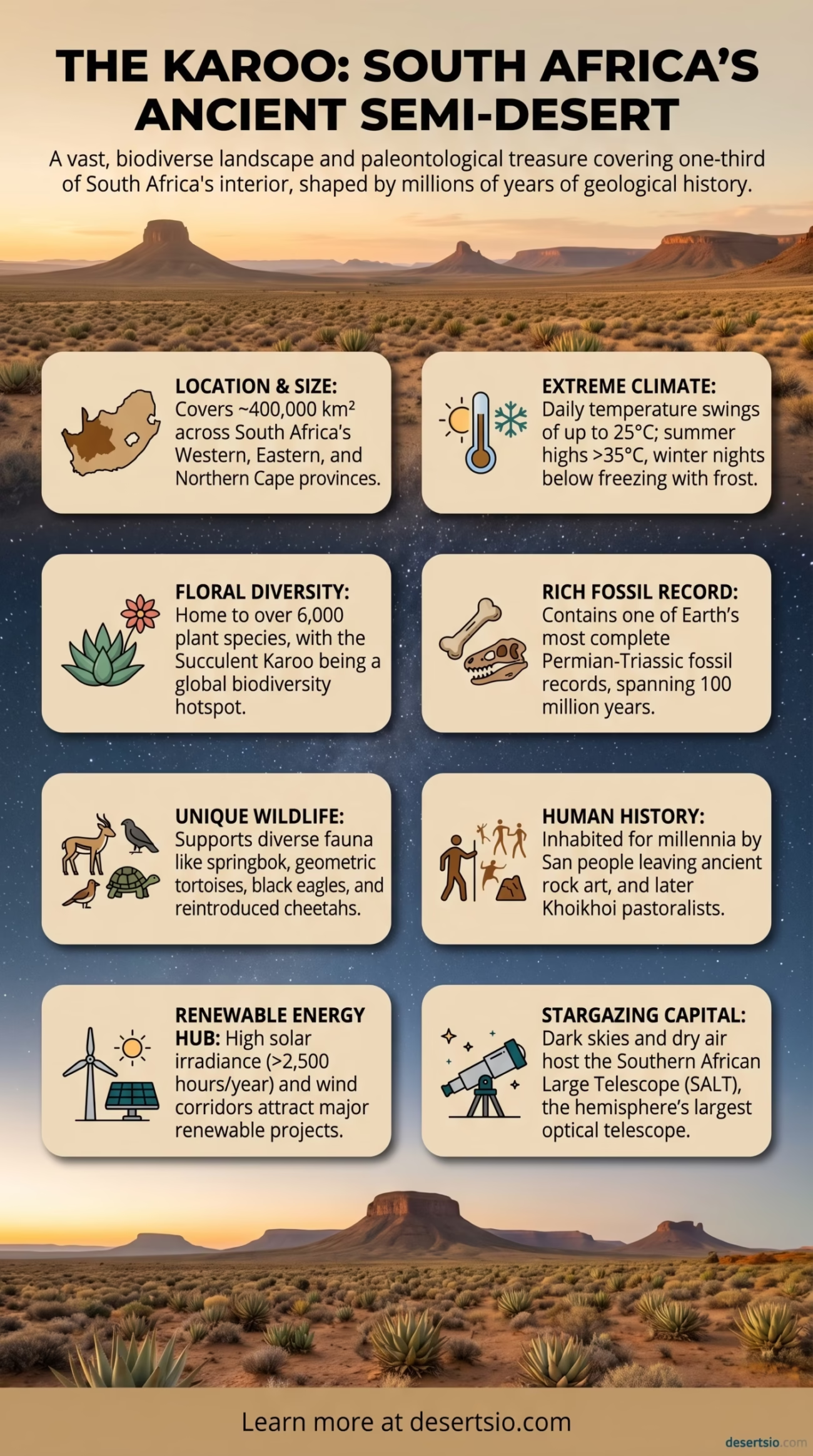
| Total Area | ~400,000 km² (154,000 sq mi) |
| Elevation | 300 – 1,800 m above sea level |
| Annual Rainfall | 50 – 250 mm per year |
| Average Daytime Temperature | 25°C – 35°C (summer) / 15°C – 22°C (winter) |
| Average Nighttime Temperature | 0°C – 7°C (winter nights, frost common) |
| Day-Night Temperature Difference | Up to 20°C – 25°C in a single day |
| Main Subdivisions | Great Karoo, Little Karoo, Succulent Karoo, Nama Karoo |
| Dominant Vegetation | Succulents, dwarf shrubs, fynbos transition species |
| UNESCO Status | Succulent Karoo — Biodiversity Hotspot |
| Fossil Significance | One of the richest Permian-Triassic fossil records on Earth |
| Human Population | Sparse; small towns and farming communities |
| Notable Towns | Beaufort West, Graaff-Reinet, Oudtshoorn, Prince Albert |
The Karoo is not a desert in the way most people picture one — no towering sand dunes, no endless golden seas of sand. Instead, it stretches across South Africa’s interior as a vast, semi-arid plateau, raw and ancient, covered in low scrub and punctuated by dramatic flat-topped hills called koppies. It is a landscape that demands a second look. And a third.
Covering roughly 400,000 square kilometers, the Karoo is larger than Germany and the Netherlands combined. That scale alone tells you something. It dominates a huge portion of southern Africa’s interior and shapes the climate, ecology, and culture of entire provinces.
Karoo Desert: Location and Map View
How the Karoo Formed
The Karoo’s origin is geological — and ancient. During the Permian and Triassic periods (roughly 300 to 200 million years ago), the region was a massive inland basin filled with rivers, floodplains, and shallow lakes. Sediment accumulated in layers over tens of millions of years, preserving an extraordinary record of prehistoric life. Over time, tectonic uplift and the rain shadow effect created by the Cape Fold Mountains to the south progressively dried out the basin.
The Cape Fold Mountains — particularly the Swartberg and Langeberg ranges — block moisture-laden winds from the Indian and Atlantic oceans. What reaches the Karoo interior is already dry air. Annual rainfall averages between 50 and 250 mm, depending on the subregion, and most of it falls unpredictably. That dryness, layered over millions of years of geological history, is what shaped the Karoo as we see it today.
Four Faces of One Desert: The Karoo’s Subdivisions
The Karoo is not a single uniform landscape. It divides into four main ecological zones, each with its own character:
- Great Karoo — The largest subdivision, covering much of the Central Plateau. Wide open plains, sparse vegetation, and intense temperature swings. Towns like Beaufort West and Graaff-Reinet sit here.
- Little Karoo (Klein Karoo) — A narrow valley between mountain ranges. Warmer and more sheltered than the Great Karoo; famous for ostrich farming and the Cango Caves.
- Succulent Karoo — Along the western coast, this subregion is a global biodiversity hotspot. It contains more succulent plant species per square kilometer than anywhere else on Earth.
- Nama Karoo — Transitioning northward toward the Namib and Kalahari, this drier zone is dominated by sparse grasses and dwarf shrubs.
How Big Is the Karoo, Really?
At 400,000 km², the Karoo is bigger than the entire state of California (approximately 424,000 km² — they are remarkably close in size, actually). It covers roughly one-third of South Africa’s total land area. When you factor in the Nama Karoo extending toward Namibia, the broader Karoo ecosystem stretches even further. That is not a desert you accidentally stumble into — it defines a region.
Temperature: The Karoo’s Dramatic Rhythm
Temperature is where the Karoo reveals its semi-arid nature most sharply. Summer days in the Great Karoo regularly push past 35°C — sometimes reaching 40°C in low-lying areas. Nights, even in summer, cool significantly. In winter, nighttime temperatures frequently drop below 0°C, with frost a common occurrence across the plateau.
That daily swing — 20 to 25°C between afternoon and pre-dawn — is the Karoo’s defining thermal signature. It is the kind of temperature range that stresses most organisms and, at the same time, drives the extraordinary adaptations found here. Succulents, for instance, use Crassulacean Acid Metabolism (CAM) photosynthesis — they open their stomata at night to conserve water, a direct response to exactly this kind of environment.
Flora and Fauna: Life Adapted to the Edge
The Karoo is, biologically speaking, one of the most interesting dry landscapes on the planet. The Succulent Karoo alone contains over 6,000 plant species, of which approximately 40% are endemic — found nowhere else. The concentration of succulent diversity here is unmatched globally.
Key plant groups include:
- Mesembs (Aizoaceae) — The stone plants, split rocks, and living stones that blend almost perfectly into the gravel substrate
- Aloes — Several species native to the Karoo, including Aloe ferox, harvested commercially for its bitter sap
- Quiver Trees (Aloidendron dichotomum) — Iconic tree-like aloes that store water in their trunks
- Renosterveld and fynbos transition species — Along the western and southern margins
- Karoo bush (Sclerolaena and related shrubs) — The low, grey-green scrub that defines the visual texture of the landscape
Wildlife in the Karoo is recovering. Historically, European settlers nearly wiped out the large mammal populations. Today, private game reserves and conservation projects have reintroduced springbok, gemsbok, black wildebeest, mountain zebra, and even cheetah across significant areas. The Karoo National Park near Beaufort West now supports over 60 mammal species. Birdlife is exceptional too — the secretarybird, the Karoo korhaan, the black eagle (Verreaux’s eagle), and the ostrich are all strongly associated with this biome.
And then there are the reptiles. The Karoo hosts a remarkable diversity of lizards and tortoises — the geometric tortoise (one of the world’s most endangered tortoises) survives in a narrow range along the southwestern Karoo edge.
The Fossil Record: A Window Into Deep Time
The Karoo Basin holds one of the most complete Permian-Triassic fossil records on Earth. The sedimentary layers — called the Karoo Supergroup — span over 12 km in thickness and document approximately 100 million years of Earth’s history. Fossils of Lystrosaurus, Dicynodon, and hundreds of other therapsids (the mammal-like reptiles that eventually gave rise to mammals) have been recovered here in extraordinary numbers. Paleontologists consider the Karoo’s Beaufort Group essential to understanding the Permian-Triassic extinction event — the largest mass extinction in Earth’s history, which eliminated roughly 90–96% of all marine species and 70% of terrestrial vertebrate species around 252 million years ago.
Human Life in the Karoo
People have lived in the Karoo for tens of thousands of years. The San people — among the world’s oldest continuous human populations — left rock art across the region’s caves and rock shelters, some of it dating back over 8,000 years. The Graaff-Reinet area and the Cederberg mountains (on the Karoo’s western edge) preserve some of southern Africa’s finest San rock art.
Later, the Khoikhoi pastoralists moved through the Karoo seasonally with their livestock, following the sparse rains. Their name for this land — Karoo — likely derives from a Khoikhoi word meaning “land of thirst” or “dry, barren place.” That etymology alone captures something essential.
Today, the Karoo’s human population is sparse. Vast sheep and goat farms — some covering 5,000 to 10,000 hectares or more — define the rural economy. Merino wool production from the Karoo is important globally; the region produces some of the highest-quality wool in Africa. Small towns like Graaff-Reinet (often called the “Gem of the Karoo”), Prince Albert, and Matjiesfontein function as service centers and, increasingly, as destinations for travelers drawn by the landscape’s stark beauty.
The Karoo and the Energy Debate
The Karoo has become a focal point of renewable energy development in South Africa. The combination of high solar irradiance — the region receives over 2,500 hours of sunshine per year — and strong wind corridors has attracted large-scale solar and wind farm projects. The Loeriesfontein and Khobab wind farms in the Northern Cape are among the largest in sub-Saharan Africa.
At the same time, the Karoo has been at the center of discussions around natural gas exploration, particularly shale gas via hydraulic fracturing (fracking). The Karoo Basin is estimated to hold significant natural gas reserves. This remains a complex issue, with environmental scientists, farmers, and ecologists raising serious concerns about groundwater impacts in an already water-scarce environment. No large-scale fracking has proceeded as of 2024, but the regulatory debate continues.
Stargazing Capital: The Karoo’s Dark Skies
Low population density, dry air, and minimal light pollution make the Karoo one of the finest stargazing environments in the Southern Hemisphere. The South African Astronomical Observatory (SAAO) operates its largest telescope — the Southern African Large Telescope (SALT), with a primary mirror of 11 meters — at Sutherland, right in the heart of the Karoo. SALT is the largest optical telescope in the Southern Hemisphere.
And the skies here are genuinely extraordinary. On a clear Karoo night, the Milky Way is so dense and bright it casts a faint shadow.
Neighboring Deserts and Regional Context
The Karoo does not exist in isolation. It sits within a broader network of southern African arid and semi-arid systems:
| Desert / Region | Location | Key Difference from Karoo |
| Namib Desert | Namibia, coastal | True hyper-arid desert; vast dune fields; older than the Karoo |
| Kalahari Desert | Botswana, South Africa, Namibia | Semi-arid like Karoo but sandier; more wildlife; higher rainfall |
| Nama Karoo | Northern Cape, Namibia border | Direct transitional zone between Karoo and Namib/Kalahari |
| Bushmanland | Northern Cape | Flat, gravelly; sparse vegetation; culturally significant San territory |
The Kalahari is probably the Karoo’s closest regional cousin — both are semi-arid, both support significant wildlife, and both cover enormous areas. But the Kalahari sits on deep Kalahari sand (a fossil sand sea), while the Karoo’s surface is rocky, shale-based, and geologically far more complex. The Namib, by contrast, is the real extremist — a hyper-arid coastal desert where some weather stations have recorded zero rainfall for years at a time.
Climate Change Pressures on the Karoo
Current climate projections for southern Africa indicate that the Karoo is likely to become hotter and drier over coming decades. Models suggest average temperature increases of 1.5°C to 3°C by 2050 relative to late 20th-century baselines, with a corresponding reduction in already-scarce rainfall across the interior. This matters enormously for both the Karoo’s unique succulent flora — many species have extremely narrow climate tolerances — and for the farming communities that depend on groundwater and seasonal rain.
Invasive plant species, particularly invasive acacias and prickly pear (Opuntia species), already compete with native Karoo vegetation across large areas. Climate shifts are expected to accelerate this pressure. South Africa’s Working for Water program has cleared millions of hectares of invasive plants nationally, with Karoo areas among the priority zones.
The Karoo’s Unique Identity
There is something about the Karoo that resists easy categorization. It is technically semi-arid, not a full desert by strict climatological definition — and yet it carries the psychological weight of a desert. The silence, the distances, the hardness of the light at midday. South African writers and artists have long been drawn to it. The word “Karoo” itself carries cultural weight in South Africa in a way that few landscape names do — it signals remoteness, resilience, and a certain uncompromising nature that the land itself embodies.
And beneath all of that — literally beneath the cracked clay and shale — lies one of the most important paleontological archives on Earth. A record of life written in stone, 300 million years deep.