
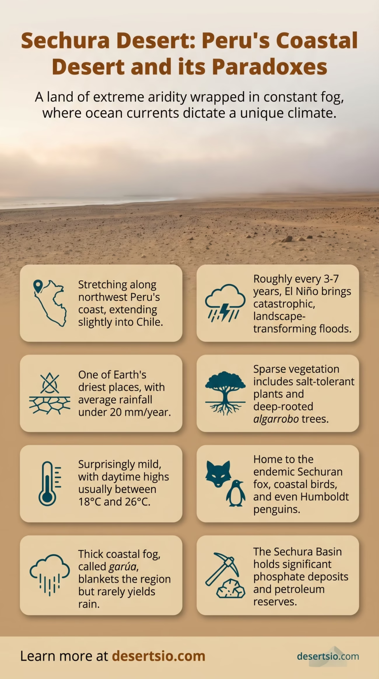
| Location | Western South America — coastal Peru (extends slightly into northern Chile) |
| Area | Approximately 188,000 km² (72,600 sq mi) |
| Type | Coastal desert (subtropical) |
| Annual Rainfall | Less than 20 mm/year on average; some years virtually zero |
| Daytime Temperature | 18°C – 26°C (64°F – 79°F) |
| Nighttime Temperature | 12°C – 16°C (54°F – 61°F) |
| Elevation | Sea level to ~1,000 m along the western Andean slopes |
| Bordering Features | Pacific Ocean (west), Andes Mountains (east) |
| Main River | Piura River; seasonal quebradas (dry riverbeds) |
| Dominant Wind System | Humboldt (Peru) Current-driven cold upwelling; steady southerly winds |
| Humidity | High relative humidity (60–98%) despite extremely low rainfall |
| Countries | Peru (primarily), minor extension into northern Chile |
| UNESCO Status | Part of the Sechura–Piura dry forest ecoregion recognized by WWF |
The Sechura Desert sits right at the edge of the Pacific — literally. Stretching along Peru’s northwestern coastline, it is one of the driest places on Earth, yet paradoxically wrapped in thick coastal fog for much of the year. With rainfall averages below 20 mm annually (comparable to the hyperarid core of the Atacama to its south), the Sechura challenges every assumption people carry about what a desert looks like. No towering dunes dominate the entire landscape — instead, you get flat, gravelly plains called pampas, scattered salt flats known as salinas, and a coastline where cold ocean water meets scorching dry air.
How Big Is the Sechura Desert?
At roughly 188,000 km², the Sechura is not a giant by global desert standards — but scale it against familiar geography and the number hits differently. It is larger than the entire country of Uruguay and about the size of the state of Washington in the U.S. For a coastal desert wedged between the world’s longest mountain range and the Pacific Ocean, that is a remarkable footprint.
The desert runs roughly 1,400 km along the coast from around the Piura region in northern Peru down toward the Atacama transition zone. Its width rarely exceeds 160 km — constrained on one side by the ocean and on the other by the sharp rise of the Andes. This elongated, narrow shape is actually quite typical of rain-shadow and cold-current coastal deserts worldwide.
Formation: Why Is There a Desert on the Coast?
This is the question most people ask first. A coastal desert seems like a contradiction — water everywhere, yet almost no rain. The answer is the Humboldt Current (also called the Peru Current), a cold oceanic current that flows northward along South America’s western coast. It chills the air above it so dramatically that moisture cannot rise high enough to form rain-bearing clouds. The air stabilizes. Clouds form at low levels — hence the famous coastal fog, called garúa in Peruvian Spanish — but actual precipitation rarely materializes.
And the Andes make things worse. Or better, depending on your perspective. The mountain range acts as a wall blocking moist Amazonian air from ever reaching the western coast. The Sechura is caught between two moisture-blocking systems simultaneously. That double mechanism is what makes it so persistently dry.
Geologically, the desert sits on a sedimentary basin — the Sechura Basin — which is one of Peru’s significant fossil-fuel and phosphate-bearing formations. Beneath the arid surface lies a layered record of marine sediments, indicating the region was submerged under shallow seas millions of years ago during the Miocene epoch.
Temperature: Cooler Than You’d Expect
Most people picture a desert and imagine crushing heat. Sechura breaks that mold. The Humboldt Current keeps coastal temperatures remarkably moderate year-round. Daytime highs generally sit between 18°C and 26°C (64°F–79°F), which feels more like a mild Mediterranean afternoon than a desert. Nights drop to around 12°C–16°C — cool, sometimes genuinely cold near the ocean.
That said, temperature behavior changes as you move inland and away from the ocean’s moderating influence. Toward the desert’s interior margins, where elevation begins to climb, daily temperature swings widen. Inland areas can hit 35°C+ during peak summer (December–March) while dropping sharply overnight. During El Niño years — more on that below — the entire temperature and humidity pattern transforms almost completely.
El Niño and the Desert That Floods
Here is where the Sechura Desert becomes genuinely extraordinary. Periodically — roughly every 3 to 7 years — the El Niño Southern Oscillation (ENSO) event warms the Pacific surface waters off Peru’s coast. The Humboldt Current weakens. Warm, moisture-laden air replaces the cold stability. And suddenly, one of Earth’s driest landscapes receives catastrophic rainfall.
During the 1982–83 El Niño, parts of the Sechura received over 1,000 mm of rain in a single season — more than 50 times the annual average. Dry riverbeds (quebradas) roared back to life. Flash floods reshaped valleys overnight. The event repeated in 1997–98 with similar intensity. And during the 2017 “Coastal El Niño”, which affected northwestern Peru specifically, the Piura region saw devastating floods that displaced over 100,000 people and destroyed thousands of homes.
El Niño Impact on the Sechura Desert — by the numbers:
- Normal annual rainfall: <20 mm/year
- Rainfall during 1982–83 El Niño: ~1,000+ mm in weeks
- Flash flood events in 2017: severely impacted Piura, Tumbes, and Lambayeque regions
- Temporary lake formed in Sechura Basin (1983): covered over 2,000 km²
- Economic losses in 1997–98 El Niño (Peru-wide): estimated at $3.5 billion USD
After each major El Niño, the desert surface briefly transforms into something resembling savanna — green grasses pushing through cracked soil, flowers blooming across pampas that were bone-dry months before. Locals call this fleeting phenomenon desierto florido, the “flowering desert.” It disappears almost as quickly as it arrives.
Flora and Fauna: Life Against the Odds
The Sechura is not lifeless. Far from it — though biodiversity here demands patience and sharp eyes. Vegetation is sparse but specialized. Along the coast, salt-tolerant plants called halophytes cling to the margins of salinas (salt flats). Deeper inland, drought-resistant shrubs like Capparis species (cappers) and scattered algarrobo trees (Prosopis pallida, a native mesquite relative) provide the only real canopy in an otherwise open landscape.
Fauna adapts with equal ingenuity:
- Sechuran fox (Lycalopex sechurae) — endemic to this desert; smaller than a typical fox, highly adapted to arid conditions
- Marine mammals along the coast — sea lions, South American fur seals, and Humboldt penguins (yes, penguins in a desert)
- Peruvian pelican and various shorebirds that feed on the nutrient-rich Humboldt Current upwelling
- Reptiles — several lizard species, including Microlophus lava lizards common across Peruvian coastal deserts
- Invertebrates — after El Niño rains, populations of toads, insects, and crustaceans explode temporarily in ephemeral pools
The coastal waters adjacent to the Sechura are biologically some of the richest on the planet — driven by cold upwelling that brings nutrients to the surface. Peru consistently ranks among the world’s top 5 fishing nations, and much of that productivity originates right here.
Human Life in the Sechura
People have lived in and around the Sechura Desert for thousands of years. Archaeological evidence points to pre-Columbian settlements along the coastal quebradas and river valleys — populations that learned to exploit both marine resources and the seasonal river flows. The Sechura people, an indigenous group for whom the desert is named, inhabited this region before Spanish colonization in the 16th century. Their traditional practices centered on fishing, gathering shellfish, and herding along the desert margins.
Today, the city of Piura (population approximately 500,000) anchors the northern edge of the desert and serves as the economic hub of the region. Smaller towns like Sechura itself (around 40,000 people) sit within the desert proper. The economy mixes fishing, phosphate mining, petroleum extraction from the Talara basin (one of Peru’s oldest oil-producing areas), and increasingly, agro-industrial production in irrigated valleys.
Nomadic or semi-nomadic lifestyles have largely faded — replaced by settled communities dependent on infrastructure. But knowledge of the desert, its moods, and its cycles remains deeply embedded in local culture. Fishermen read the color of the sea; farmers track the garúa fog. And this is the knowledge that matters most when El Niño years come around again.
Natural Resources: What Lies Below
The Sechura Basin holds some of Peru’s most significant mineral wealth. The region contains one of the largest phosphate deposits in South America — the Bayóvar phosphate project, operated near the Bay of Sechura, holds estimated reserves of over 800 million metric tons of phosphate rock. Phosphate is essential for fertilizer production globally, and Bayóvar has drawn substantial international investment over the past two decades.
Additionally, petroleum extraction in the Talara area (northwestern fringe of the Sechura zone) has operated since the late 19th century — making it one of the oldest oil fields in South America. And offshore, anchovy fishing powered by the Humboldt Current supports Peru’s massive fishmeal and fish oil industry, worth billions annually.
Nearby Deserts: The Broader Coastal Desert System
The Sechura does not exist in isolation. It forms the northern section of a continuous coastal desert system running down South America’s Pacific coast. Understanding its neighbors adds important context.
| Desert | Location | Area | Key Distinction vs. Sechura |
| Atacama Desert | Chile / southern Peru | ~105,000 km² | Far more extreme aridity; some areas receive zero measurable rainfall for decades; higher elevation zones |
| Coastal Peru Desert | Central/southern Peru | Part of broader system | Transitional zone connecting Sechura to Atacama; similar cold-current mechanism |
| Piura Dry Forest | Piura region, northern Peru | Overlaps Sechura margins | More vegetation; classified as tropical dry forest rather than full desert |
The Atacama Desert to the south is the most obvious comparison point. Both are coastal, both are driven by the Humboldt Current, and both share that eerie high-humidity-but-no-rain paradox. But the Atacama is far more extreme — and far more studied. The Sechura gets less scientific and media attention, yet its ecological and geological complexity is arguably just as fascinating.
And what makes the Sechura distinct? It is the El Niño vulnerability. The Atacama’s aridity is more stable, locked in by geography and elevation. The Sechura oscillates — sometimes dramatically — between hyperaridity and temporary flood. That dynamic makes it a priority region for climate scientists studying ENSO behavior and desert ecosystem resilience.
Climate Change and the Sechura’s Future
Current climate projections raise serious questions about the Sechura’s future stability. Warming Pacific Ocean temperatures — a broader climate trend — may alter the frequency and intensity of El Niño events. Some models suggest more frequent but irregular ENSO cycles through the latter half of the 21st century. For a desert defined by this cycle, that uncertainty carries significant consequences.
Desertification pressure is also expanding into areas that historically supported dry forest on the desert’s margins. Overgrazing, charcoal production from algarrobo trees, and informal agricultural expansion have pushed the Sechura’s boundary eastward in some areas. The Peruvian government and international conservation organizations have flagged the Piura dry forest ecoregion as critically threatened — with less than 5% of original vegetation cover remaining in some sectors.
Key Terms: Sechura Desert Glossary
- Garúa — The thick coastal fog that forms over Peru’s Pacific coast due to cold Humboldt Current air; provides minor moisture to coastal organisms but rarely generates rainfall
- Quebrada — A dry riverbed or seasonal stream channel; during El Niño events, these fill rapidly and dangerously with floodwater
- Salina — A salt flat or shallow salt marsh; common in the Sechura Basin where evaporation exceeds any water input
- Pampa — Flat, open gravelly or sandy plain; the dominant landform across much of the Sechura Desert interior
- Algarrobo — Prosopis pallida; a native leguminous tree found in dry coastal Peru, culturally and ecologically important, with deep root systems that access groundwater
- Desierto florido — “Flowering desert”; the brief post-El Niño bloom of plants and grasses across the normally barren Sechura surface
The Sechura Desert is unique in its environment. It sits where oceanography, climatology, and ecology intersect — a place where the “desert” can flood in weeks, and where animals like penguins inhabit a coastal strip that receives almost no rain. Understanding the Sechura requires looking at how climate systems, ocean currents, and geological history combine to shape this environment.