- Creep: grains roll along the ground under steady push and small impacts.
- Saltation: sand-sized grains hop like tiny skipping stones over the surface.
- Suspension: fine dust lifts and stays aloft, turning the air hazy for longer.
The key link is saltation. Those hopping grains smack into the ground and knock loose extra fines. It’s like juggling oranges over a tray of flour: the flour isn’t moving until the impacts start. Once fines are airborne, turbulence keeps them there, and visibility can drop quickly even if the surface looks unchanged.
- Easy Clues A Dust Storm Is About To Form
- Common Questions About Dust Storm Causes
- Can Dust Storms Happen Without Deserts?
- Does Heat Alone Create Dust Storms?
- Why Do Some Dust Storms Look Like A Solid Wall?
- Mini Glossary
- The Core Recipe For A Dust Storm
- Where The Dust Actually Comes From
- Natural Dust Sources
- Human-Influenced Dust Sources
- The Wind Triggers That Kick Things Off
- Haboobs And Thunderstorm Outflows
- Surface Conditions That Make Dust Storms More Likely
- Why Some Places See Dust Storms Again And Again
- Dust Storm Vs Sandstorm
- How Scientists Describe Dust Lifting
- Easy Clues A Dust Storm Is About To Form
- Common Questions About Dust Storm Causes
- Can Dust Storms Happen Without Deserts?
- Does Heat Alone Create Dust Storms?
- Why Do Some Dust Storms Look Like A Solid Wall?
- Mini Glossary
Easy Clues A Dust Storm Is About To Form
You can often recognize the conditions without specialized equipment. Look for gusty winds, a dry, exposed surface, and a horizon that begins to blur. If a dust storm is driven by a gust front, you may see a low, advancing band of darker air with a defined leading edge. In front-driven events, the sky can shift from clear to milky as dust rises in wide sheets across the landscape.
- Sudden temperature change and a wind shift can hint at a boundary moving through near the ground.
- Dust lifting in patches that come and go suggests turbulent bursts tapping faster winds just above the surface.
- New haze with a tan tone near the horizon often means fine particles are entering suspension over a wide area.
Common Questions About Dust Storm Causes
Can Dust Storms Happen Without Deserts?
Yes. Deserts are famous for dust, but the real requirement is fine material plus exposure and wind. Dry lakebeds, open plains, and seasonal drylands can all produce dust when surfaces are bare and winds spike at the right moment.
Does Heat Alone Create Dust Storms?
Heat helps by drying the surface and increasing mixing in the lower atmosphere, but heat by itself doesn’t lift dust. You still need strong near-ground wind to start motion, especially the first hops of sand-sized grains that free finer dust into suspension.
Why Do Some Dust Storms Look Like A Solid Wall?
That “wall” look often comes from a gust front where wind speed and turbulence are strongest along a narrow edge. Dust lifts intensely right at that boundary, so your eyes see a sharp contrast: clear air in front, thick dust behind in one moving line like a theater curtain.
Mini Glossary
- Fetch: the open distance wind travels over land, building surface strength as it goes.
- Saltation: hopping motion of sand-sized grains that can kick up dust by impact.
- Suspension: fine dust staying aloft in turbulent air for longer distances.
- Gust Front: the leading edge of spreading cool air that can lift dust like a moving broom.
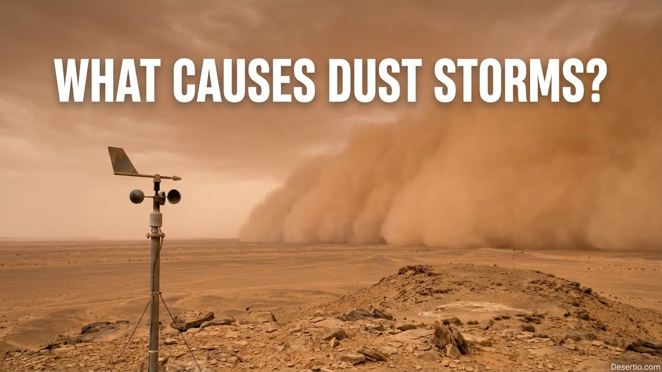
A dust storm is what you get when dry, loose ground meets strong, restless wind, and the landscape basically “lets go” of fine particles. Those tiny grains can lift, bounce, and then float high into the sky until the air looks hazy, golden, or even milk-chocolate brown. It can feel sudden, too—one minute the horizon is clear, the next it’s soft-edged and smoky like someone shook a giant bag of flour across the world.
Think of dust storms as a recipe: you need movable dust, a surface that’s ready to shed it, and wind that’s strong enough to start the first grains jumping. Once that “jumping” begins, it can knock more particles loose, and the storm builds momentum fast.
The Core Recipe For A Dust Storm
Most dust storms boil down to three essentials: fine sediment (silt and clay-sized material), dryness (so particles aren’t glued down by moisture), and wind stress that crosses a local tipping point. That tipping point matters because the wind doesn’t lift dust like a vacuum; it first sets sand-sized grains hopping along the ground, and those hops can “sandblast” the surface, freeing even finer dust into the air.
- Loose, exposed material like dry floodplains, lakebeds, or open soils with plenty of fine particles ready to move downwind.
- Low surface moisture so grains don’t clump; even a thin film of water can calm dust emission a lot for a while.
- Wind that ramps up quickly—gusts, fronts, outflows—so the surface can’t “settle in” before particles start skipping and lifting into suspension.
Where The Dust Actually Comes From
Dust is usually sourced from places where fine sediment accumulates and the ground gets disturbed or dried out. Classic hotspots include dry lakebeds and salt flats (often called playas), broad valley floors, and the edges of old water channels where silt settles like powdery flour. These surfaces can develop a crust, but once the crust breaks, the underlying fines are surprisingly mobile.
It also helps to know the difference between dust and sand. Dust is made of very small particles (often smaller than about 0.063 mm), which can stay aloft for a long time. Sand is larger and heavier; it tends to stay low and move by bouncing. Many “dust storms” start with sand hopping that frees finer dust—like tapping a rug so the hidden powder finally rises into the air.
Natural Dust Sources
- Dry lakebeds and playas with powder-fine silt near the surface.
- Alluvial plains where rivers once spread fine sediment in wide sheets.
- Desert margins where vegetation thins and bare patches expand between shrubs.
Human-Influenced Dust Sources
- Recently tilled fields with unprotected topsoil between crops.
- Construction zones and open lots where ground cover is temporary or missing.
- Unpaved roads and track networks that keep fine dust loose at the surface.
The Wind Triggers That Kick Things Off
Dust doesn’t rise because the air is “angry.” It rises because the wind at ground level reaches a speed where it can overcome gravity and surface stickiness. Meteorologists often talk about pressure differences that tighten up—when air is pulled from one region to another, wind speeds can jump, and gustiness does the rest. These patterns are closely connected to broader desert wind systems that shape how air moves across arid regions. The real troublemaker is usually not steady wind, but quick bursts that jolt the surface into motion again and again.
| Trigger Type | What It Does Near The Ground | Common Visual Clue |
|---|---|---|
| Cold Front Passage | Brings sudden wind shifts and strong gusts along the boundary | A moving haze wall that advances like a wide curtain |
| Thunderstorm Outflow | Creates a dense gust front that scoops dust upward in a rolling edge | A dramatic “rolling” leading edge, often called a haboob |
| Downslope Or Gap Winds | Funnels air through terrain, boosting speed and turbulence in corridors | Local dust plumes that grow into broader blowing dust |
| Strong Mixing On Hot Days | Deep daytime turbulence taps faster winds aloft down to the surface as bursts | Patchy dust lifting in pulses, with brief clears between |
Haboobs And Thunderstorm Outflows
A common dust storm trigger is thunderstorm outflow. When rain-cooled air descends and spreads outward, it acts as a small-scale cold front, moving quickly along the surface and lifting loose dust. The leading edge often forms a low, advancing band of dense air with a clear boundary where winds are strongest. Even if rainfall stays distant, the outflow can still produce substantial blowing dust.
Imagine a giant broom sweeping across a dry floor. The broom isn’t lifting dust by itself; it’s pushing air, and the air does the lifting in a rush.
Surface Conditions That Make Dust Storms More Likely
Wind is only half the story. The ground has to be ready. When soil is dry, crumbly, and exposed, it behaves like powder on a countertop. Add a gust and—whoosh—it’s airborne. On the flip side, soil moisture and vegetation cover act like nature’s glue and net. Roots bind particles, leaves slow wind at the surface, and moisture makes grains stick together.
Here are surface factors that often raise the odds of blowing dust without needing extreme weather:
- Low ground cover: fewer plants means less friction and more exposed soil for wind to grab.
- Fine-textured soils: silts and clays provide lots of liftable dust when disturbed.
- Broken surface crusts: once a crust cracks, the softer material beneath can release dust in bursts.
- Long “fetch”: wide open stretches let wind build strength at ground level, making gusts more effective over distance.
Why Some Places See Dust Storms Again And Again
Repeat dust storms usually come from repeatable setups: big sediment stores plus winds that show up seasonally. Basins that trap fine material, desert edges with patchy vegetation, and plains that dry out after wet periods can all become reliable dust suppliers. Some of the world’s major deserts—like the Sahara, Gobi, and Taklamakan—have broad source regions where fine sediment is plentiful and strong winds can organize into large events under the right pattern.
Terrain also matters. Mountains and ridges can steer wind through gaps, creating fast “wind lanes.” Valleys can act like funnels. Flat expanses can act like runways for gusts, letting them accelerate and stay close to the surface. In dust storm terms, shape is power because it shapes the wind.
Dust Storm Vs Sandstorm
People mix these up all the time, so let’s make it clean. A sandstorm is dominated by larger grains that bounce and skim close to the ground. A dust storm has a big load of fine particles that can rise higher and travel farther before settling. Many real events are hybrids: sand starts moving first, then the surface gets “peppered,” and dust takes over the sky like a veil pulled across the horizon.
How Scientists Describe Dust Lifting
You’ll often hear three motion styles in plain-language summaries of windblown sediment:
- Creep: grains roll along the ground under steady push and small impacts.
- Saltation: sand-sized grains hop like tiny skipping stones over the surface.
- Suspension: fine dust lifts and stays aloft, turning the air hazy for longer.
The key link is saltation. Those hopping grains smack into the ground and knock loose extra fines. It’s like juggling oranges over a tray of flour: the flour isn’t moving until the impacts start. Once fines are airborne, turbulence keeps them there, and visibility can drop quickly even if the surface looks unchanged.
Easy Clues A Dust Storm Is About To Form
These conditions are usually visible without specialized equipment. Watch for increasingly gusty winds, a dry, exposed surface, and a horizon that begins to blur. When a dust storm forms from a gust front, a low, advancing band of darker air with a defined leading edge often appears. In front-driven events, the sky can shift from clear to milky as dust rises in broad sheets across the area.
- Sudden temperature change and a wind shift can hint at a boundary moving through near the ground.
- Dust lifting in patches that come and go suggests turbulent bursts tapping faster winds just above the surface.
- New haze with a tan tone near the horizon often means fine particles are entering suspension over a wide area.
Common Questions About Dust Storm Causes
Can Dust Storms Happen Without Deserts?
Yes. Deserts are famous for dust, but the real requirement is fine material plus exposure and wind. Dry lakebeds, open plains, and seasonal drylands can all produce dust when surfaces are bare and winds spike at the right moment.
Does Heat Alone Create Dust Storms?
Heat helps by drying the surface and increasing mixing in the lower atmosphere, but heat by itself doesn’t lift dust. You still need strong near-ground wind to start motion, especially the first hops of sand-sized grains that free finer dust into suspension.
Why Do Some Dust Storms Look Like A Solid Wall?
That “wall” look often comes from a gust front where wind speed and turbulence are strongest along a narrow edge. Dust lifts intensely right at that boundary, so your eyes see a sharp contrast: clear air in front, thick dust behind in one moving line like a theater curtain.
Mini Glossary
- Fetch: the open distance wind travels over land, building surface strength as it goes.
- Saltation: hopping motion of sand-sized grains that can kick up dust by impact.
- Suspension: fine dust staying aloft in turbulent air for longer distances.
- Gust Front: the leading edge of spreading cool air that can lift dust like a moving broom.
