Desert geography looks simple from far away—just dry land under a big sky—but up close it’s a clever mix of air circulation, landforms, and water that shows up on its own schedule. If you understand where deserts sit and why the rain misses them, the whole map starts to make sense.
- Desert geography in one glance
- What you’ll learn here
- What counts as a desert
- Desert ≠ just dunes
- Hot deserts and cold deserts
- Where deserts form on Earth
- Four formation pathways that create deserts
- Desert landforms and surface types
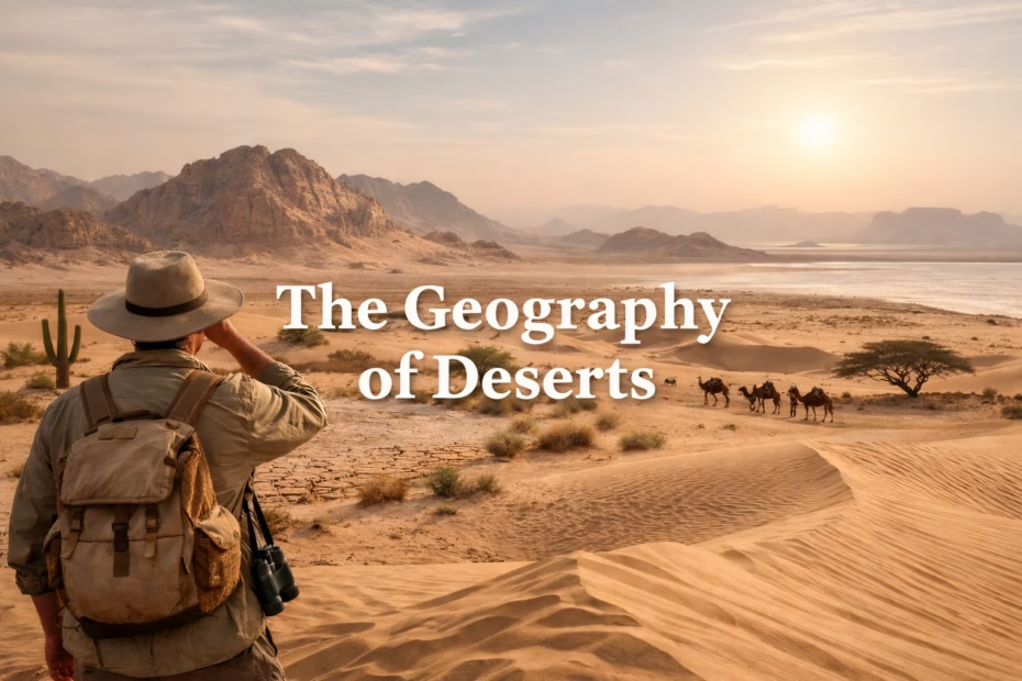
- Dunes and sand seas
- Rock, gravel, and desert pavement
- Playas, salt flats, and “white deserts”
- Fast landform decoder
- Water in dry places: brief, bold, and surprisingly important
- Ephemeral rivers and wadis
- Oases and groundwater
- Soils, salts, and the “quiet chemistry” of deserts
- Why some desert surfaces look “varnished”
- Deserts as geographic systems
- Common desert “engines” to watch for
- How to read a desert map (and instantly spot the story)
- Topography first
- Then look for water “ghosts”
- A friendly “myth-buster” section
- Mini glossary of desert geography terms
Desert geography in one glance
A desert is defined more by water balance than by temperature. It’s a place where evaporation demand tends to beat precipitation supply, so moisture rarely sticks around long enough to become forests or permanent streams.
- Not all deserts are sandy (many are rock or gravel dominated).
- Some deserts are cold, shaped by thin air, winter storms, and big temperature swings.
- Most desert patterns can be traced to latitude belts, mountain shadows, and ocean currents.
Think of Earth’s deserts like quiet “rain gaps” on the planet’s blanket. In those gaps, sun, wind, and sparse water do most of the sculpting, so the land often looks clean-edged and boldly textured.
Quick mental model: deserts form where air sinks, where mountains block, where land sits far from moisture, or where seas stay cold at the surface.
What you’ll learn here
- What counts as a desert (and what doesn’t)
- Where deserts form on the planet
- Four formation pathways that create arid regions
- Landforms: dunes, rock plains, salt flats, and more
- Water in dry places: wadis, aquifers, playas
- Soils & salts and why they matter
- How to read a desert map like a pro
- Mini glossary of key desert terms
What counts as a desert
In physical geography, a desert is mainly an aridity zone. It’s not “no rain ever.” It’s more like: rain is rare, patchy, and often arrives in short bursts, while the air and sun keep asking for more moisture than the land can give. That mismatch is the heart of desert climate.
A helpful way to picture it: imagine a bank account where deposits (rain or snow) come in small, unpredictable payments, and withdrawals (evaporation) are steady and persistent. In many desert landscapes, the balance rarely stays positive for long.
Desert ≠ just dunes
Sand seas are iconic, sure. Still, plenty of desert surfaces are pebbly plains, bare bedrock, or crusty flats where salts sparkle after a dry season. That’s why desert geography is as much about surface type as it is about heat.
Hot deserts and cold deserts
Temperature changes the “feel,” but dryness drives the system. Cold deserts can be arid because moisture is limited and the atmosphere holds little water vapor, especially when air masses stay stable. The geography still revolves around scarce liquid water.
Desert geography is the story of missing moisture—and the creative ways land and life adapt when water won’t stay put.
Where deserts form on Earth
When you zoom out to a world map, desert belts don’t appear randomly. Many line up near the subtropics, where large-scale air circulation often encourages clear skies and descending air. Other deserts sit behind tall mountain chains or deep in continental interiors where ocean moisture struggles to reach.
It helps to think in patterns instead of pinpoints. Arid regions commonly show up in:
- Subtropical zones where air tends to sink and warm up, making clouds less eager to form.
- Rain-shadow basins on the dry side of mountains, where storms drop most moisture earlier on the windward slopes.
- Continental interiors far from reliable moisture sources, where each air mass arrives a little drier than the last.
- Coastal margins near cold ocean currents, where stable air can limit rainfall even beside the sea.
- Polar and high-elevation areas where cold air holds less water vapor, supporting cold desert conditions.
Four formation pathways that create deserts
Most deserts can be explained by a handful of repeating geographic mechanisms. They often overlap, too—like ingredients in the same recipe. Here are the big four, with a plain-language “why it dries out” for each.
| Formation pathway | What’s happening in the air | Typical geography | Signature clues on the ground |
|---|---|---|---|
| Subtropical sinking air | Air descends, warms, and discourages clouds; rainfall becomes infrequent. | Broad belts and plateaus in the subtropics | Wide gravel plains, dune fields, dry drainage networks |
| Rain shadow | Moisture falls on windward slopes; leeward air arrives wrung out. | Basins behind major mountain ranges | Alluvial fans, salt flats, sharp vegetation boundaries |
| Cold-current coast | Cool sea surface stabilizes the lower atmosphere; clouds may form but rain struggles. | West coasts near cold currents | Foggy mornings, sparse soils, salt-tolerant plants |
| Polar/high-elevation aridity | Cold air holds little moisture; precipitation stays low. | Polar deserts or elevated interior regions | Stone pavements, patterned ground, wind-shaped ridges |
Notice how none of these require “endless heat.” The common thread is always limited usable water, shaped by atmosphere and topography. That’s the core of desert geography.
Desert landforms and surface types
Deserts are like open-air workshops for geomorphology. With fewer plants to protect the ground, wind and rare-but-powerful water flows can leave clean signatures. You can often “read” the last major event—wind season, flash flood, or dry-lake cycle—just by looking.
Dunes and sand seas
Dunes form when sand supply meets steady winds and places for grains to slow down. Different dune shapes reflect wind direction patterns and sand availability—like nature’s wind diary written in curves.
- Barchan dunes: crescent forms linked to one dominant wind direction and limited sand.
- Linear dunes: long ridges often tied to seasonally shifting winds.
- Star dunes: multi-armed giants where winds come from several directions over time.
Rock, gravel, and desert pavement
Many deserts are dominated by stone, not sand. Desert pavement is a tight layer of pebbles that can form as fine dust is lifted away by wind or washed downward by sporadic rains. It’s like a natural cobblestone armor that slows further erosion.
Where bedrock is exposed, wind can carve yardangs—streamlined ridges that point like arrows, hinting at persistent wind corridors. Teh shapes can look almost engineered.
Playas, salt flats, and “white deserts”
In closed basins, water may arrive briefly, spread into a shallow sheet, then vanish into air, leaving behind salts and fine sediments. Over repeated cycles, this creates playas and salt flats with crisp polygons, crunchy crusts, and mirror-like surfaces after rare wet spells.
Fast landform decoder
- Alluvial fan at a mountain front? Think flash floods and sediment pulses.
- Wadi channel with dry gravel? Think “river that mostly sleeps.”
- Rippled dune face? Think wind sorting grain sizes like a sieve.
- Salt crust in a basin? Think evaporation concentrating minerals over time.
Water in dry places: brief, bold, and surprisingly important
Water is scarce in deserts, yet it’s also the main architect of some of the most dramatic features. That sounds backward until you remember: when rain is rare, it often arrives as intense storms, and the ground may be too hard, crusted, or bare to soak it in quickly.
Ephemeral rivers and wadis
Ephemeral streams (often called wadis in some regions) may be dry most days, then suddenly carry fast water that rearranges gravel, builds bars, and feeds brief green corridors along banks.
Oases and groundwater
Many classic oases are less “magic springs” and more groundwater geology: aquifers stored in permeable layers, then forced to the surface by faults, rock boundaries, or basin edges. On a map, look for contacts between rock types and subtle slope breaks.
Desert lakes can be seasonal or ancient relicts in long-lived basins. Even when the surface is dry, subsurface moisture and salts can influence which plants take hold, how dust moves, and where animals travel.
Soils, salts, and the “quiet chemistry” of deserts
Desert soils often develop slowly because organic inputs are limited and moisture is intermittent. That doesn’t mean they’re lifeless. Many hold microbial communities and thin crusts that stabilize the surface and reduce dust.
Salts matter because deserts are good at concentrating whatever water leaves behind. Over time, minerals can accumulate in layers or crusts, shaping soil structure and influencing what grows where. It’s one reason desert vegetation often forms patchy mosaics instead of continuous blankets.
Why some desert surfaces look “varnished”
On certain rocky surfaces, you may see a dark sheen called desert varnish. It’s a slow-building coating linked to fine dust, trace minerals, and long exposure. From a distance it can make hillsides look painted, a subtle reminder that time is a major force in desert geography.
Deserts as geographic systems
A desert isn’t just a climate label. It’s a system with energy flow, material movement, and feedback loops. Wind transports sand and dust. Water moves sediment in short bursts. Vegetation anchors patches of soil. Even tiny changes in wind corridors or surface roughness can nudge dune fields or dust plumes in new directions.
Common desert “engines” to watch for
- Aeolian processes (wind): deflation, abrasion, sand transport, dune building.
- Flash hydrology (water): short floods, fan building, channel shifting.
- Thermal stress (temperature swings): expansion/contraction that can fracture rock over long periods.
- Salt weathering: crystal growth that can pry apart rock and soil grains.
How to read a desert map (and instantly spot the story)
Desert maps reward small clues. Once you know what to look for, you can infer wind, water pathways, and surface types from simple layers like elevation, slopes, and drainage patterns.
Topography first
- Closed basins often point to playas and salt flats.
- Mountain fronts often pair with alluvial fans.
- Long, low ridges can hint at wind-shaped yardangs or dune alignments.
Then look for water “ghosts”
- Dry channels that braid and fade suggest episodic flow.
- Vegetation lines (even sparse ones) often mark shallow groundwater or flood paths.
- Fan-to-basin patterns often reveal where sediment and salts accumulate over time.
If you’re comparing deserts, a simple trick is to check proximity to oceans, prevailing winds, and mountain barriers. Those three hints usually explain most of the precipitation pattern without needing fancy tools.
A friendly “myth-buster” section
Myth: Deserts are empty and uniform.
Reality: desert landscapes are highly varied—dunes, basalt fields, gravel plains, salt pans—often switching within a short drive. The “empty” feeling comes from low biomass, not from lack of structure.
Myth: “Desert” means “hot.”
Reality: aridity is the key. Cold deserts exist where moisture is limited and the atmosphere stays dry, even if temperatures are cool for much of the year.
Myth: Wind is the main force everywhere in deserts.
Reality: wind is huge, yes, yet short-lived water flows can move more sediment in one storm than wind does in weeks. In desert geography, the dramatic moments often come from rare rain.
Mini glossary of desert geography terms
Here are quick definitions you can return to anytime. Each term is a small key that unlocks more of the desert map.
- Aeolian: shaped by wind (sand transport, dunes, dust).
- Alluvial fan: a fan-shaped deposit where fast water spreads out and drops sediment.
- Desert pavement: a tight pebble surface that can protect the ground like a natural shield.
- Playa: a flat basin floor that floods shallowly, then dries and often leaves salts.
- Rain shadow: a dry zone on the leeward side of mountains where storms already lost moisture.
- Wadi: a channel that is usually dry but carries water during brief flow events.
- Yardang: a streamlined ridge carved by persistent wind abrasion and deflation.