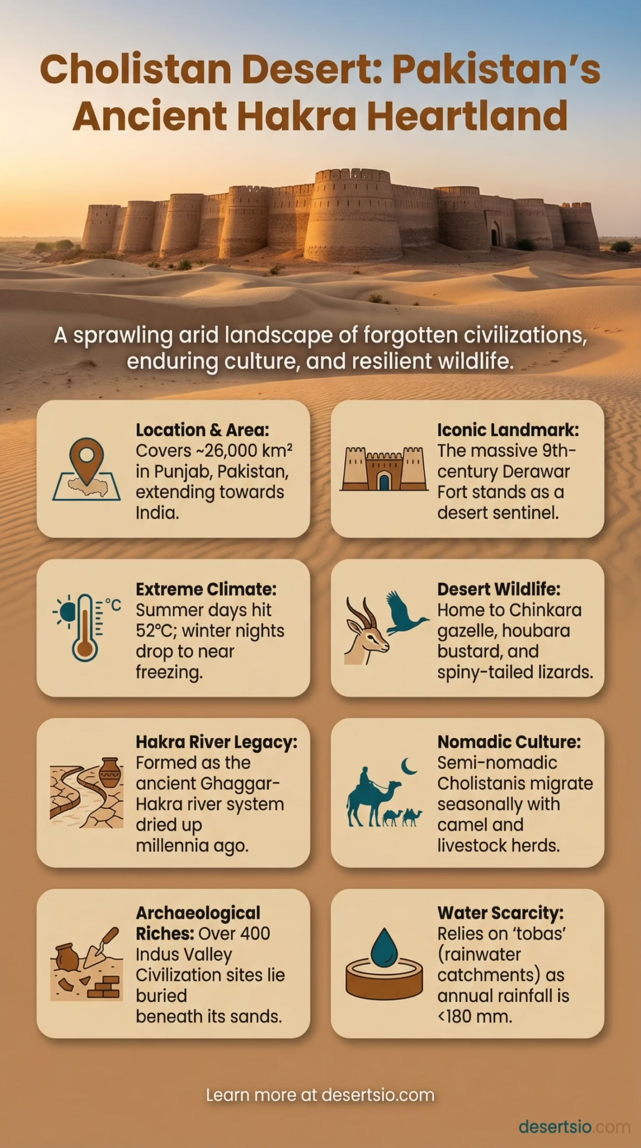
| Location | Punjab Province, Pakistan (extending toward Rajasthan, India) |
| Area | Approximately 26,000 km² (10,000 sq mi) |
| Type | Sandy desert / Semi-arid desert |
| Avg. Summer Temperature (Day) | Up to 52°C (126°F) |
| Avg. Winter Temperature (Night) | As low as 0°C (32°F) — frost is possible |
| Annual Rainfall | Less than 180 mm (7 inches) |
| Major Landmark | Derawar Fort — a massive 9th-century mud-brick fortress |
| Primary River (Historical) | Hakra River (ancient dried-up channel of the Ghaggar-Hakra system) |
| Dominant Terrain | Rolling sand dunes, scrubland, seasonal wetlands (tobas) |
| Human Population | Approximately 0.1–0.3 million (semi-nomadic and settled communities) |
| Key Wildlife | Chinkara gazelle, Indian wolf, desert monitor lizard, houbara bustard |
| Archaeological Significance | Over 400 sites linked to the Indus Valley Civilization |
| Adjacent Desert | Thar Desert (eastern border) |
Cholistan is not just sand. Stretching across the southern reaches of Pakistan’s Punjab province, this desert carries the weight of one of the oldest civilizations on Earth — buried beneath its dunes, forgotten by most, yet remarkably intact. The name itself comes from the Turkic word chol, meaning “desert” or “wasteland.” But calling it a wasteland misses the point entirely.
- Cholistan Desert: Location and Map View
- How Cholistan Formed
- Size — Bigger Than You Might Expect
- Temperature: Extreme on Both Ends
- Flora and Fauna of Cholistan
- Plants
- Animals
- Human Life in Cholistan
- Derawar Fort — The Desert’s Crown
- Cholistan and the Thar Desert — Neighbors, Not Twins
- Nearby Deserts Worth Knowing
- Desertification and Current Pressures
- The Cholistan Jeep Rally — A Desert Spectacle
- Archaeological Depth — The Hakra Civilization
- Cholistan’s Glossary — Terms Worth Knowing
The desert covers roughly 26,000 square kilometers — an area larger than the entire country of Slovenia, or nearly twice the size of Lebanon. And yet it remains one of South Asia’s least-discussed arid landscapes, often overshadowed by its more famous neighbor, the Thar Desert.
Cholistan Desert: Location and Map View
How Cholistan Formed
Cholistan’s origin is deeply tied to a river that no longer exists. The Hakra River — part of the ancient Ghaggar-Hakra system — once flowed through this region, sustaining dense human settlements and rich agricultural land. Geological and paleoclimatic evidence suggests this river system began drying out between 4,000 and 5,000 years ago, likely due to tectonic shifts that redirected its tributaries toward the Indus and Yamuna rivers.
As the water disappeared, the land followed. Vegetation died back, soils dried out, and wind-blown sand gradually took over. The Tethys Sea sediments that underlie much of the region contributed to its sandy, nutrient-poor soils. What was once a fertile floodplain became, over millennia, the rolling dune landscape seen today.
The dunes themselves range from 3 to 18 meters in height, and they still move — slowly, predictably, but constantly. Some areas show a clear north-to-south dune alignment driven by seasonal monsoon winds.
Size — Bigger Than You Might Expect
At 26,000 km², Cholistan is larger than New Hampshire and Vermont combined. If you placed it over Israel, it would nearly cover the entire country. Within South Asia, it forms the western continuation of the Thar Desert — and together, the Thar-Cholistan system extends across more than 200,000 km², making it one of the most populated desert regions in the world.
Cholistan itself is divided into two broad zones:
- Lesser Cholistan — the northern section, closer to the Sutlej River, with more accessible groundwater and slightly higher vegetation cover
- Greater Cholistan — the southern zone, more arid, more remote, and home to the ancient Hakra riverbeds
Temperature: Extreme on Both Ends
Cholistan operates in extremes. During summer (May to July), daytime temperatures regularly exceed 45°C (113°F) and can spike to 52°C (126°F) in open sandy areas. The ground surface itself can reach temperatures well above 70°C — hot enough to cause burns on contact.
Then winter arrives, and everything shifts. Between December and February, nighttime temperatures drop to near 0°C (32°F), with occasional frost in the deeper desert. The diurnal temperature range (the difference between day and night) can exceed 25°C within a single 24-hour period — a hallmark of true desert climates.
Rainfall is scarce and unreliable. Annual precipitation averages less than 180 mm, most of which arrives during the brief monsoon season (July–September). Years with below-average monsoons can see totals drop below 50 mm, triggering acute water stress for both people and wildlife.
Flora and Fauna of Cholistan
Despite the heat and aridity, Cholistan supports a surprisingly resilient collection of plants and animals — ones that have adapted, over thousands of years, to thrive in exactly these conditions.
Plants
- Prosopis cineraria (Jand) — a drought-resistant tree considered sacred in local culture; its deep roots tap into groundwater unavailable to other species
- Calligonum polygonoides (Phog) — a shrubby plant that stabilizes dunes and provides fuel wood
- Haloxylon salicornicum (Lana) — a salt-tolerant shrub common in saline depressions
- Capparis decidua (Karir) — produces small, edible fruits consumed by both wildlife and people
After monsoon rains, the desert briefly transforms. Ephemeral grasses and wildflowers carpet the dunes for a few short weeks — a phenomenon locals refer to as the desert “breathing.”
Animals
- Chinkara gazelle (Gazella bennettii) — the most iconic mammal of Cholistan; highly adapted to water scarcity, it can survive without drinking water by metabolizing moisture from vegetation
- Indian wolf (Canis lupus pallipes) — a smaller, leaner subspecies compared to northern wolves; rare but present
- Houbara bustard — a migratory bird of significant ecological and cultural importance across arid Central and South Asia
- Desert monitor lizard (Varanus griseus) — one of the largest reptiles in the region, capable of reaching 1.5 meters in length
- Spiny-tailed lizard (Uromastyx hardwickii) — herbivorous, burrowing, and remarkably heat-tolerant
The seasonal tobas — natural rainwater catchments — are critical for wildlife survival and serve as gathering points for dozens of bird species during migration.
Human Life in Cholistan
People have lived in Cholistan for at least 7,000 years. Over 400 archaeological sites linked to the Indus Valley Civilization have been identified in the region — including settlements at Dingarh and Yazman Mandi. The ancient city of Derawar was once a major node on trade routes connecting Central Asia to the subcontinent.
Today, an estimated 200,000 to 300,000 people live in or seasonally migrate through Cholistan. The dominant group is the Cholistanis — semi-nomadic herders who move their livestock (primarily cattle, camels, sheep, and goats) according to seasonal water and pasture availability. This practice, known locally as shikari migration, can involve journeys of 200–400 km in a single season.
The camel is everything here. Transport, milk, trade currency — the Cholistan camel (a local variety prized for its endurance) can go up to two weeks without water under moderate conditions. These animals are as much a part of the desert’s identity as the dunes themselves.
Access to clean water remains the most pressing challenge. The traditional toba system — engineered depressions that collect and store monsoon rainwater — is the primary water source for many communities. Government canal extensions from the Bahawalpur Irrigation System have reached parts of Lesser Cholistan, but Greater Cholistan remains largely dependent on rainfall.
Derawar Fort — The Desert’s Crown
Derawar Fort stands at the heart of Cholistan like a sandstone colossus. Its 40 bastions, each rising to 30 meters, form a near-perfect square with a perimeter of 1.5 kilometers. Originally built in the 9th century by Rai Jajja Bhatti and later expanded by the Nawabs of Bahawalpur in the 18th and 19th centuries, the fort is one of the best-preserved desert fortifications in South Asia. Visible from 50 km away on a clear day, it served as both a military stronghold and a symbolic marker of the old Bahawalpur State’s power across this arid expanse.
Cholistan and the Thar Desert — Neighbors, Not Twins
Cholistan shares its eastern border with the Thar Desert, and the two are often lumped together in popular geography. They are related — geologically and climatically — but distinct in several important ways.
| Feature | Cholistan Desert | Thar Desert |
| Total Area | ~26,000 km² | ~200,000 km² |
| Countries | Pakistan | India, Pakistan |
| Population Density | Low (~10/km²) | High (~83/km²) |
| Archaeological Significance | Indus Valley sites, Hakra culture | Indus Valley sites, Rajputana history |
| Primary Water Source | Tobas, irrigation canals | Wells, seasonal rivers, canals |
| Iconic Landmark | Derawar Fort | Jaisalmer Fort |
The Thar is larger and more densely populated. Cholistan, by contrast, feels rawer — less developed, less visited, and in many ways, more archaeologically rich per square kilometer. The Hakra culture (also called the Ghaggar-Hakra civilization), which predates or parallels the Harappan phase of the Indus Valley Civilization, left its deepest marks right here in Cholistan.
Nearby Deserts Worth Knowing
Cholistan sits within a broader arid belt that connects South Asia to Central Asia. Several other desert systems are within geographic reach:
- Thar Desert — directly to the east, straddling the India-Pakistan border; the most densely populated desert on Earth
- Kharan Desert — southwest of Cholistan, located in Balochistan province; more barren, less studied, and significantly colder in winter
- Indus Valley Lowlands — not a desert in the strict sense, but the arid plains flanking the Indus River create semi-desert conditions that blur into Cholistan’s western edges
- Dasht-e-Kavir and Dasht-e-Lut (Iran) — further west but connected through the same Afro-Asian arid belt; the Lut Desert recorded the highest land surface temperature ever measured on Earth: 70.7°C in 2005
Desertification and Current Pressures
Cholistan is expanding. Not slowly — at a rate that scientists and policymakers are increasingly concerned about. Overgrazing is the primary driver. With an estimated 2 million livestock moving through the region seasonally, the fragile desert vegetation — which takes decades to establish — is being stripped faster than it can regenerate.
Sand encroachment onto agricultural land is a documented problem in the districts of Bahawalpur, Bahawalnagar, and Rahim Yar Khan. Some villages that existed at the desert’s edge 40 years ago are now engulfed or abandoned. This is desertification in a very real, very measurable form.
Climate data adds another layer of urgency. The region’s average temperature has increased by approximately 0.6–0.8°C over the last 50 years, consistent with broader South Asian warming trends. Monsoon rainfall, already unreliable, has become more erratic — with longer dry spells punctuated by intense, short-duration rain events that the dry soil can barely absorb.
And groundwater? Rapidly depleting. Borehole data from Lesser Cholistan shows water table drops of several meters per decade in areas where extraction has outpaced natural recharge.
The Cholistan Jeep Rally — A Desert Spectacle
Every year, Cholistan draws an unusual crowd. The Cholistan Desert Jeep Rally — one of the largest off-road motorsport events in Asia — sees hundreds of vehicles tear across the dunes near Derawar Fort. The event, which has been running since 2005, attracts participants from across South Asia and beyond, with spectator numbers reaching into the hundreds of thousands in popular years.
It’s a curious thing — this collision of ancient landscape and roaring engines. The rally brings economic activity to one of Pakistan’s most economically marginalized regions and has, inadvertently, drawn attention to Cholistan’s extraordinary natural and cultural heritage.
Archaeological Depth — The Hakra Civilization
This is where Cholistan genuinely surprises people. Over 400 prehistoric sites have been documented within the desert, many of them associated with the early and mature phases of the Indus Valley Civilization (3300–1300 BCE). Sites like Ropar, Kalibangan, and dozens of unnamed mounds along the dried Hakra channel suggest that this desert was once one of the most densely settled regions of the ancient world.
Pottery, fired bricks, beads, and tools recovered from surface surveys point to sophisticated urban culture. The Hakra Ware — a type of ceramic found exclusively in this region and predating Harappan pottery — places Cholistan at the very root of South Asian civilization. Some researchers argue that the drying of the Hakra River may have been the primary driver of the Harappan collapse around 1900 BCE, forcing massive westward migration toward the Indus.
Most of these sites remain unexcavated. The desert, in a strange way, has preserved them — its aridity slowing the biological decay that destroys organic material in wetter climates.
Cholistan’s Glossary — Terms Worth Knowing
Toba — A natural or engineered depression in the desert floor that collects and holds monsoon rainwater; the lifeline of both human and animal communities in Greater Cholistan.
Jand (Prosopis cineraria) — A sacred, drought-resistant tree; arguably the most important plant in the Cholistan ecosystem. Locals say, “where jand grows, life follows.”
Hakra — The ancient river system whose drying created the modern desert; its ghost channel is still traceable by satellite imagery across the desert floor.
Chinkara — The Persian gazelle (Gazella bennettii), the most recognizable wildlife symbol of Cholistan; its name derives from the Hindi/Urdu word for the sound it makes when startled.
Cholistan is a desert that demands more attention than it gets. Its dunes hold ancient cities. Its people carry knowledge about water management that engineers are only now beginning to study seriously. And its fragile ecosystem — caught between expanding agriculture, climate pressure, and overgrazing — is at a genuine tipping point. The desert is not silent. It just requires a different kind of listening.
